If you’re choosing between Hampta Pass and Pin Parvati for your first big Himachal trek, do Hampta. Pin Parvati is a real expedition. Hampta is a five-day crossover that gives you the same valley-to-desert payoff with a fraction of the technical risk.
I’ve seen first-time trekkers come off Hampta grinning. I’ve also seen people I rate highly turn back from Pin Parvati at Mantalai, ten days in, because the snow on the pass was the wrong kind of snow.
That’s the real version of the choice readers face when they search for treks in Himachal Pradesh. There are roughly two dozen trails worth doing in the state, and the gap between the easy ones and the difficult ones is enormous. Triund is a half-day uphill picnic. Pin Bhaba Pass is nine days at altitude with a glaciated crossing.
Both turn up on the same “best treks in Himachal” listicles, which is why people show up at Manali bus stand confused. This guide steers you through the real decisions: which trek for which fitness level, which months actually work, which valleys the trails sit in, and where to start from.
Prices are quoted in Indian rupees with a USD anchor on first mention in each section so the conversion is quick. Every altitude and distance has been cross-checked against operator data and Wikipedia.
In This Article
- The map of Himachal trekking
- The matchups people actually face
- Easy treks that still feel like real trekking
- Triund (~2,850 m)
- Kheerganga (~2,960 m)
- Prashar Lake and Bijli Mahadev
- The Manali-side moderate treks
- Hampta Pass (4,287 m / 14,065 ft)
- Bhrigu Lake (~4,235 m)
- Beas Kund (~3,700 m)
- Deo Tibba base camp (~4,250 m)
- Dharamshala-side and Kangra Valley treks
- Indrahar Pass (4,342 m / 14,245 ft)
- Kareri Lake (~2,950 m)
- Bara Bhangal (challenging traverse)
- The expedition-grade passes
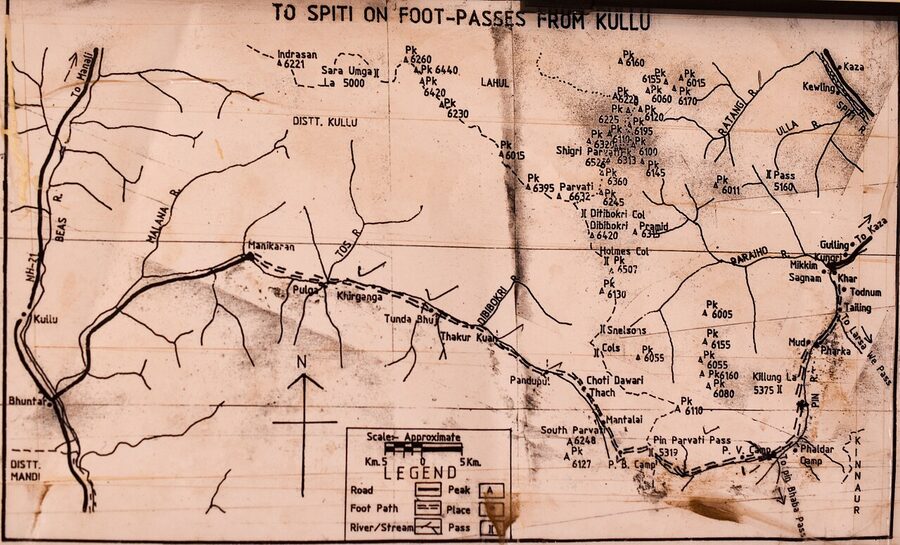
- Pin Parvati Pass (5,319 m / 17,451 ft)
- Pin Bhaba Pass (4,915 m)
- Buran Ghati (~4,575 m)
- Rupin Pass (4,650 m / 15,250 ft)
- Kinnaur Kailash parikrama (challenging)
- The Spiti and Lahaul side
- Chandratal and Baralacha La
- Kanamo Peak (5,964 m / 19,553 ft)
- Parang La (5,580 m)
- Miyar Valley
- Tirthan, Sainj, and the Great Himalayan National Park
- Sar Pass and Sainj Valley
- Which trek for which person
- Seasons and when each trek opens
- Permits, operators, and what it costs
- Gear that actually matters
- Getting to the trailheads
- Food, lodging, and what to do on rest days
- What I’d actually do
The map of Himachal trekking
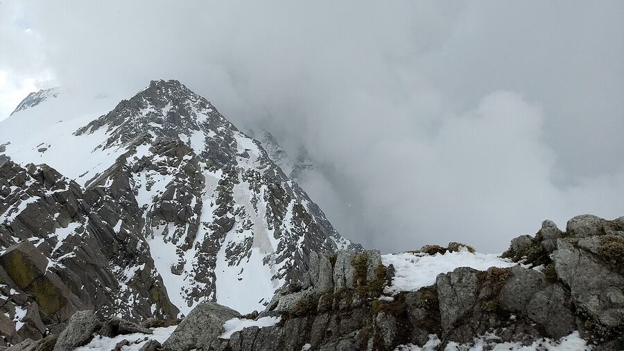
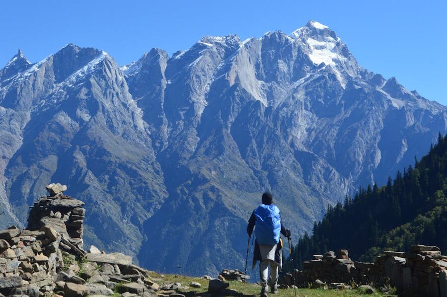
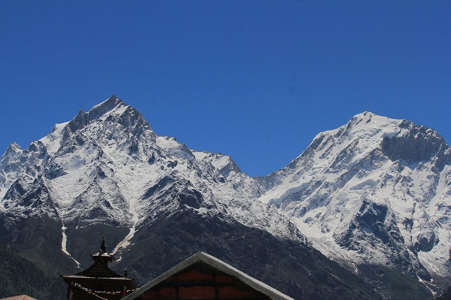
Himachal Pradesh sits across roughly 10% of the Indian Himalayas, which is more variety than any other state in the country offers. The Dhauladhar range hangs over Dharamshala in the west, getting climbers and pilgrims onto Triund and Indrahar Pass.
The Pir Panjal divides Kullu from Lahaul, and the crossover passes through it (Hampta, Bhrigu Lake, Beas Kund) are the bread and butter of the Manali trekking economy. Further east, the Greater Himalayas and the rain-shadow region of Lahaul and Spiti hold the long, hard expeditions: Pin Parvati, Pin Bhaba, Parang La. Down in the south-east corner, the Kinnaur ranges hold their own pilgrimage and pass routes.
That geography is the single most useful filter when choosing a trek. If you’re flying into Delhi and have ten days, you’re realistically picking from Manali-side trails or the Dharamshala-side ones. Kinnaur and Lahaul-Spiti add long road days at both ends. Bara Bhangal, the classic shepherd traverse, takes two weeks once you’ve factored in arrival and recovery.
The matchups people actually face
Before the long version, the four head-to-head decisions that come up over and over:
- Hampta Pass vs Pin Parvati Pass. Hampta if you have under a week and want a moderate adventure; Pin Parvati only if you’ve done at least two high-altitude treks and have ten days clear. The altitude gap (4,287 m vs 5,319 m) and duration gap (six days vs eleven) are bigger than they look on paper.
- Triund vs Kheerganga. Triund if you want a ridgeline view of the Dhauladhar range from one campsite (~2,850 m), a single steep night out and back. Kheerganga if you want hot springs at the end of the climb (~2,960 m) and a Parvati Valley village vibe at the bottom.
- Bhrigu Lake vs Beas Kund. Both are four-day Manali-side moderate treks at similar altitudes (around 4,200 m vs 3,700 m), but Bhrigu wins on meadows and lake colour while Beas Kund wins on glacier-amphitheatre views. Bhrigu is the harder of the two.
- Buran Ghati vs Rupin Pass. The two scenic-variety eight-day passes everyone considers after they’ve done one moderate trek. Buran sits entirely in Himachal and exits at Barua village; Rupin starts in Uttarakhand and finishes in Sangla Valley. They’re roughly equal in altitude (around 4,575 m and 4,650 m). Pick on which side you want to start.
The rest of the article unpacks each of these and the longer expedition-grade treks behind them.
Easy treks that still feel like real trekking
A common mistake is to write off the easy trails as “not real trekking” and jump straight to a pass crossing. Don’t. The gradient from sea level to 4,000 m is what gets you in trouble at altitude, and the cheap way to test how your body handles it is to do a two-day trek at 2,800 m before you commit to anything bigger.
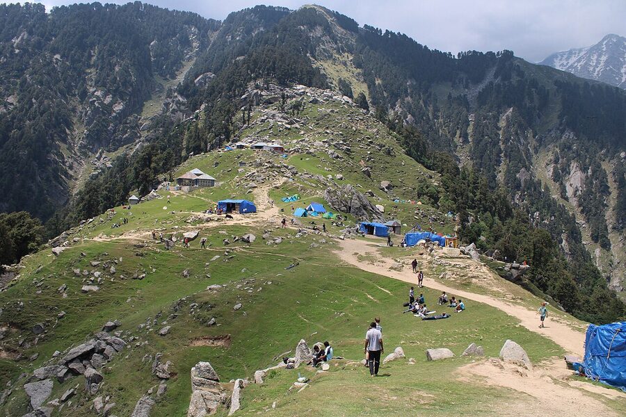
Triund (~2,850 m)
Triund is the most-walked trail in Himachal and the one I’d send anyone on first. The route climbs from Galu Devi temple above Dharamshala, around 9 km of mostly steady uphill, with the last stretch (the “22 curves”) steepening sharply before the meadow opens out.
Most fit walkers do it in four to six hours. The view at the top is the full Dhauladhar wall: Mun Peak, the Indrahar Pass ridgeline, the white teeth of the range catching evening light.
Camp the night. The day-tripper version, where you walk up and run back down before dark, misses the whole point. A tent rental and food package from one of the McLeod Ganj agencies runs around ₹1,500 to ₹3,000 (~$18 to $36) per person depending on the season.
Permit is now required and tents have to come down by morning under a fragile-ecosystem rule the state introduced after the trail got mobbed. That’s a good thing for the meadow.
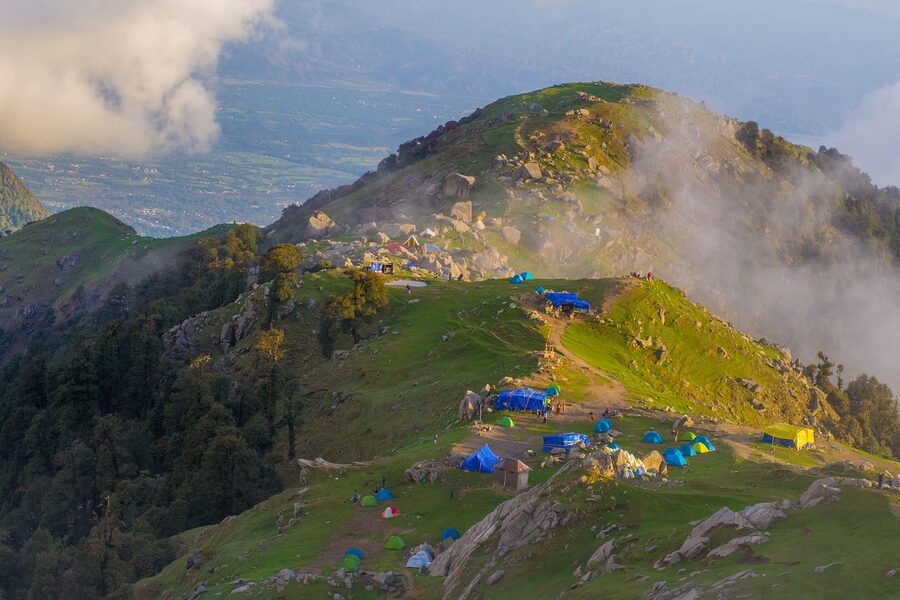
It’s steep enough to be real exercise. The trail is rocky, the late stretch in winter has ice, and people do twist ankles. But it’s a single climb, single night, no acclimatisation issues.
If you can manage Triund comfortably, you can probably handle a four-day moderate trek. If Triund flattens you, take that information seriously.
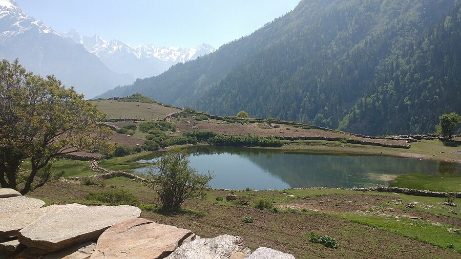
Kheerganga (~2,960 m)
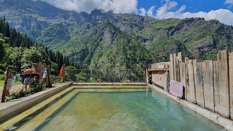
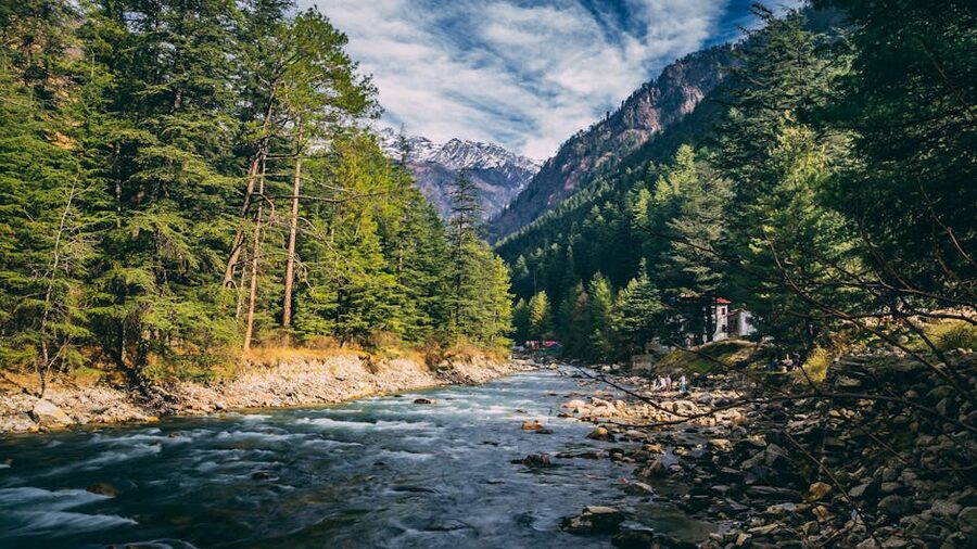
Kheerganga is the same difficulty bracket but feels nothing like Triund. The trailhead is Barshaini, at the head of the road that runs up Parvati Valley from Kullu through Kasol. From there the trail follows the Parvati River through pine forest, past the Rudra Nag waterfall, and climbs steadily for around 12 km to a meadow with a hot spring at the top.
The hot spring is the whole reason to go. After three to five hours uphill in shoulder weather you sit in 40°C sulphurous water looking down a forested gorge. The men’s and women’s pools are separate. Locals consider it sacred (the name means “milk-Ganga”); behave accordingly.
The catch is that the camping ban around the spring meadow gets enforced unpredictably. Sometimes you can stay overnight in a tent on the lower slope; sometimes the patrols push everyone out and you have to walk back down to Nakthan or Rudra Nag. Check before you go.
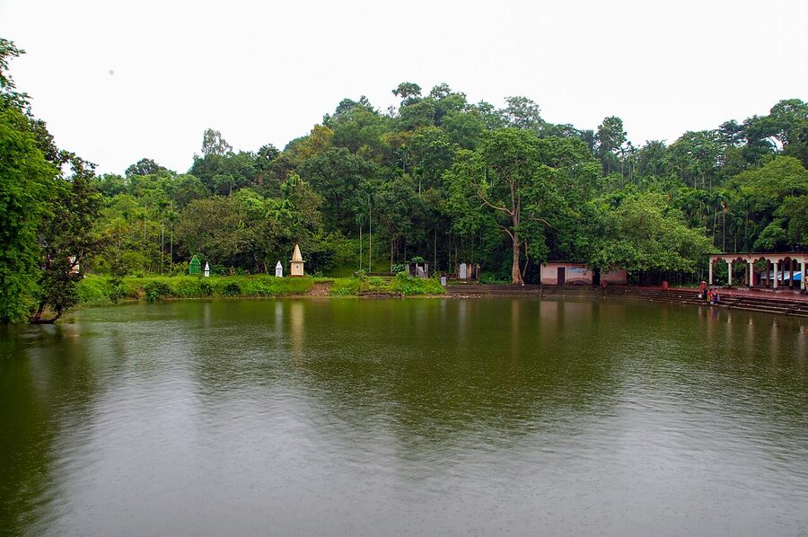
Prashar Lake and Bijli Mahadev
Two short ones I’d put on the same shelf. Prashar Lake (~2,730 m) sits about three hours’ drive north of Mandi, with a small mountaintop temple beside an oddly oval lake; the actual trekking is a two-day, easy walk-up best done in October when the meadows are gold.
Bijli Mahadev (~2,460 m) is a short pilgrimage hike above Kullu town, three to four hours up to a Shiva temple struck by lightning every twelve years. Both are fine winter options because the snow line is below the summit.
The Manali-side moderate treks
Manali is the natural base for the cluster of four-to-six-day treks that cross the Pir Panjal range. Almost every Indian trekking operator runs the same rotation here: Hampta, Bhrigu, Beas Kund, Deo Tibba, Chandratal Baralacha. They’re more or less interchangeable in cost (₹8,000 to ₹14,000 / ~$96 to $168 for the basic packages) and what differs is what the trail looks like.
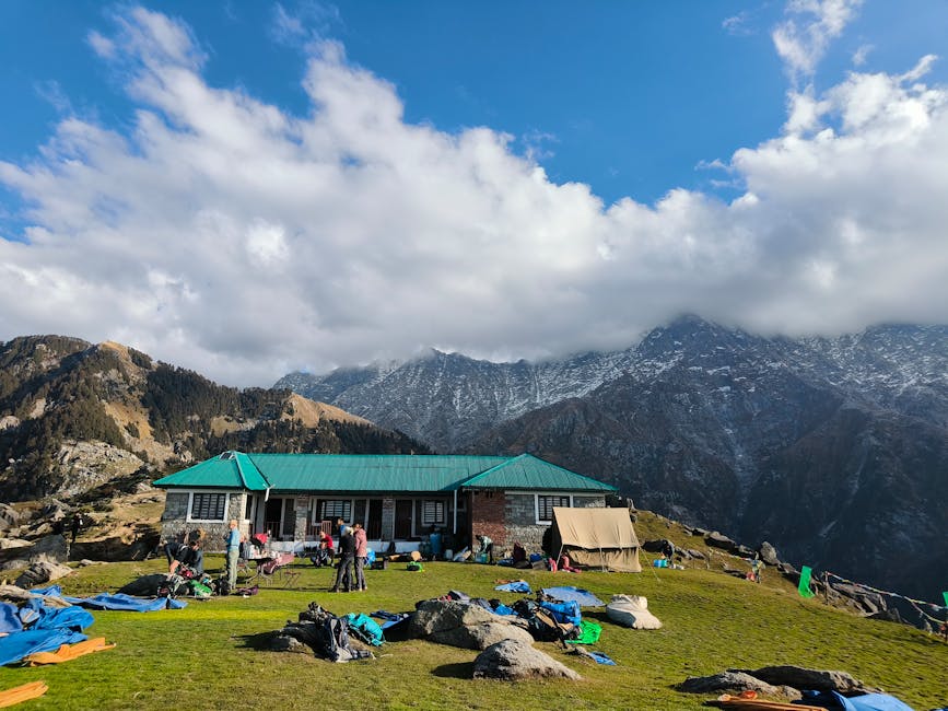
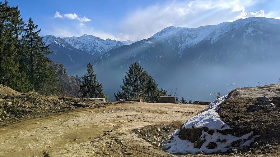
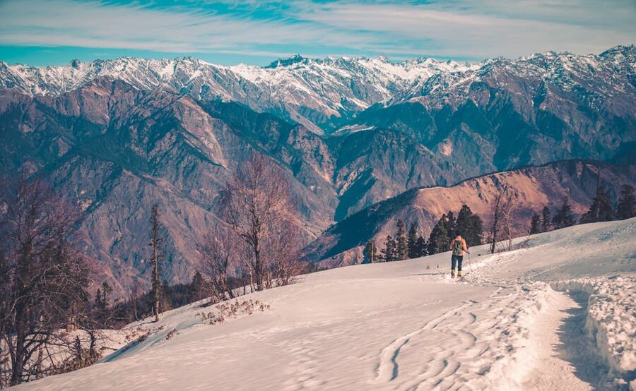
Hampta Pass (4,287 m / 14,065 ft)
Hampta Pass is the trek I send most first-time crossover trekkers on. Five days from Jobra (a one-hour drive from Manali), through Chika and Balu ka Ghera, over the pass at 4,287 m, down into Shea Goru on the Lahaul side, ending at Chatru.
The altitude gain is gentle enough that altitude sickness is rare if you’ve slept a couple of nights at Manali (2,050 m) first. Most groups add a sixth day for a side trip to Chandratal Lake.
What makes Hampta worth doing over the equally-priced Bhrigu and Beas Kund is the contrast on the two sides of the pass. The Kullu approach is wildflower meadows and pine. The Lahaul descent is grey moraine, glacier silt, and stark rock.
Both halves take a single day. The pass-crossing day is long (eight to ten hours) and there’s a steep down-climb on the north side that you’ll feel in your knees, but there’s no technical scrambling and no real exposure.
The real weakness is crowding. From late June to mid-September the trail can feel like a traffic queue at the pass, with two or three groups stacked up waiting to descend. If solitude matters more than weather, do it in the first ten days of June or the second half of September.
June rewards you with snow on the pass crossing (which is fun but slows things down). Late September gives you cold nights but empty trails.
Bhrigu Lake (~4,235 m)
Bhrigu Lake is the four-day Manali-side trek that delivers the most landscape variety per day on the trail. From Gulaba (around 24 km from Manali on the Rohtang road), you climb through oak and pine into open alpine meadow within about two hours, and you’re in meadow country for the rest of the trek.
The lake itself sits at 4,235 m by Wikipedia’s infobox, though guides usually quote the round figure of 4,300 m. Either way, it’s a high-altitude tarn that changes colour with the cloud and the season: green-grey in clear weather, slate when the weather closes.
The reason I’d pick Bhrigu over Beas Kund for a second-time trekker is the gradient. Bhrigu has more meadow walking and less moraine, which is gentler on the legs. The reason I’d pick Beas Kund over Bhrigu for a strong first-timer is that Beas Kund is closer to a glacier, with Friendship Peak and Hanuman Tibba towering directly over the campsite, and that’s the kind of view that makes someone want to keep trekking after they get home.
Beas Kund (~3,700 m)
.jpg)
Beas Kund is the source of the Beas River: a small green lake at the foot of the glacier under Hanuman Tibba (5,932 m). The trek starts from Dhundi or Solang, both reachable in under an hour from Manali. Four days suffices.
The campsite at Bakarthach (a wide open meadow at around 3,300 m) is one of the better ones in Himachal: flat, water close, surrounded by 5,000 m peaks on three sides.
The trek is technically the easiest of the Manali-side cluster. The highest point is the lake itself, around 3,700 m, well below the altitudes where most people start feeling the air thin. It’s the trek I’d recommend for anyone who’s done Triund and wants to see what a four-day trek with packed mules and tents feels like, before committing to a pass.
Deo Tibba base camp (~4,250 m)
Deo Tibba is a 6,001 m peak south of Manali, and the base camp trek is a six-to-eight-day walk to Tenta Meadow at its foot, starting from Jagatsukh village (around 10 km from Manali). It’s harder than Bhrigu and Beas Kund because of the duration and the gain, but easier than the pass crossings because there’s no high crossing day.
The Chhota Chandratal lake at the base of the peak is one of the prettier moments on any Himachal trek; a shallow alpine pool with the white bulk of Deo Tibba hanging over it.
Best done in May to June when the rhododendrons are flowering on the lower slopes, or late September when the high meadow turns gold. Avoid full monsoon. The trail crosses several streams that get unpredictable in heavy rain.
Dharamshala-side and Kangra Valley treks
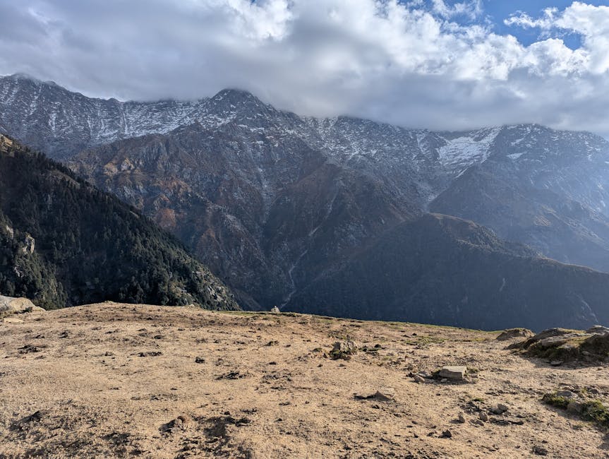
The Dhauladhar range above Dharamshala holds a different style of trekking. The trails are shorter (the range is narrow), but the gradient is brutal: the Dhauladhar rises from around 1,000 m at Kangra to over 5,000 m in twenty horizontal kilometres. That means the climbing is concentrated into long uphill days, and the views are vertical: you look up at Mun Peak from Triund, not across.
Indrahar Pass (4,342 m / 14,245 ft)
Indrahar is the natural next step up from Triund. Same trailhead (above Dharamkot), same first-night campsite at Triund or just above it at Snowline, then a second day up to Lahesh Cave (a rock overhang that serves as the high camp), and a third pre-dawn push to the pass at 4,342 m.
The pass itself is a notch in the Dhauladhar ridge with views opening northward into the Pir Panjal and Lahaul.
The technical part is the last 200 metres of vertical to the pass. It’s loose scree on a 45-degree slope, the kind of climbing where you take three steps up and slide one back, and where strong wind is a real factor.
June is the safe window. After August the snow comes in early and the cave camp is exposed. This is the trek where I’d say: don’t do it as your second trek. Do Triund, then a four-day moderate, then Indrahar.
Kareri Lake (~2,950 m)
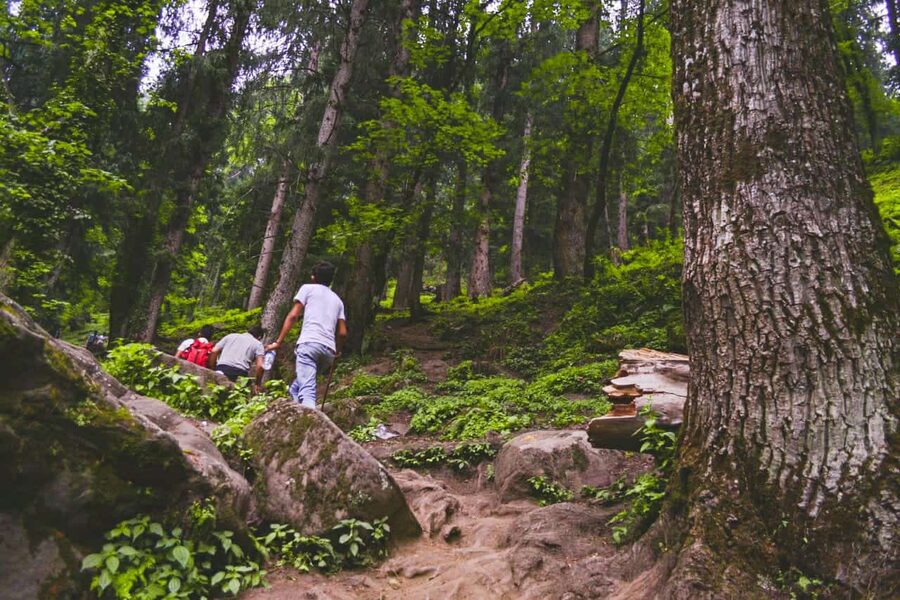
Kareri Lake is the gentle alternative on the Dhauladhar side. From Kareri village (about 25 km north of Dharamshala) the trail follows the Nyund stream up through dense oak and rhododendron forest for around 13 km to a small glacier-fed lake at the base of the Dhauladhar wall.
Three days at most. The lake freezes over completely in winter, which is when the trek is most photographed but also when the upper trail is icy and the camp is brutal. April-May or September-October are kinder windows.
Bara Bhangal (challenging traverse)
Bara Bhangal is the classic shepherd’s traverse from Manali to Bir via the village of Bara Bhangal in Kangra district, crossing two passes (Kalihani at around 4,800 m and Thamsar at around 4,750 m). It’s eleven to thirteen days on trail and another three days of buffer at either end, and it’s serious.
The campsites mostly sit below 4,000 m, but the constant up-down across two passes is what makes it strenuous; you’re never resting at altitude, you’re always either climbing to a pass or coming off one.
The reason it remains my favourite Himachal trek isn’t the difficulty. It’s the village of Bara Bhangal itself: a 200-house community at 2,500 m that has no road access, where the only way in or out for most of the year is the trek you’ve just done.
Spending a rest day there, watching the goat herds come back in from the pasture, gives you a glimpse of pre-road Himalayan life that’s almost gone elsewhere. Operators run this June through early October. Not before, because Kalihani holds snow until mid-June. Not after, because Thamsar gets cut off in heavy autumn snow.
The expedition-grade passes
This is where the article starts steering hard. The treks below are not appropriate for first-timers and not appropriate for trekkers with fewer than two prior high-altitude trips on their record. They’re not quoted as harder for sport.
They’re objectively riskier: longer time at altitude, more glaciated terrain, more weather-dependent days, more chance that something goes wrong far from a road.
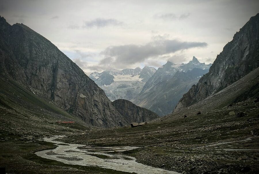
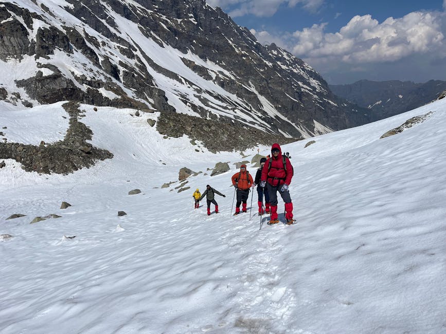
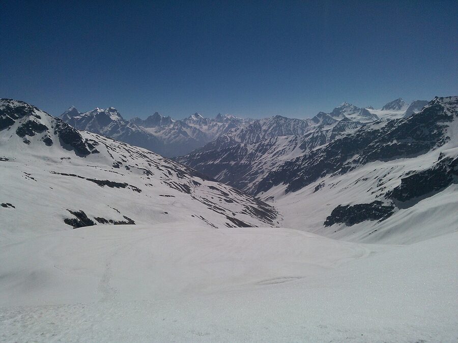
Pin Parvati Pass (5,319 m / 17,451 ft)
Pin Parvati crosses from the green Parvati Valley side of Kullu to the rain-shadow Pin Valley of Spiti via a 5,319 m pass. The trek is eleven days minimum, from Barshaini up through Kheerganga, Tunda Bhuj, Thakur Kuan, Odi Thach, and Mantalai (the source of the Parvati River, around 4,100 m), then a long climb to base camp and over the pass into the Pin Valley. Exit at Mud village.
The objective hazards are real. The Parvati Valley side has river crossings and exposed sections above the gorge. The pass itself is a glaciated saddle that catches weather; groups sometimes wait at base camp for two or three days for a window.
The descent into Pin Valley is loose scree for hours. If you’re not on a properly equipped expedition with two trek leaders, fixed rope on the technical sections, and a satellite communicator, don’t go.
The reward, when conditions cooperate, is one of the most complete crossover treks in India. You start in monsoon-green Kullu and finish three days later in the moonscape of Spiti without ever leaving foot-pace. There’s no other trail that compresses that geographic shift into a single trek.
Pin Bhaba Pass (4,915 m)
Pin Bhaba is Pin Parvati’s smaller, tougher cousin. Smaller because the pass itself is around 400 m lower (4,915 m by most operator data), and the trek is nine days rather than eleven. Tougher because the trail is less travelled, the route-finding is harder, and the descent into Pin Valley is steeper. Same crossover concept (Bhaba Valley in Kinnaur to Pin Valley in Spiti), same demand on fitness and prior experience.
Best done in late August through mid-September when the monsoon is winding down on the Bhaba side and the Pin Valley meadows are at peak gold. Earlier in summer the river crossings are dangerous; later, the snow is too deep on the pass.
Buran Ghati (~4,575 m)
Buran Ghati is the most rewarding moderate-difficult trek I’d send a fit second-or-third-timer on. Eight days from the village of Janglik (about three hours from Rohru in Shimla district), through Dayara meadow, the alpine campsite at Dunda, over the pass and down into the storybook village of Barua in Sangla Valley.
The pass itself involves a snow-gully descent on a fixed rope; trekking outfits supply the rope and harness, and it’s the most technical stretch on any standard Himachal trek that’s not an expedition.
The variety per day is what makes it worth the effort. Janglik is a wooden-templed shepherd village. Dayara is the kind of meadow that goes for kilometres. Dunda is alpine.
The pass crossing is dramatic. Barua is fruit orchards and slate roofs. Five distinct landscapes inside eight days.
Rupin Pass (4,650 m / 15,250 ft)
Rupin Pass is the same shape as Buran but on a different ridge. Eight days from Dhaula village in Uttarakhand, through Jiskun and Saruwas Thach, with the famous three-stage Rupin waterfall midway, over the pass and down into the Sangla Valley side at Sangla Kanda.
It’s the only Himachal trek where the start point is in a different state, which has practical knock-on effects: most groups fly into Dehradun rather than Delhi, and the trek-end logistics involve a long road day from Sangla back to Shimla. Best in May to June for snow on the pass and water in the waterfall, or September for clear post-monsoon visibility.
Kinnaur Kailash parikrama (challenging)
_and_Jorkanden_(6473_m)_from_Kalpa_photographed_By_Sumita_Roy.jpg)
The Kinnaur Kailash circuit is a different proposition: not a trek to a destination but a circumambulation of the 6,055 m sacred peak, done as a pilgrimage by Shaivites in August and as a serious high-altitude trek the rest of the season. The route is roughly 70 km, six to eight days, with the high point at Charang La pass (around 5,300 m).
The trail is steep, the campsites high, and the water sources unreliable. It’s not for tourists. The pilgrimage version, which most travellers join, is around three to four days and goes only to the Shivling rock formation rather than the full circuit.
The Spiti and Lahaul side
,_HP,_India,_D35_7333_nx01.jpg)
The treks on the rain-shadow side of the Pir Panjal feel completely different from the Kullu-side ones. There’s almost no forest. The colours are red, beige, and the green of irrigated barley terraces around villages.
The altitude is higher to start with: most Spiti villages sit between 3,500 and 4,000 m. So the gain to a pass is shorter, but acclimatisation matters more.
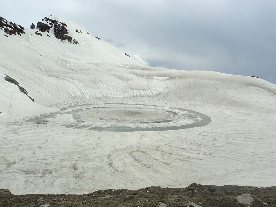
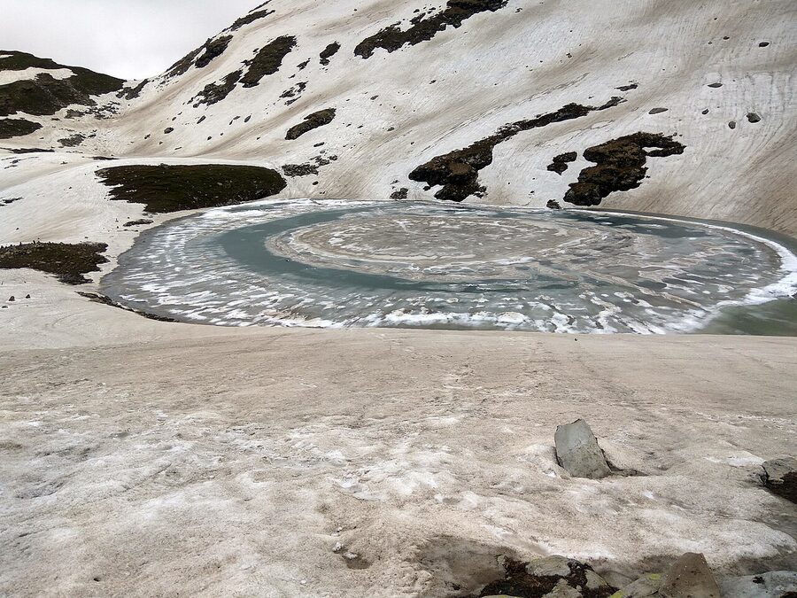
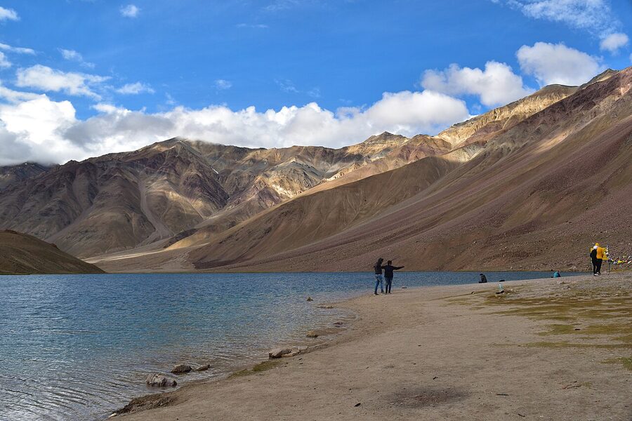
Chandratal and Baralacha La
The classic Lahaul trek follows the Chandra River from Batal up to Chandratal Lake (4,300 m), then over Baralacha La (4,890 m) to the Suraj Tal lakes and on towards Sarchu. Six or seven days. The lake itself is now reachable by 4×4 in summer, which has knocked a lot of the romance off, but a foot-pace approach is still the right way to see it.
Expect strong wind. The camp at Chandratal in shoulder season has a real “edge of the inhabited world” feeling.
Kanamo Peak (5,964 m / 19,553 ft)
Kanamo is the trekking peak above Kibber in Spiti: a non-technical summit at 5,964 m that you can walk up from the village in five days if you’re acclimatised. It’s the closest most non-mountaineers will get to a 6,000 m peak, and the 360-degree view at the summit is the full Spiti-Lahaul-Kinnaur panorama.
The catch is that “non-technical” doesn’t mean easy. The summit day is twelve hours of moving on scree and snow, and the altitude does its work; people who haven’t slept four nights above 4,000 m before the summit attempt usually don’t make it.
Parang La (5,580 m)
Parang La is the old salt-trade route between Spiti and Ladakh, crossing a 5,580 m pass and ending at Tso Moriri Lake. Two weeks at expedition pace.
Wildlife is the draw. The trail passes through the meadows above Kibber where snow leopards, blue sheep, and ibex are seen, and the descent into the Rupshu plains has Tibetan wild ass and Brahminy ducks. It’s a serious commitment with cross-state permit logistics; book through an operator who’s done it before.
Miyar Valley
The gentler Lahaul option. Miyar is a remote, S-shaped valley west of Keylong, accessed by a long road day from Manali via Udaipur. The trek follows the valley north for six or seven days through villages, alpine meadow, and eventually to the toe of the Miyar Glacier at around 4,000 m.
No pass crossing, no extreme altitude. It’s a long valley walk rather than a difficult trek. Worth doing as a second-week add-on if you’ve already done Hampta and want to see Lahaul without the danger of Pin Parvati.
Tirthan, Sainj, and the Great Himalayan National Park
The trails inside the Great Himalayan National Park (GHNP) deserve their own bracket because they’re the most ecologically interesting trekking in Himachal. The park covers 1,171 km² in the Banjar sub-division of Kullu district, between roughly 1,500 m and 6,000 m, and it’s strictly regulated: no commercial cattle grazing, no hunting, permit-only entry, set campsites.
The wildlife density rewards that protection: blue sheep, Himalayan tahr, musk deer, brown bear, and a healthy population of Western tragopan.
The two access points are Sairopa-Gushaini in Tirthan Valley and the Sainj-side villages further north. Most operators run a five-to-seven-day trek up the Tirthan or Sainj rivers to a high meadow (Rola Got, Rolla, or similar campsites between 2,500 and 3,500 m), with the option to push to one of the higher passes.
It’s the only place in Himachal where I’ve seen a Himalayan tahr from a hundred metres in good light. If wildlife is what brings you to the mountains, prioritise GHNP over the more famous trekking destinations.
Sar Pass and Sainj Valley
Sar Pass (4,220 m) is the Parvati Valley side companion, run by youth-hostel-style outfits that take large groups in summer and have made it the entry-level “long” trek for college-aged Indians. The trail is fine, the operator quality is variable. Better to go with a small dedicated outfit than the cheapest mass-batch.
Which trek for which person
If a friend asked me what to do, I’d answer with a question first: how many trekking days have you done above 3,500 m? The answer drives everything else.
Zero days above 3,500 m. Triund (or Kheerganga) for a two-day weekend test. If that goes well, a four-day Manali-side moderate the next season: Beas Kund or Bhrigu Lake. Don’t jump to a pass crossing in the same trip.
Two to four days above 3,500 m. Hampta Pass is the natural next trek. Six days, a 4,287 m pass, real crossover variety, manageable risk. Bhrigu Lake or Deo Tibba base camp also work if you want to push altitude before duration.
Five to ten days above 3,500 m. You’re ready for Buran Ghati or Rupin Pass: the eight-day Himachal classics with a real pass crossing. Indrahar Pass works as a shorter alternative on the Dharamshala side.
Two or more weeks above 4,000 m, with a pass crossing or two on record. Bara Bhangal (the long shepherd traverse), Pin Parvati Pass, Pin Bhaba Pass, Kanamo Peak, Parang La. These are the expedition-grade trails. Don’t sign up for one as a stretch; sign up when you genuinely want what they offer and can handle what they ask.
The temptation to skip a level is the single most common mistake I see. A friend who did Roopkund last year and then signed up for Pin Parvati this year had the wrong expectation: Roopkund is a six-day trek to 4,800 m in Uttarakhand, mostly meadows, with one short steep day. Pin Parvati is eleven days, glaciated, with technical sections. The progression is not linear.
Seasons and when each trek opens
Himachal trekking runs in two seasons with a rough divider on either side of the monsoon.
Pre-monsoon (May to mid-July). Snow on the high passes is fresh and stable. The wildflowers start in late May at lower altitudes and move up the slope through June and July.
Hampta, Beas Kund, Bhrigu Lake, Buran Ghati, Rupin Pass all open early-to-mid-June; the higher expedition treks (Pin Parvati, Pin Bhaba) need until July to clear. Triund is open year-round but icy in winter and unpleasant in May with the haze.
Monsoon (mid-July to mid-September). The Kullu-side trails get hammered with rain and the rivers are dangerous. The exception is the rain-shadow side: Spiti, Lahaul, and the Pin Valley side of any crossover get less than 200 mm of rain even in a heavy monsoon year.
Pin Parvati, Pin Bhaba, Parang La, Kanamo, Miyar Valley, and the Spiti-side approach to Hampta all run safely in this window. Don’t go to Tirthan or the Dharamshala-side trails during monsoon.
Post-monsoon (mid-September to October). The shoulder window most experienced trekkers prefer. Skies clear, crowds thin, and the autumn light on the Dhauladhar and Pir Panjal is the best of the year.
Hampta, Bhrigu, Beas Kund, Buran Ghati, Rupin Pass all run until early-to-mid October. The pass-crossing days get cold by late September; bring a proper down jacket.
Winter (November to April). Most trails close. The exceptions are the low-altitude pilgrim hikes (Bijli Mahadev, Prashar Lake, Triund as a day-trip) and the speciality winter expeditions like Kareri Lake when it’s frozen, or the Chadar-style snow walks that don’t really exist in Himachal proper. Skip winter unless you’re specifically chasing a frozen-lake photo.
Permits, operators, and what it costs
Most Himachal treks don’t require a permit beyond what your operator handles, but a few do.
GHNP treks need a forest department permit issued at the Sairopa office; the operator will arrange it but you’ll need ID copies. The Pin Parvati and Parang La routes that cross into Spiti or Ladakh need inner-line permits, and groups with foreign trekkers need additional clearance.
Indrahar Pass is occasionally restricted when there’s military activity in the upper Dhauladhar; check at McLeod Ganj before booking. Triund now requires an online permit through the Forest Department; most operators bundle it.
Operator quality varies wildly. The big names (Indiahikes, Trek the Himalayas, Bikat Adventures) run consistent batches with trained leaders, fixed itineraries, and proper safety equipment. The smaller Manali- and Dharamshala-based outfits range from excellent to risky depending on which guide you draw on the day.
For first trekkers I’d pay the premium for one of the big operators. For your fifth trek, a good local guide can be cheaper and better.
Pricing on standard treks (six-day Hampta, four-day Bhrigu, four-day Beas Kund) sits between ₹8,000 and ₹14,000 (~$96 to $168) per person on a shared-tent group basis. The eight-day moderate-difficult treks (Buran Ghati, Rupin Pass) run ₹14,000 to ₹22,000 (~$168 to $264). The expedition-grade treks (Pin Parvati, Bara Bhangal, Kanamo Peak) run ₹22,000 to ₹40,000 (~$264 to $480).
All of those exclude transport from Delhi to the trailhead and back. Custom or private trips are roughly double the per-head cost.
Gear that actually matters
The standard trekking-gear list runs to about thirty items. Three of them matter more than the rest.
First: a properly broken-in pair of waterproof trekking boots with ankle support. The single most common reason I’ve seen people abandon a trek is blisters from new boots, and the second most common is a twisted ankle on loose moraine. Don’t bring trail runners on a Himachal pass crossing.
Second: a real down jacket rated for at least −10°C, even on the easier moderate treks. A 4,000 m campsite at 4 a.m. in September is colder than most beach-living visitors imagine. Synthetic puffy jackets work too but weigh more for the same warmth.
Third: a 2L+ water carrying capacity and water-purification tablets or a filter. Operators provide boiled water at meals but you’ll want to drink between meals, and stream water on most trails has goat-herd watershed upstream. Tablets are fine; a Sawyer Mini-style filter is better.
Operators rent the rest (sleeping bag, mattress, gaiters, micro-spikes for snow crossings) and the rental is usually cheaper than buying gear you’ll use twice. The exception is a small daypack (around 25-35L); bring your own one you’ve worn before.
Getting to the trailheads
The route in is part of the trip. Delhi to Manali is around 14 hours by overnight Volvo bus or 1.5 hours by flight to Bhuntar (Kullu airport). Delhi to Dharamshala is 12 hours by bus or one hour by flight to Gaggal.
From either airport you’ll take a shared cab or local bus to the trailhead village. Allow a full day for the road approach in either direction.
For Spiti and Lahaul-side treks, the road approach is longer: Manali to Kaza is a full 200 km day on the new tunnel route, or two days on the old Rohtang-Kunzum road if you want the scenery. For Kinnaur trailheads (Buran Ghati, Kinnaur Kailash), Shimla is the natural arrival airport. Reckong Peo or Sangla is the staging town.
If you’re flying into India for a trek, it’s worth budgeting two days at Manali, Dharamshala, or Shimla before the trek for acclimatisation. People who fly straight from sea level to Jobra and start walking the next morning are statistically more likely to develop altitude sickness on day three. A night at 2,000 m before going to 4,000 m matters.
Food, lodging, and what to do on rest days
On the trek itself, food is whatever the operator’s kitchen team can carry: usually rotis, dal, vegetable curry, rice, with porridge and parathas for breakfast. The standard is decent. Don’t expect variety. If you have specific dietary needs (vegan, gluten-free), tell the operator in writing at booking.
For pre- and post-trek lodging, Himachal hotels range from basic guesthouse rooms at around ₹800 to ₹1,500 (~$10 to $18) to mid-range hotels at ₹2,500 to ₹5,000 (~$30 to $60) and a small cluster of luxury properties at ₹10,000+ (~$120). Manali, Dharamshala, and Shimla all have the full range.
The trailhead villages (Jobra, Barshaini, Janglik, Dhaula) generally have only basic guesthouses or homestays, which is usually fine for a one-night stop.
Rest days at Manali are best spent at Old Manali (cafes, walks, cleaner air than the main town) or up at the Manali Wildlife Sanctuary for an easy afternoon forest walk. At Dharamshala, McLeod Ganj has the cluster of cafes and the Tibetan complex worth half a day. At Kasol, sit by the river.
The state’s festival calendar sometimes intersects with trekking season. Kullu Dussehra falls in October, and trekkers ending a Hampta or Bhrigu trek can drop straight into the festival in Kullu town.
What I’d actually do
If I had a first trip to Himachal and ten days, I’d fly to Delhi, take the overnight Volvo to Manali, sleep one night, then do Hampta Pass with a Chandratal extension on day six. Then a recovery day in Old Manali and the bus back to Delhi. That’s the trip that gives you the most variety with the least risk.
If I had two weeks and one prior trek, I’d go to Sangla via Shimla and do Buran Ghati. The eight-day trek through that ridgeline gives you everything Himachal has (meadow, forest, pass crossing, slate-roofed village) without the expedition-level commitment.
If I had three weeks and serious miles in my legs, Bara Bhangal Manali to Bir is the trek I’d pick over any other in Himachal. It’s the one that stays with you longest after you come back.
The treks that don’t make my list are the ones the marketing copy pushes hardest: the photogenic Instagram trails that get oversold to first-timers. Some of them are great trips done with the right preparation. Pin Parvati is a great trip done with the right preparation.
As an entry trek it’s a mistake, and the sub-six-day “easy Triund-and-Kheerganga combo” tour packages that pretend you’re “trekking in the Himalayas” sell you the postcard, not the real thing.
Pick one trek, train for it, do it properly, and come back next year for the next one. The mountains aren’t going anywhere.