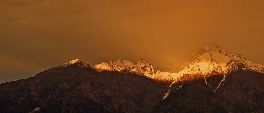
The first sunrise over Kinner Kailash is the moment that justifies the drive. From a Kalpa rooftop at 6 a.m. in late September, the cold is sharp enough that your breath fogs the camera, and the silver pyramid of rock across the valley turns gold for about ninety seconds before the sun clears it.
Kinnaur is the high-altitude district at the eastern edge of Himachal Pradesh, sitting between two more famous neighbours. Below it, the apple country and hill towns of Shimla district. Above it, the cold-desert moonscape of Lahaul and Spiti.
To the east, the closed border with Tibet. The road that runs through it, the old Hindustan Tibet Highway, is the spine the whole trip is organised around.
For most international travellers planning a Himachal trip, the question is not whether to visit Kinnaur. It’s whether to visit Kinnaur or Spiti. They get bracketed together in itineraries and Instagram reels, and they are administratively neighbours, but they are not the same place.
Spiti is the rain-shadow desert with the photogenic Tibetan monasteries. Kinnaur is the green, watered, half-Hindu half-Buddhist district below it, with its own monasteries, its own peaks, and its own quieter rhythm. Most people who do both end up saying Kinnaur was the part they wished they had stayed in longer.
This guide is for travellers from outside India trying to weigh that choice, work out the permit logistics (mostly simpler than people think), and figure out which villages anchor the trip. Prices are in Indian rupees with the US dollar conversion on first mention; the conversion drifts a bit but the order of magnitude is what matters.
Kinnaur or Spiti? The Real Difference
Spiti gets the magazine covers. Key Monastery on its hilltop, the high villages around 4,500 metres, the photogenic emptiness of a cold desert. None of that is wrong. But the trade-offs people skip over when they pick Spiti for a first Himalayan trip add up fast.
The numbers, side by side:
| Factor | Kinnaur | Spiti |
|---|---|---|
| Open to visitors | March to November (most of the district year-round) | June to September from Manali side; May–October via Kinnaur |
| Altitude of main villages | 2,700–3,450 m | 3,650–4,500 m+ |
| Acclimatisation risk | Low to moderate | Genuine, first night above 3,500 m is a problem for many |
| Permit (Indians) | None for the main circuit | None until you cross Sumdo from Spiti side back into Kinnaur |
| Permit (foreigners) | None for Kalpa, Sangla, Chitkul, Sarahan, Reckong Peo | Inner Line Permit needed for Sumdo onwards on the Kinnaur route, or via the Manali tunnel route |
| Landscape | Apple orchards, cedar and pine forests, river valleys | High-altitude cold desert, almost no trees |
| Religion at most temples | Mixed Hindu and Buddhist, often in the same village | Tibetan Buddhist almost exclusively |
| Time needed | 5 to 7 days for the standard circuit | 7 to 10 days minimum |
| Mobile signal | Decent in lower Kinnaur, patchy past Pooh | Spotty everywhere, BSNL only in many villages |
The short summary: if you have eight to fourteen days and any tolerance for altitude, do both as a loop. If you have five to seven days, pick Kinnaur. Spiti rewards the patient traveller who has time for one slow week at altitude. Kinnaur rewards the shorter trip with a softer learning curve and arguably better food.
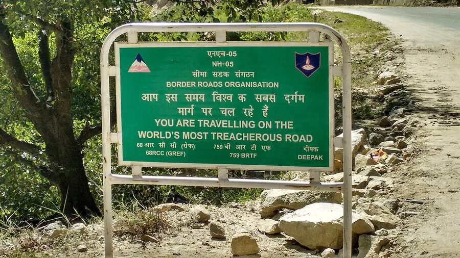
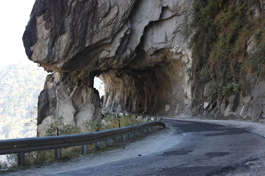
One other thing the comparison tables never say. Kinnaur’s road, the Hindustan Tibet Highway, was already filmed for a History Channel “deadliest roads” episode. The Spiti road is rougher in absolute terms, with more washouts and more water crossings between Gramphoo and Losar.
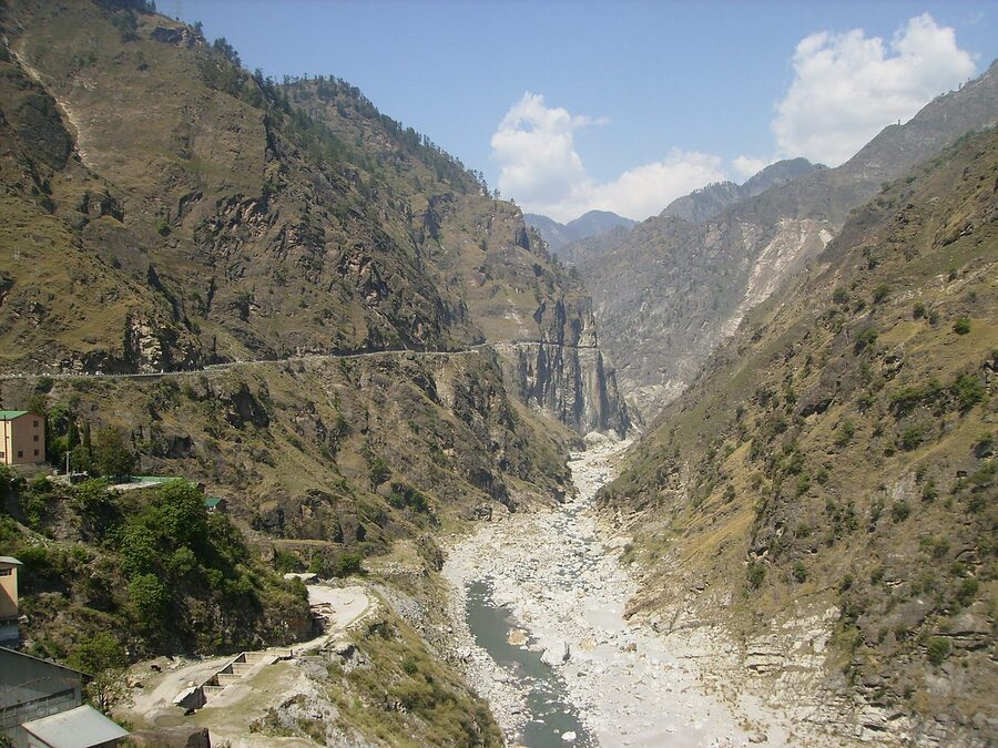
But the Kinnaur road has more gorge-edge sections where the drop is straight down to the Sutlej a thousand feet below. Both are safe if your driver is local and not in a hurry. Neither is safe if either of those is wrong.
What Is Kinnaur, Geographically
Kinnaur is one of Himachal Pradesh’s twelve districts, sandwiched between Shimla district to the south, Kullu and Lahaul-Spiti to the north and west, and Tibet (China) to the east. It covers about 6,400 square kilometres and has a permanent population of around 84,000 people. The district capital is Reckong Peo, an unglamorous market town that everyone calls Peo.
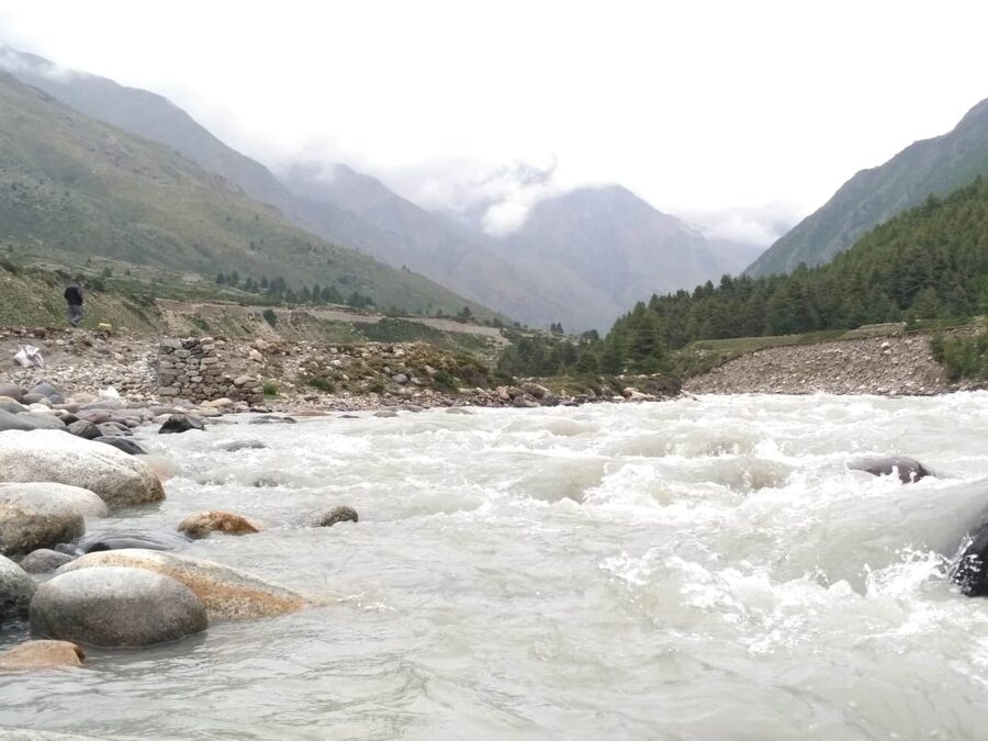
The Sutlej river is the geographic spine. It enters Kinnaur from Tibet near Shipki La (closed to civilians), flows roughly southwest the full length of the district, and exits into Shimla district past Bhabanagar. Most of the major villages either sit on the Sutlej or up a tributary valley.
The biggest tributary is the Baspa, which joins the Sutlej at Karcham and runs east-southeast into the Sangla–Chitkul valley. Locals don’t really talk about “Kinnaur Valley” the way travel sites do. The district has several distinct sub-valleys: the Sutlej corridor, the Baspa (Sangla) valley, the Hangrang valley up at Nako, the Bhaba valley off Wangtu, the Ropa valley near Pooh.
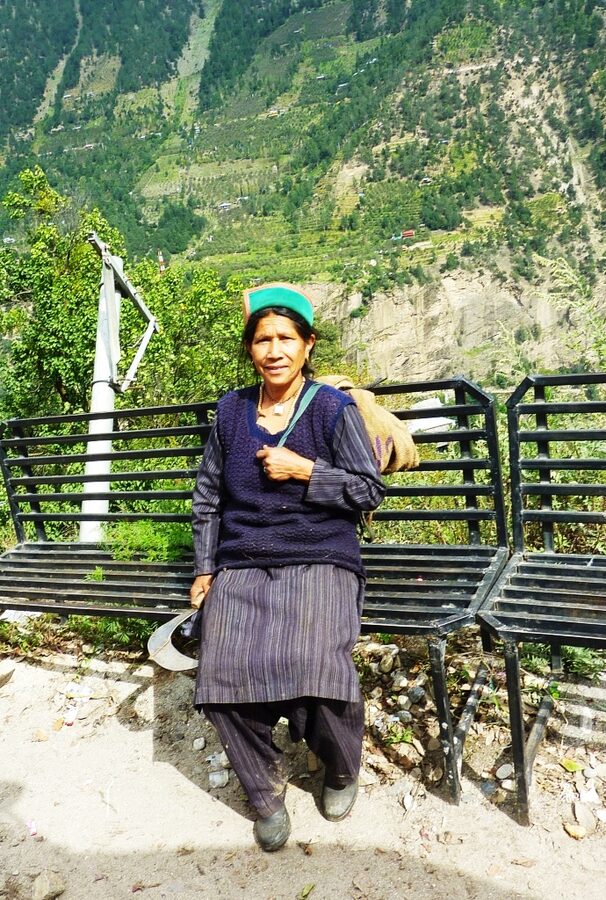
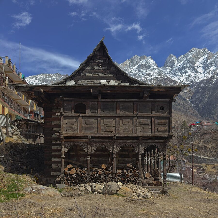
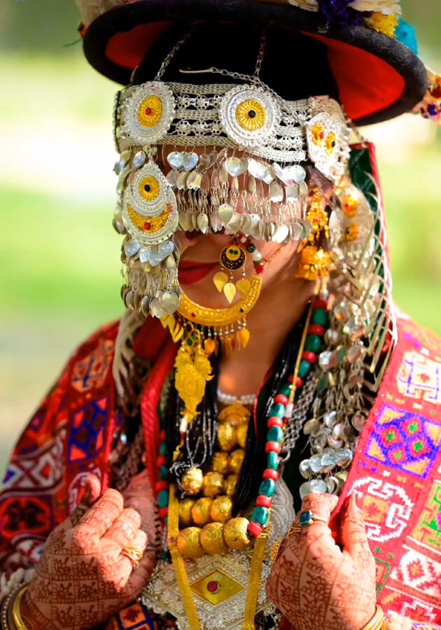
Each sub-valley has its own dialect of the Kinnauri language, its own variation on the green-bordered Kinnauri topi (cap), and its own mix of Hindu and Buddhist temples.
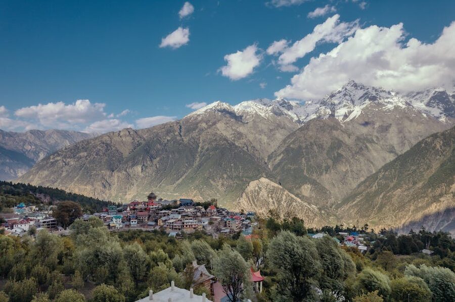
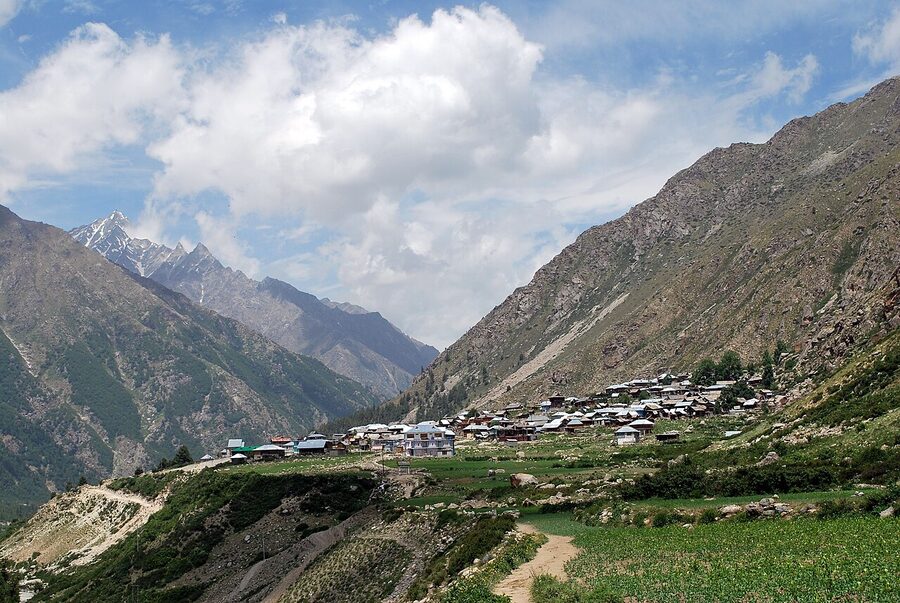
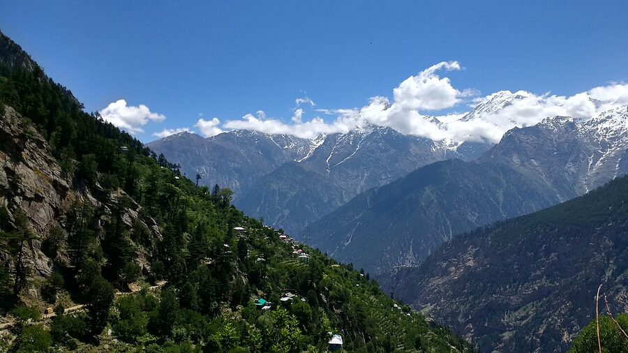
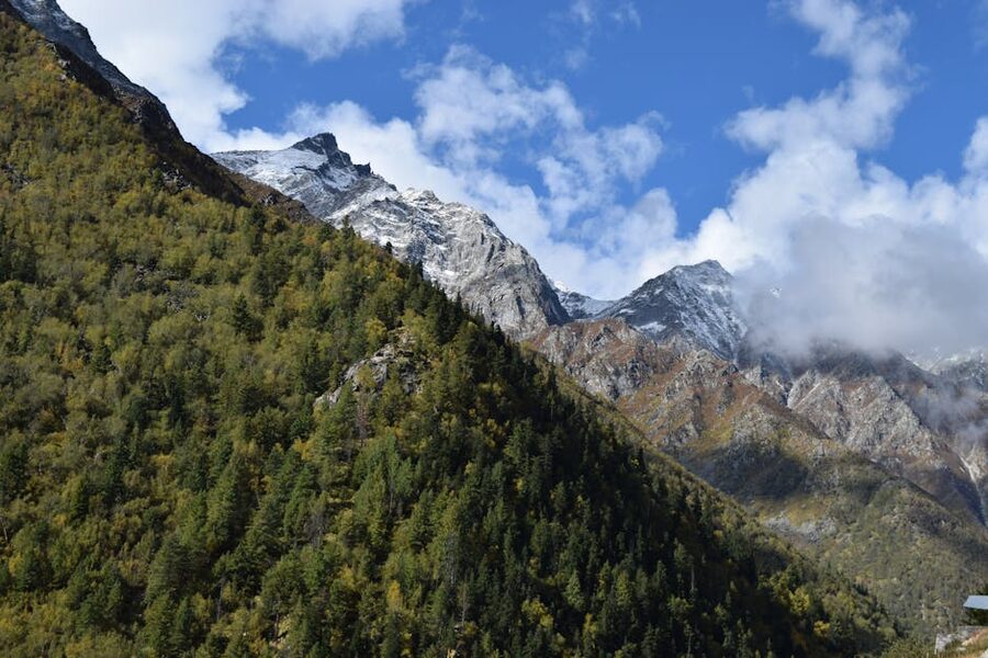
Lower Kinnaur (Sarahan, Sangla, Kalpa, Reckong Peo) is the green half. Apple orchards everywhere, pine and cedar forest above the orchards, fields of millet and peas on the irrigated terraces.
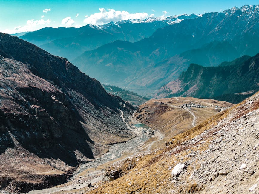
Upper Kinnaur (past Pooh, up to Nako and beyond to Sumdo) is drier, browner, and starts to look like Spiti. The treeline drops out around Pooh and the houses turn from slate-roofed wood to flat-roofed mud-brick. That transition is one of the more striking shifts you’ll see anywhere in India: a single day’s drive takes you from cedar forest to high-altitude desert.
When to Go
The short answer: April to June, and then late August through October. If you can only pick one, pick the second one. Specifically, mid-September to mid-October is the sweet spot the locals will quietly tell you about if you ask.
Spring (March–June)
March is too early for Chitkul. The road usually opens around the first week of April, sometimes later if there’s been heavy snow. By mid-April the apricot trees are blossoming in lower Kinnaur and the apple blossom follows about two weeks behind.
May and June are the warmest months, daytime temperatures of 18 to 25°C in Kalpa and Sangla, dropping toward freezing at night above 2,800 metres. The downside of late May and June is the volume of Indian school-holiday traffic. Hotels in Kalpa and Sangla fill up two months ahead, and Chitkul gets a tour-bus rush most weekends.
Monsoon (July–August)
I’d avoid this window unless you’re flexible with dates. The monsoon hits the lower stretches of Kinnaur hard, and the geology of the Sutlej gorge makes landslides a near-weekly event somewhere along NH-5. Sections of the road close for hours or days at a time.
You can absolutely still travel. The apple harvest has started by late August and the post-monsoon clarity is beginning to set in. But if you have a tight schedule, pick a different month.
Post-monsoon (late August–October)
This is the window. The rains have finished by the first week of September, the dust has been washed off the mountains, and the apples are red and being trucked out by the lakh-tonne. The air is so clear that Kinner Kailash looks close enough to touch from Kalpa.
October daytime temperatures stay around 15 to 18°C in lower Kinnaur. Nights get cold but not yet bitter. Hotels are easier to find, and trucks on the highway thin out by mid-October.
If I had a single week to give to Kinnaur, I’d plan it for the last ten days of September.
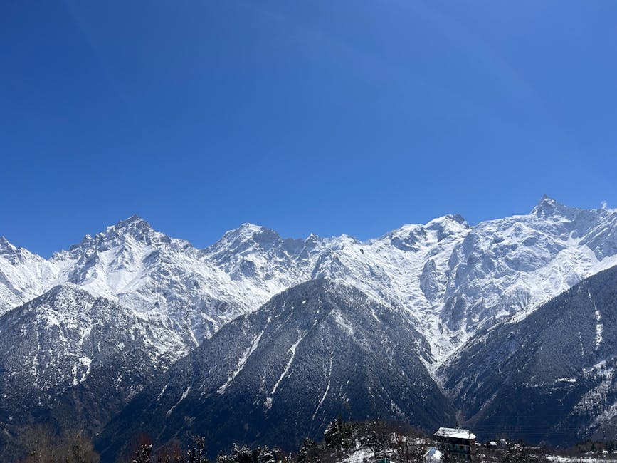
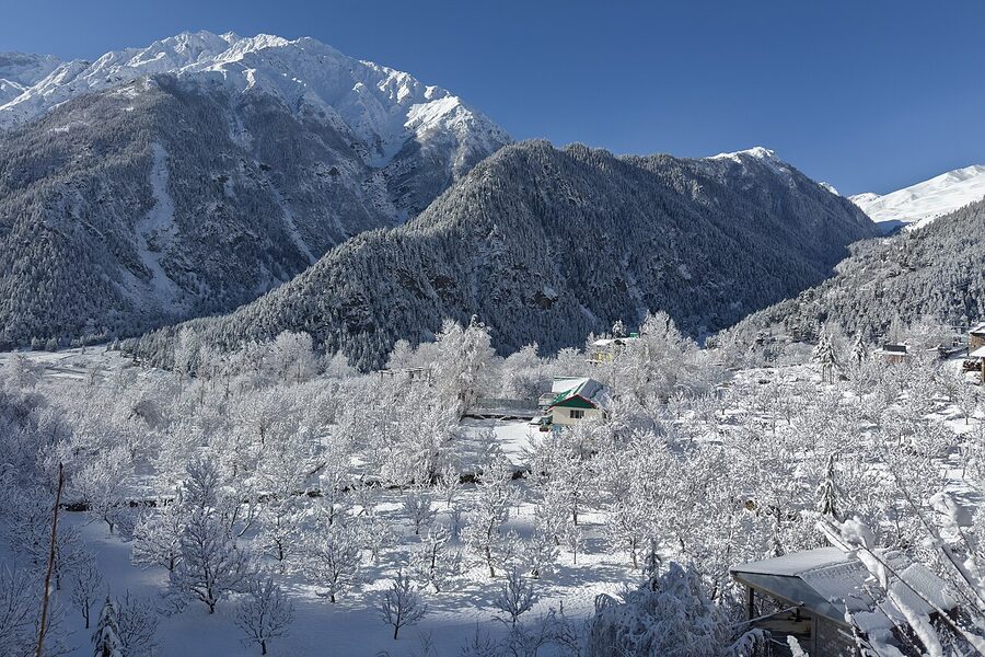
Winter (November–February)
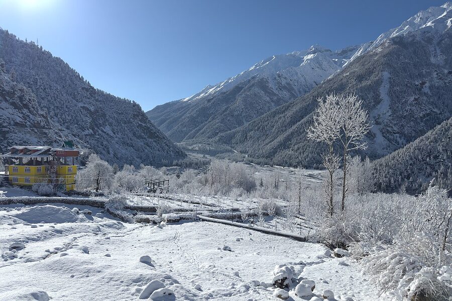
Sarahan stays open year-round. Kalpa and Sangla mostly stay open, with intermittent road closures during heavy snow.
Chitkul closes; the road is usually blocked from late December through March and most of the village’s thousand-odd residents move down to Sangla or Rakcham for the winter. If you specifically want snow and don’t mind that some places are unreachable, January in Kalpa is genuinely beautiful. Just don’t book a non-refundable trip and assume Chitkul will be open.
Permits: The Important Distinction
This is the question I get asked most often by foreign travellers planning a Kinnaur trip, and the answer is much simpler than the internet usually makes it sound.
The whole strip of land between the Inner Line (a notional boundary the Government of India draws back from the actual frontier) and the international border is a Protected Area. Foreigners need permits to enter it.
But the Inner Line in Kinnaur is drawn far enough back that all the main tourist destinations sit safely on the open side of it. The places you actually want to see, Sarahan, Sangla, Rakcham, Chitkul, Reckong Peo, Kalpa, Roghi, Kothi, all sit below the Inner Line. No permit needed for any of them, regardless of nationality. You just carry your passport and travel.
Where the permit kicks in, for foreigners, is when you continue past Pooh into the upper district (Nako, Sumdo, and onward into Spiti through the Kinnaur route). From Pooh upwards you are inside the Inner Line, and a foreign visitor needs an Inner Line Permit (ILP).
The fee through the Kinnaur e-Governance Centre is ₹200 (~$2.40) per person, plus a small handling charge if you go through a travel agent. ILPs are issued at the SDM offices at Kaza, Pooh, Kalpa (Reckong Peo), or Shimla. You’ll need photocopies of your passport and visa, plus passport photographs. The simplest place for foreigners to apply is the District Magistrate’s office in Reckong Peo, before you head north past Pooh.
Indian nationals do not need an ILP to enter the Inner Line in Kinnaur. They do need one if they are going on into Spiti via the Kinnaur–Sumdo route, but that’s issued on the spot at the Sumdo checkpost, no fee. The official guidance from the district administration is on the Kinnaur tourism page, worth reading before you travel because the rules occasionally update.
Two practical notes. Foreigners going further than Nako toward Sumdo should travel in groups of two or more, per the standing rules; solo foreigners are technically supposed to be sponsored by a registered travel agent. In practice the rule is enforced loosely, but the cleanest path is to travel with one other person.
And: the road to Shipki La itself, where the Sutlej crosses from Tibet, is closed to foreign visitors entirely. There’s no negotiating it. The official line is that Shipki is a protected military area; the unofficial line is the same.
Getting There: The Hindustan Tibet Highway
You reach Kinnaur by road. There is no airport, and the nearest railhead (Kalka, the start of the Shimla toy train) is a long day’s drive away. The whole trip is organised around NH-5, the Hindustan Tibet Highway, which runs from Kalka through Shimla, Narkanda, Rampur, into Kinnaur, and on to Spiti and the Tibet border (where it stops being a public road). If you’re booking a multi-stop Himachal trip, our Himachal tour packages page has driver-and-itinerary options that cover the Kinnaur stretch.
From Delhi or Chandigarh
Most international travellers fly into Delhi, then either drive overnight to Shimla (about 8 hours) or take a daytime train (Shatabdi Delhi to Kalka, then connecting onward). From Shimla, Reckong Peo is roughly 235 km. Done sensibly that’s two days with an overnight at Sarahan or Narkanda. Drive it in one day and you’ll arrive in Peo too tired to enjoy the place.
The road climbs gradually. You’re at 2,200 metres by Shimla, dropping to 1,000 metres at Rampur on the Sutlej, then climbing back through the Kinnaur entry at Jeori to around 2,600 metres at Reckong Peo. The gradual climb is one of Kinnaur’s quiet advantages: the body adjusts as you go. By the time you reach Sangla or Kalpa, you’ve already had two nights at altitude.
From Manali
If you’re already in Manali, you have two routes. The shorter one runs over Jalori Pass (3,120 m) to Rampur, then onto NH-5. About 310 km, twelve to fifteen hours including the pass. Break it overnight at Jalori or in Jibhi at the Tirthan turnoff.
The longer alternative goes through the Atal Tunnel to Lahaul, into Spiti from the Manali side, and exits Spiti into Kinnaur over Kunzum Pass and down through Tabo and Nako. That’s a 12-day Spiti–Kinnaur loop in itself, not a way to “just get to Kinnaur.” For the broader Manali-side context (and where to sleep before you set off) see our Manali hotels guide.
Buses and shared taxis
Himachal’s state bus service (HRTC) runs daily buses from Delhi (ISBT Kashmiri Gate) to Reckong Peo and Sangla, plus regular buses from Shimla and Chandigarh. The Delhi–Peo buses are seventeen-hour overnight haulers. Perfectly fine if you’re under thirty and budget-driven, but exhausting otherwise.
Shimla–Peo buses are more reasonable at six to seven hours. Buses are around ₹600 to ₹1,200 (~$7 to $14) one way depending on whether it’s a basic Volvo, an HRTC ordinary, or a private operator. Shared taxis run from Shimla and Rampur to most main villages and cost roughly twice the bus fare per seat.
Self-drive vs hired car
I would not self-drive Kinnaur as a first-time visitor unless you have real mountain-driving experience. The road has too many one-lane gorge sections, blind switchbacks, and apple-truck convoys to learn on. Hire a driver with the car.
Reliable Reckong Peo and Shimla operators charge ₹4,500 to ₹7,000 (~$54 to $84) per day for a sedan with driver, fuel, parking and the driver’s accommodation included. Innovas and SUVs run ₹6,000 to ₹9,000 (~$72 to $108) per day. For a one-week Kinnaur trip with two passengers, that’s about ₹40,000 (~$480) total split between you, which is competitive with self-drive once you factor in fuel and stress.
Sarahan: The Gateway and the Bhimakali Temple
Sarahan technically sits in Shimla district, not Kinnaur, but it’s a 17 km detour from the Jeori turn-off on NH-5 (about 23 km past Rampur) and almost everyone treats it as the first stop on the Kinnaur circuit. Make it the first night out of Shimla and you turn an exhausting one-day drive into two manageable half-days.
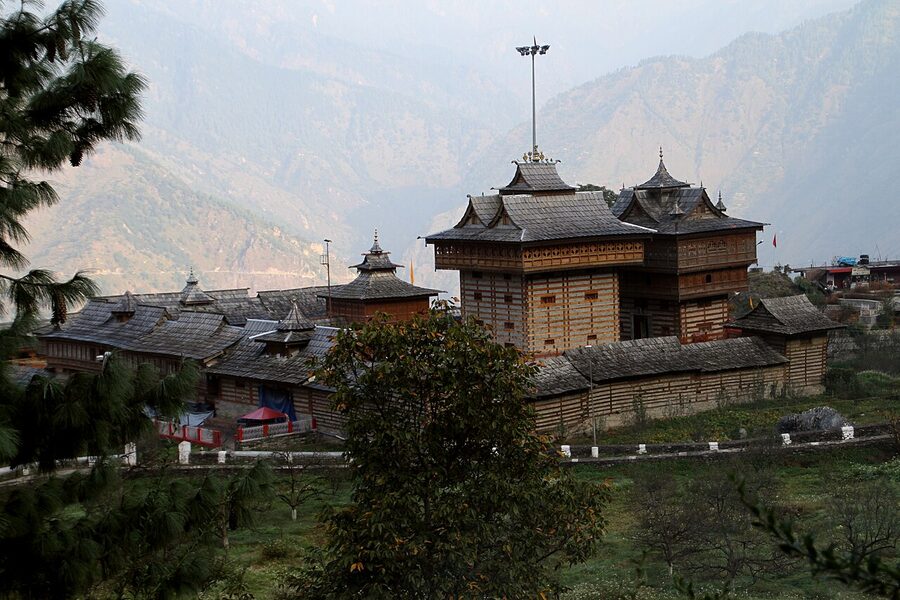
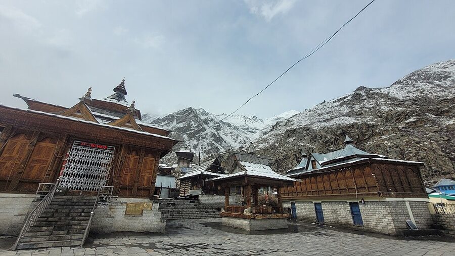
The reason to stop here is the Bhimakali temple. Two stone-and-wood pagoda towers, the older one possibly fifteenth-century but rebuilt around 1800 after an earthquake, the newer one built in 1927 to take over the active worship.
The shrine is one of the 51 Shaktipeethas (sites where, in the founding myth, fragments of the goddess Sati’s body fell to earth, Sarahan claims her left ear). It was the seat of the Bushahr royal family, who ruled this part of the western Himalayas for several centuries before independence. The temple’s architecture is the standout example of Kinnauri pagoda style: square towers, slate roofs in stacked tiers, intricately carved deodar wood throughout. Bhimakali sits on the same Hindu-temple circuit as the better-known Jwalamukhi shrine in Kangra, and both feed the older Himachali festival calendar in their own ways.
Practical notes. The temple is open from about 6 a.m. to 8 p.m. with a midday break, and there’s no entry fee. Cameras and leather goods (belts, wallets) have to be left in the lockers at the gate; you also receive a temple cap to cover your head before entering the inner sanctum.
Photographs are fine in the courtyard but not inside the working temple. Try to time your visit for the evening aarti at around 7 p.m., when the courtyard fills with locals and the temple bells start.
For an overnight, the HPTDC’s Hotel Srikhand at Sarahan has rooms from about ₹2,500 to ₹4,500 (~$30 to $54) and the best location in the village. It also has a big dorm that runs ₹300 to ₹400 (~$3.50 to $4.80) a bed if you’re on a tight budget. Several mid-range homestays in the village charge ₹1,200 to ₹2,000 a night. Daranghati Sanctuary, the old Bushahr royal hunting reserve, is a half-day drive away if you want a pre-dawn forest excursion before continuing on to Sangla.
Sangla and Chitkul: The Baspa Valley
From Karcham on NH-5 you turn off the main highway and follow the Baspa river upstream. The road is single-track in places, the gradient steep, the views ridiculous. About 18 km in, the valley opens into the Baspa (Sangla) valley, the most famous side trip of the whole Kinnaur circuit.
Sangla town
Sangla itself sits at 2,700 metres on the right bank of the Baspa, with apple orchards on every irrigated terrace and the snow-line visible above. The town has the area’s best mid-range accommodation, a working market, an ATM that’s usually functional, and the trailheads for several day hikes including the climb to Sangla Kanda meadow above the town.
Sangla is sometimes glossed as “Pass of Light” in old Tibetan; whether that’s etymologically correct or not, it fits the place.
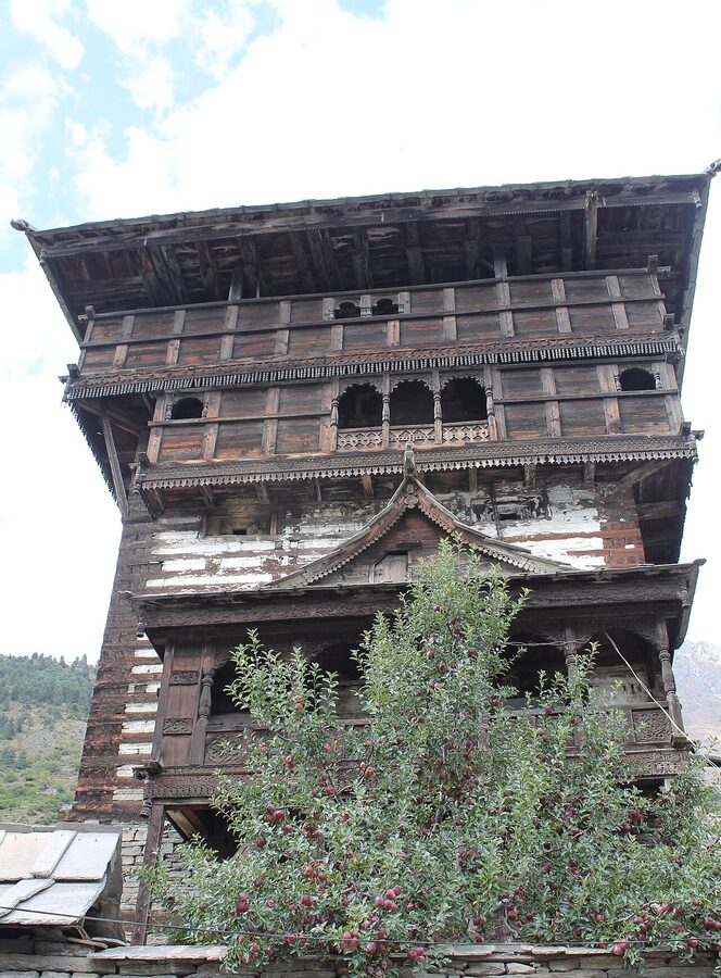
The standout stop in Sangla is Kamru Fort, a 2 to 3 km uphill walk from the town centre. The fort is the older home of the Bushahr royal family (they relocated to Sarahan and then Rampur over the centuries) and dates from around the 15th century, though the present structure has been rebuilt in pieces.
The lower floors are now a temple to Kamakhya Devi (the same goddess form worshipped at the famous Kamakhya temple in Assam, which is the lineage point), and above the temple is the carved wooden upper structure. You can climb to the upper floors but not into the residential parts; the views down the valley alone are worth the walk up.
Other things to do from Sangla. The 12 km walk along the river to Batseri village through cedar forest is the local favourite hike, about four hours one way. Pick a packed lunch up at the Sangla bazaar before you start.
The trout fishery on the Baspa, established in the 1960s, sells fresh trout you can take to any homestay kitchen to be cooked. And in apple harvest season, late August through October, almost any orchard owner will let you walk through if you ask. The Kinnauri varieties (Royal, Red Delicious, Golden) are smaller than the supermarket Kashmir apples but sweeter, with a longer shelf life.
For sleeping in Sangla itself, Banjara Camp & Retreat on the Baspa is the long-running mid-range pick (apple-orchard setting, riverside tents and rooms, open mid-March to October). Most homestays in the village proper run ₹1,500 to ₹3,000 (~$18 to $36) and are easier to book on arrival than online.
Rakcham and Mastrang
From Sangla the road climbs another 14 km up the Baspa to Rakcham, sitting in a wider stretch of the valley where the meadows roll out flat between the river and the cliffs.
Rakcham has a couple of dozen homestays, a few small camp sites set up by the river in summer, and a working population that includes a fair number of people whose families moved up from Chitkul to handle the tourist season. If you’re doing a four-night Baspa-valley itinerary, splitting two nights between Rakcham and Sangla beats two nights in either alone.
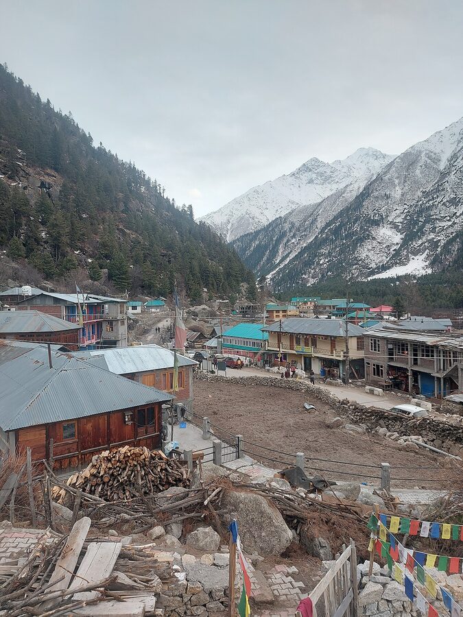
Chitkul: the last village
The road ends at Chitkul, 28 km past Sangla at 3,450 metres. This is the last roadhead in the valley and, depending on which version you accept, the last inhabited village in India before the Tibet border.
Strictly speaking there are smaller villages further upstream that fall within India’s claim, but Chitkul is the last one connected by a public road. The village has roughly 600 to 900 residents in summer; almost all of them move down to Rakcham or Sangla in winter when the road closes.
What’s there. A clutch of slate-roofed houses on the cliff above the Baspa, the old Mathi Devi temple in the village centre, a Buddhist Kagyupa temple a couple of houses over (the syncretism is the point: Hindu and Buddhist temples in the same village), the celebrated “Hindustan ka Aakhri Dhaba” (the last dhaba in India) where everyone stops for rajma chawal, and increasingly a row of newer hotels and homestays catering to the day-tripper rush.
The Mathi temple itself is over 500 years old. It’s a wood-frame, multi-tiered shrine to a local goddess, sister to the Kamakhya at Kamru Fort and worshipped here as the village’s patron deity.
The carving on the eaves and the door frames is what to look at; most of it predates the British era. The temple is usually open at sunrise and again from late afternoon. There’s a small donation box; ₹50 to ₹100 is the right amount to leave.
What Chitkul actually feels like now. Five years ago this was a one-night stop where you sat on the riverbank with a thermos and watched the Baspa go by. It’s still that, but with a lot more company.
Day-trippers from Sangla pour in by 11 a.m. and clear out by 4 p.m. If you want the quiet version, stay overnight. Zostel Chitkul has dorm beds from ₹500 (~$6) and private rooms from around ₹1,500 (~$18); homestays in the village are ₹1,200 to ₹2,500.
Walk along the river before breakfast. Have dinner at the dhaba after the buses have gone. The 6 p.m. to 10 a.m. version of Chitkul is the one worth coming for.
One thing worth knowing about the road in. The 28 km from Sangla to Chitkul is a single track for most of its length, with the river on one side and the cliff on the other. Drivers know to honk before blind corners and use the wider passing places. In the rush from June to August, expect the drive to take an hour and a half rather than the marked thirty minutes; expect to back up at least once to let an HRTC bus past.
Reckong Peo, Kalpa, and the View of Kinner Kailash
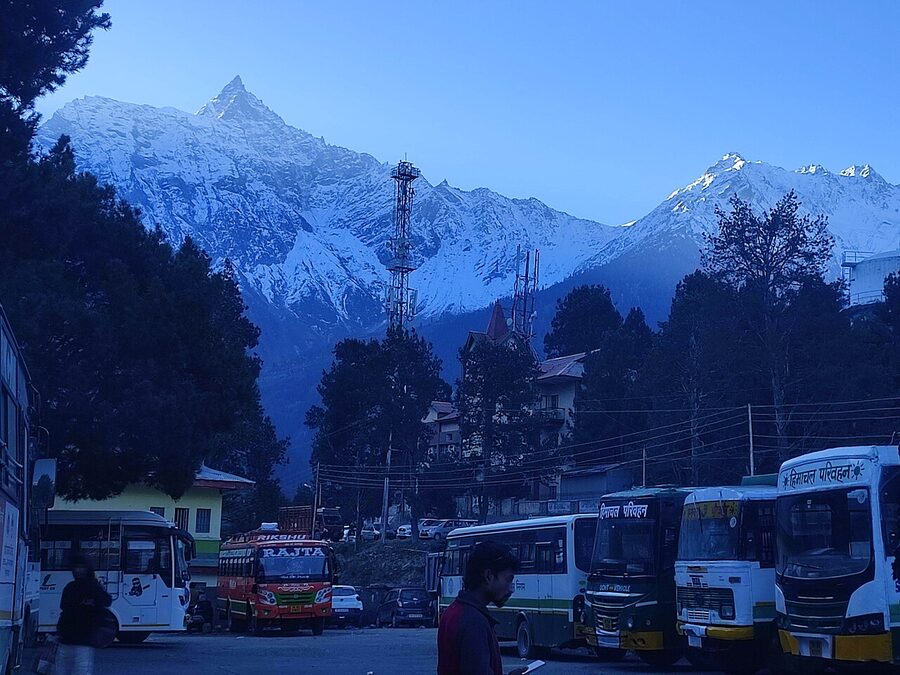
Reckong Peo (everyone says “Peo”) is the district headquarters and the practical hub for the central section of Kinnaur. It is not a tourist town. It’s a working market town at 2,290 metres, with a busy bazaar and the bus stand from which local services run to most outlying villages.
You don’t come here for atmosphere. You come for cash, fuel, an SDM signature on an Inner Line Permit, or a connecting bus.
The reason you’ll spend at least a night near Peo is its smaller, prettier neighbour seven kilometres uphill: Kalpa.
Kalpa
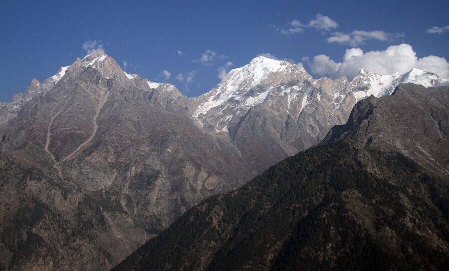
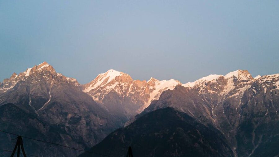
Kalpa sits at 2,960 metres on a ridge directly across the Sutlej from the Kinner Kailash range. The view is the whole point.
Step out of any south-facing hotel and the wall of snow peaks fills the horizon: Kinner Kailash itself with its famous Shivling rock formation, Jorkanden (Kinnaur’s highest peak at 6,473 m), and a row of smaller summits. At sunrise the alpenglow runs across all of them in sequence as the sun clears the eastern wall; the cliché is true.
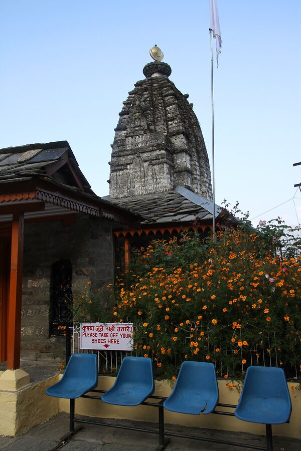
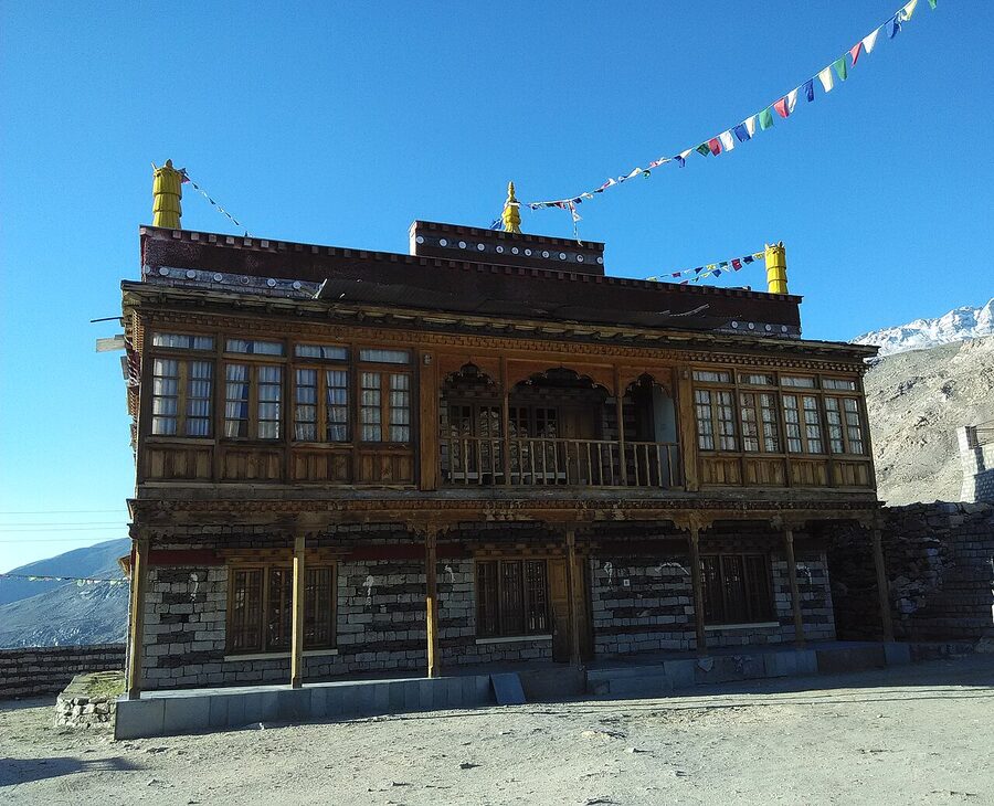
The village itself is small and laid out along a single road that climbs the hillside. The main draws are the Hu-Bu-Lan-Kar Gompa (a small Buddhist monastery traditionally attributed to the 11th-century translator Rinchen Zangpo, modest in scale but old and active) and the carved Narayan-Nagini temple just downhill from it, a kath-kuni-style Hindu shrine to a local goddess form whose precise founding date is unrecorded.
The other main thing to do is the simple act of finding a south-facing terrace and watching the mountain change colours. Most hotels offer a rooftop or a south-facing balcony for exactly this purpose. Hotel Rolling Rang is the long-running comfortable option at ₹3,000 to ₹5,000 (~$36 to $60) per night, with a row of smaller family-run guesthouses in the upper village charging ₹800 to ₹2,000.
If you have a full day in Kalpa, two side trips are worth the effort. The first is Roghi village, 8 km along the cliff road past Kalpa. The road is famous locally as the “Suicide Point” route; the cliff drop is sheer and direct, and the lookout point a kilometre out of Kalpa was named accordingly by some bored teenager about thirty years ago, though it’s now signposted as such on the official boards.
Roghi itself is a cluster of traditional Kinnauri houses with a Narayan temple at the centre. Walk it slowly. The second is the Chaka Meadows hike, an easy 3-4 km trail above Kalpa village that ends in an open meadow with a wraparound view of the Kinner Kailash range. If you’re already thinking ahead to a romantic Himachal trip, our honeymoon in Himachal page has more rooftop-view picks in this style.
One thing about the Hu-Bu-Lan-Kar gompa. The morning puja starts around 5:30 a.m. and the chanting comes through the village if your hotel is anywhere in the upper Kalpa lanes.
If you’re a light sleeper, ask for a south-facing room downhill. If you’re a curious traveller, ask for a north-facing room uphill and treat the chanting as the alarm.
Apples, Wine, and What People Eat in Kinnaur
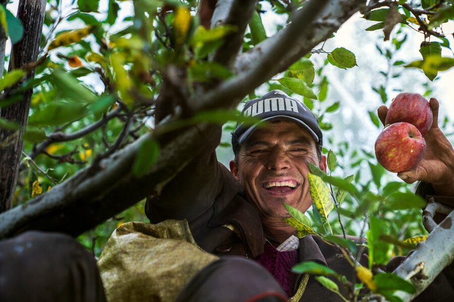
Kinnaur is one of the two best apple districts in India (Shimla being the other). Late-August through October is harvest, and you’ll see open trucks loaded with apple crates in queues along NH-5, sometimes a hundred trucks long.
The varieties are mostly Royal Delicious and Red Delicious, with smaller plantings of Golden, Granny Smith, and a few traditional Kinnauri varieties that don’t make it to commercial markets. Local prices in season run ₹40 to ₹80 per kilo (~$0.50 to $1) directly from orchards, against ₹150 to ₹250 in Delhi a few days later.
Beyond apples there are two specialty products worth knowing. Chilgoza, the local pine nut, harvested from Pinus gerardiana trees that grow wild on the higher slopes (small, expensive, more flavourful than the imported Chinese pine nuts), available at Reckong Peo and Sangla bazaars from October.
And angoori, a homemade grape wine produced in the lower Kinnaur villages around Ribba and Rispa. Angoori is not commercially sold (the licensing is complicated), but most homestays in those villages will offer a small glass if you ask politely. Apricot brandy (chuli) follows the same logic.
Food. The restaurant scene in Kinnaur is not a strong selling point. Most homestays cook standard Himachali dahl-chawal, sometimes with the local trout from the Baspa, and rajma chawal is the dependable order at any roadside dhaba.
The famous “Hindustan ka Aakhri Dhaba” at Chitkul does a good thali plate for around ₹100 (~$1.20), with unlimited rajma refills. For sit-down meals, the HPTDC restaurants at Sarahan and Reckong Peo are reliable but unexciting. The best food you’ll have on a Kinnaur trip will almost certainly be in a homestay kitchen.
Nako and Upper Kinnaur: The Edge of Spiti
Past Pooh the road climbs into upper Kinnaur and the country changes. The Sutlej, which has been with you since Rampur, turns east at Khab and disappears towards Tibet; you switch to the Spiti river coming down from the north.
The trees thin out, then disappear. The houses are mud-brick now, flat-roofed against snow. You’re inside the Inner Line at this point; foreigners need an ILP from here, Indians don’t unless they’re crossing into Spiti.
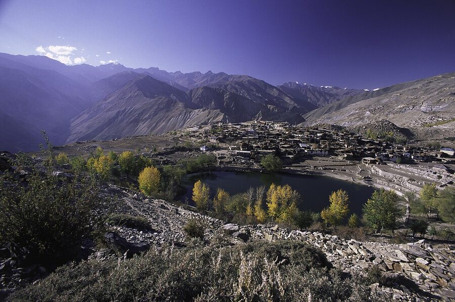
Nako is the standout stop in upper Kinnaur. A village of 600-odd people built around an artificial lake at 3,660 metres, with a thousand-year-old monastery complex (the Nako Gompa, dated to around 1025 CE under the Tibetan king Yeshe-Ö’s renaissance), four ancient temple buildings inside the gompa, and a clear view of Reo Purgyil, Himachal’s only 6,800-metre peak, directly to the south.
The largest and oldest of the four temples is the Lotsawa Lhakhang (the “Translator’s Temple”, named after Rinchen Zangpo). It’s listed by the World Monuments Fund as one of the hundred most endangered heritage sites worldwide for its 11th-to-13th-century wall paintings. The lake is small enough to walk around in twenty minutes; do it anti-clockwise, which is the Buddhist convention.
Photography inside the temple buildings is restricted. Ask the resident lama before raising the camera.
Nako has a small handful of homestays starting at around ₹800 (~$10) a night and a couple of mid-range guesthouses up to ₹2,500. Hotel Reo Purguil (named after the peak; spelled both Purguil and Purgyil locally) is the most established option. The food is basic (thukpa, momos, dal-rice), and that’s the right thing to eat at this altitude anyway.
The night sky from Nako is one of the better arguments for sleeping over rather than passing through. The village has almost no light pollution, and on a clear night the Milky Way runs the length of the lake.
Past Nako, the road continues to Sumdo (the actual border point between Kinnaur and Spiti districts) and then on to Tabo and Kaza. If you’re combining Kinnaur with Spiti, this is your route. If you’re not, Nako is the natural turn-around point. From Reckong Peo it’s about 110 km, two and a half to three and a half hours of slow driving on good roads, longer if there’s been any rain.
Off the highway: Bhaba Valley, Ribba, and the rest
Two side valleys are worth a mention if you have an extra day or two. Bhaba Valley, accessed by a turn-off at Wangtu, leads up to the village of Kafnu and the start of the Pin-Bhaba Pass trek (a 4 to 5 day hike that ends in Spiti’s Pin Valley; see the Lahaul and Spiti guide for the other side). Bhaba is greener and quieter than the main Sutlej corridor, and the road in is one of the most beautiful in Himachal.
Ribba and Rispa, just past Reckong Peo on NH-5, are the chilgoza pine and angoori wine villages mentioned earlier. Both reward a couple of hours of slow walking through the orchards and chatting with whoever is sitting on the temple courtyard wall. For longer treks and the broader wildlife in Himachal picture, the side-valley forests of Bhaba and Ropa are where the local biodiversity actually lives.
Practicalities: Cash, Fuel, Phone, Health
ATMs. The reliable cluster is at Reckong Peo (eight or nine machines spread across SBI, PNB, HDFC, ICICI, etc.). Sangla has one or two that work most of the time. Sarahan has one that’s hit-and-miss. Chitkul and Nako have none.
The general rule: top up cash at Peo to last you the rest of the trip. Have ₹10,000 to ₹15,000 (~$120 to $180) in cash for a week-long trip, in a mix of ₹100 and ₹500 notes. Digital payments work in Peo and Sangla but tail off quickly past that.
Fuel. Petrol pumps in Kinnaur: Rampur (the most reliable, last big-volume pump before entering the district), Tapri (a smaller pump just inside Kinnaur), Reckong Peo (a Hindustan Petroleum and an Indian Oil, both usually open), and a small one at Pooh. Beyond Pooh there is no petrol until Kaza on the Spiti side, around 220 km further. If you’re driving the loop, top up at Peo and carry an additional ten litres in a jerrycan for safety.
Mobile. Lower Kinnaur (Sarahan, Sangla, Reckong Peo, Kalpa, even Chitkul) has decent BSNL, Jio, and Airtel coverage. Past Pooh the network thins to BSNL only, and at Nako you’re often down to text-message-only. Foreign SIMs from Jio or Airtel work for international visitors; an eSIM bought online before arrival is the simplest route. Don’t count on data above 3,000 metres.
Medical. The district hospital is at Reckong Peo. Sangla has a smaller community health centre. For anything serious, the next real medical capacity is at Shimla, six to seven hours away in good conditions.
Carry your own first-aid kit, plus altitude-sickness medication (Diamox, prescription required) if you’re going past 3,000 metres. Acute mountain sickness is genuinely possible at Chitkul (3,450 m) and likely at Nako (3,660 m). If you’re flying into Delhi at sea level on a Wednesday and expect to sleep at Nako on the Friday, that’s too fast. Build in two nights below 2,500 metres on the way up.
Drinking water. The mountain springs are mostly drinkable, and locals drink straight from them, but if you have a sensitive stomach use a Steripen or LifeStraw to be safe. Bottled water is widely sold in lower Kinnaur (₹20 a litre), less so above Pooh. The plastic-bottle waste is starting to become a visible problem in Chitkul and Sangla; if you can travel with a refillable bottle and a filter, please do.
Beds. Across the district, expect to pay ₹800 to ₹2,500 (~$10 to $30) at homestays, ₹2,500 to ₹5,000 (~$30 to $60) at the better mid-range hotels in Sangla and Kalpa, and ₹500 to ₹1,500 (~$6 to $18) at Zostel-style hostels. For comparison-shopping the wider Himachal market, the Hotels in Himachal overview is the right starting point.
The Standard Week-Long Itinerary
Putting it all together, here is the Kinnaur itinerary I’d recommend for a first visit. It assumes you’re coming from Delhi or Chandigarh and you have a full week from arrival in Shimla to departure.
- Day 1: Shimla to Sarahan (170 km, about 6 hours with the Jeori detour). Visit Bhimakali at sunset. Overnight Sarahan.
- Day 2: Sarahan to Sangla via Karcham (about 100 km, 4 hours). Afternoon walk to Kamru Fort. Overnight Sangla.
- Day 3: Sangla. Morning hike along the Baspa to Batseri or up to Sangla Kanda. Afternoon at the trout fishery. Overnight Sangla.
- Day 4: Sangla to Chitkul (28 km), with a stop at Rakcham for lunch. Afternoon at the Mathi temple and along the river. Overnight Chitkul.
- Day 5: Chitkul to Kalpa via Karcham and Reckong Peo (about 80 km, 3-4 hours). Visit Hu-Bu-Lan-Kar gompa in the afternoon. Sunset over Kinner Kailash. Overnight Kalpa.
- Day 6: Kalpa. Morning hike to Chaka Meadows or drive to Roghi village. Afternoon free. Sunrise the next morning is the photograph everyone comes for. Overnight Kalpa.
- Day 7: Kalpa to Shimla (235 km, the long drive day). Or extend by two days to Nako and back if you want the upper-district experience.
For a longer trip, the Spiti loop adds five to seven days from Kalpa: Kalpa → Nako → Tabo → Dhankar → Kaza → Key → Kibber → Kunzum → Manali. Note that this commits you to the harder, higher half of the trip and locks you into the June-to-September weather window.
The first-time-traveller version stays in Kinnaur and saves Spiti for a future trip. There’s no shortage of Spiti articles. There is, comparatively, a shortage of people who give Kinnaur the time it deserves on its own. If you’re still trying to choose between districts, the tourist attractions of Himachal overview compares it against neighbours like Dharamshala and Kasol in the same trip-planning frame.
One Last Thing
If there’s one detail to take away from this whole guide it’s this: the Kinnaur trip you’ll remember in five years is not the one where you saw all the temples and ticked all the villages.
It’s the one where you sat on a south-facing balcony in Kalpa with a glass of chai watching the sunlight move across Kinner Kailash, or the one where you walked along the Baspa at first light when the day-trippers hadn’t arrived yet and a Kinnauri farmer in a green-banded topi nodded at you and pointed up at the peak you didn’t know the name of.
Those are the moments. Don’t over-schedule. Don’t try to do Spiti in the same trip if it means cutting Kalpa to a single night. Two unhurried valleys will beat four rushed ones every time.
Kinner Kailash is a Shiva mountain. The Shivling near its summit is one of the largest natural lingams anywhere in the western Himalayas, and devotees on the Parikrama trek treat sighting it as auspicious for the year ahead. Whether you read that mythologically or geologically, the act of looking at it across the valley at first light from Kalpa is the through-line of the whole trip. Plan around that moment and the rest will arrange itself.