
Most travellers in Himachal stop where the road from Manali ends. The drive that begins on the other side of Rohtang is to a different country.
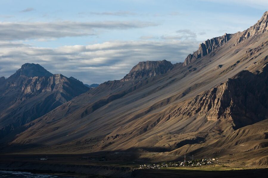
Lahaul and Spiti are two adjoining valleys north of the main Manali tourist circuit, beyond Rohtang Pass. They form a single administrative district of Himachal Pradesh, but the two halves are very different. Lahaul is the western valley, watered by the Chandra and Bhaga rivers, with patches of greenery, willow groves, and the small district headquarters at Keylong.
Spiti is the eastern valley, drier and higher, a true cold desert at the foot of the Tibetan plateau. Bare ridges, ancient monasteries, villages perched at altitudes most countries don’t have populated land at. They share a common geography, a common Tibetan-Buddhist culture, and an almost total isolation from the rest of India for half the year.
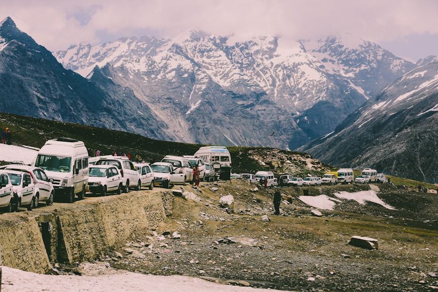
Until 2020, getting here at all meant crossing Rohtang Pass at 3,978 metres, a road that closed under snow from October to May and was a notorious traffic snarl in summer. The Atal Tunnel changed that. Since October 2020, you can drive from Manali to Sissu, the first major village in Lahaul, in under an hour, year-round. The tunnel is the single biggest reason visitor numbers to Lahaul have multiplied in the last five years.
If you came to Himachal expecting forested hill stations like Manali or the green valleys further south, this is not that. The treeline ends as you exit the tunnel. By the time you are in Spiti proper, you are in a place that geologically and culturally belongs more to Tibet than to the rest of Himachal Pradesh.
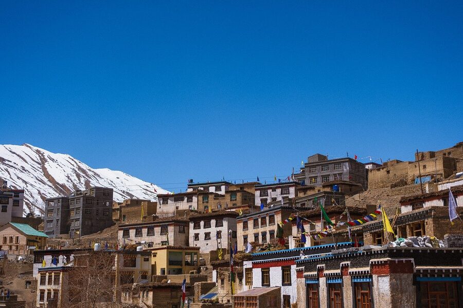
Buddhism is the dominant religion. Barley, peas, and apples grow in irrigated patches; nothing else. Old fortified monasteries cling to ridge tops in a layout that hasn’t changed in a thousand years. This guide is for travellers thinking about going up there and trying to work out whether it’s right for them.
Two Valleys, One District
The administrative name is Lahaul and Spiti, hyphenated in some places, joined in others, but always plural in meaning. The district headquarters is at Keylong, in Lahaul. The sub-divisional headquarters of Spiti is at Kaza, about 200 km to the east as the road goes.
In between sits Kunzum Pass at 4,551 metres, the only road link between the two halves, and it closes under snow each winter. So while Lahaul and Spiti share an identity in the official sense, in practical travel terms, deciding which one to go to is the first decision you will make.
Lahaul is greener. The Chandra and Bhaga rivers cut through it, joining at Tandi to form the Chandrabhaga, which becomes the Chenab once it crosses into Jammu and Kashmir. There are trees in patches, willow and poplar plantations along the river banks, fields of potatoes and peas, and a long string of old Buddhist monasteries set above the valley floor.
The district is run from Keylong, a small administrative town built into a south-facing slope at about 3,080 metres. Sissu, Jispa, and Udaipur are the other places people stop. The road continues north as the Manali-Leh Highway, climbing over Baralacha La and on towards Sarchu and eventually Ladakh.
Spiti is drier, higher, and harder. It lies in the rain shadow of the Pir Panjal range, so the monsoon barely reaches it. Average annual rainfall is around 170 mm, which makes it climatically more similar to Tibet’s Tsangpo basin than to anywhere else in India.
The valley floor sits between 3,000 and 4,600 metres. Kaza, at 3,650 metres, is the largest settlement, with a permanent population of around 1,500. The monasteries here are some of the oldest active Buddhist sites anywhere in the western Himalayas. Tabo was founded in 996 CE, and the valley’s religious life remains tied to Tibet, with the local Gelugpa school an offshoot of the same lineage.
If you have one week and you want both, you’ll spend most of it on the road. If you have ten days, the classic loop becomes possible: Manali to Lahaul through the tunnel, over Kunzum into Spiti, down through Kaza to Tabo and out through Kinnaur to Shimla, or the reverse.
When to Go: The Seasons Make or Break the Trip
The short answer is mid-June to mid-September if you want everything open, and February if you want snow leopards. Anything else is a compromise of some kind. Here’s the breakdown by season, with what each one actually delivers.
Peak Summer: Mid-June to September
This is the only window where both routes into Spiti are reliably open. The Manali side, via the Atal Tunnel and Kunzum Pass, opens after the snow on Kunzum clears, which historically happens around 15 May but has shifted as late as early June in heavy-snow years. The Shimla side, via Kinnaur, is open year-round in theory but sees its own landslide closures during peak monsoon.
From mid-June onwards, both sides are usually drivable, all the high-altitude attractions are accessible, and Chandratal Lake is open to visitors. Daytime temperatures in Kaza in July can hit 25°C in direct sun and drop near freezing at night. You’ll want layers, a windproof jacket, and a hat.
The downside of summer is that everyone else has worked this out too. Hotels in Kaza fill up two months ahead during the July-August school holidays. Chandratal in particular gets crowded; tents go up by the dozen at the official campsites a few kilometres from the lake. If you can travel mid-week, do.
Shoulder: Late April-May and October
The shoulder months are gorgeous if you accept restrictions. In late April and May, Spiti is accessible from the Shimla side via Kinnaur, but the Manali route over Kunzum is still snowed in. The same is true in October but in reverse: Kunzum closes mid-October once the season’s first heavy snowfall lands, but the Kinnaur route holds open into November.
Apricot and apple blossom in May along Kinnaur’s lower stretch is one of the most beautiful drives in the country. October has clear skies, cool air, and almost no other tourists in Spiti once Kunzum closes. The catch: you cannot do the loop. You enter and exit through the same side.
Winter: November to March
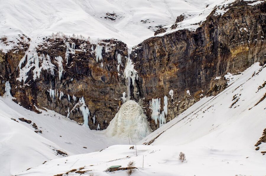
Before the Atal Tunnel, winter in Lahaul-Spiti meant total isolation. Snowfall closed Rohtang in October and the valleys went silent until April. The tunnel ended that for Lahaul.
Sissu, Keylong, and the lower stretch of the valley are now accessible year-round, and a small winter tourism economy has grown up around frozen waterfalls, snow trekking, and homestays. Day trips from Manali to Sissu in January are now the easiest winter mountain experience in India.
Spiti is harder. Beyond Keylong the road north is closed, and beyond Kunzum the road east into Spiti is also closed. The only way in is the Shimla-Kinnaur route, which is itself rough and slow, with regular avalanche risk between Reckong Peo and Tabo.
Temperatures in Kaza in January regularly drop below -25°C. Most homestays close. The ones that stay open run on heated charcoal sigris, layered blankets, and not much else.
The reason people still go is the snow leopards. Kibber Wildlife Sanctuary is one of the most reliable places in the world to spot a wild snow leopard in winter, with conservation-led tours running January to early March. The success rate of properly run tours is genuinely high. The cost is also genuinely high: figure ₹1,20,000 to ₹2,50,000 (~$1,440 to $3,000) for a 10-12 day fully-included tour with experienced trackers.
Crossing Over: The Atal Tunnel Has Changed Everything
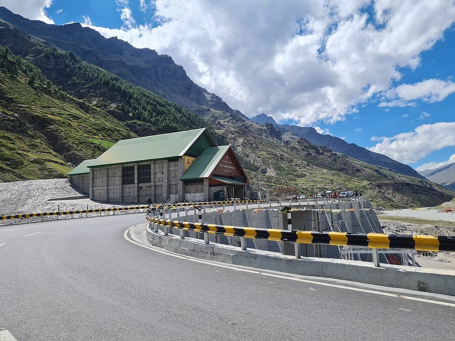
The Atal Tunnel, also called the Rohtang Tunnel, is a 9.02 km horseshoe-shaped road tunnel under the Pir Panjal range, opened in October 2020 by the Border Roads Organisation. It is the world’s longest highway tunnel above 3,000 metres.
The south portal is at 3,060 metres near Solang Valley above Manali. The north portal is at 3,071 metres at Sissu in Lahaul. Driving the tunnel takes about ten minutes at the 60 kmph speed limit. Compare that to the old Rohtang crossing, which on a bad summer day could take six hours of traffic and switchbacks, and you understand why so much has changed.
Before October 2020, Lahaul received maybe a few thousand visitors a year. Since then, weekend traffic from Delhi-NCR through Manali has reshaped the local economy. Sissu has new homestays, new cafes, a paragliding operation in summer.
The flip side is that the tunnel has pushed Lahaul towards a Manali-style tourism model in ways that not everyone in the valley likes. Plastic waste is up. Local water tables are being tested. The administration has started talking about visitor caps for fragile sites like Chandratal.
For the practical traveller, the change is unambiguously good. From Manali, Sissu is about 33 km via the tunnel, roughly under an hour. Keylong is 115 km, about 3-4 hours, and Jispa is 140 km, 4-5 hours.
The tunnel does not require a permit to drive through. There are no toll fees for cars. The only restriction is on hazardous-cargo vehicles and a handful of weather-related closures during heavy snow events. Check the BRO’s Border Roads Organisation site for current status before driving.
Lahaul: What’s Worth Stopping For
Lahaul rewards a slow approach. The valley runs roughly east-west along the Chandra and Bhaga rivers, joining at Tandi about 8 km below Keylong. From the Atal Tunnel, the road follows the Chandra east, then turns north along the Bhaga to Keylong and beyond.
Sissu
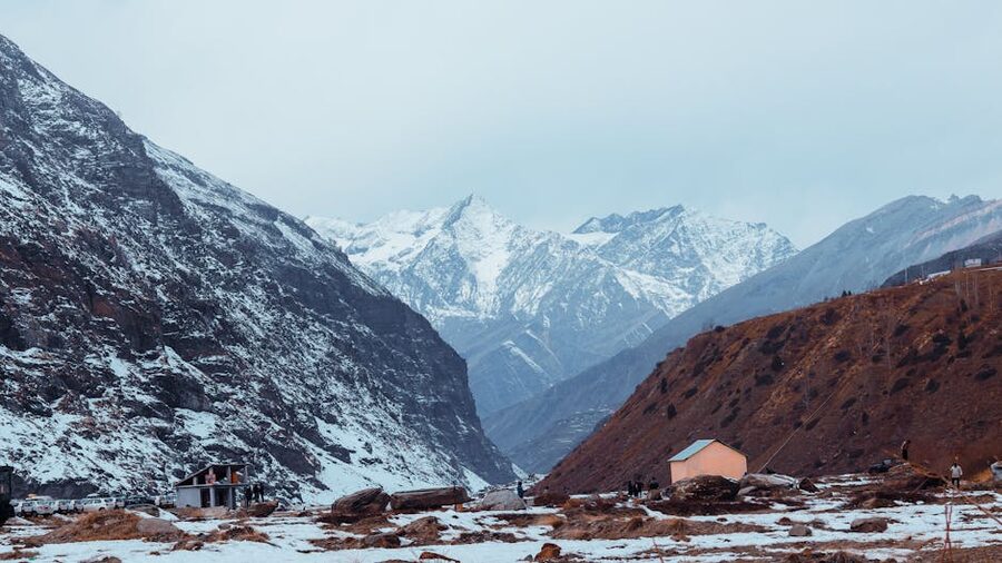
Sissu is the village right at the north portal of the tunnel and the easiest taste of Lahaul if you only have a day from Manali. The village sits at 3,120 metres on the right bank of the Chandra. There’s a small lake at the entrance, glacier-fed, that has become Sissu’s social media calling card.
Behind the village rises the Sissu waterfall, dropping straight off the cliff. In summer it’s a thin braid of snowmelt; in winter it freezes solid into a vertical column of ice that draws ice-climbing groups from Manali. The Ghepan Monastery, on a low rise above the village, has views down the valley that justify the climb.
If you want to overnight in Sissu, the supply has expanded fast since 2020. Homestays run from ₹1,500 to ₹3,500 (~$18 to $42) for a double; a couple of new boutique stays charge more. Avoid weekends in summer if you can.
Keylong and Shashur Monastery
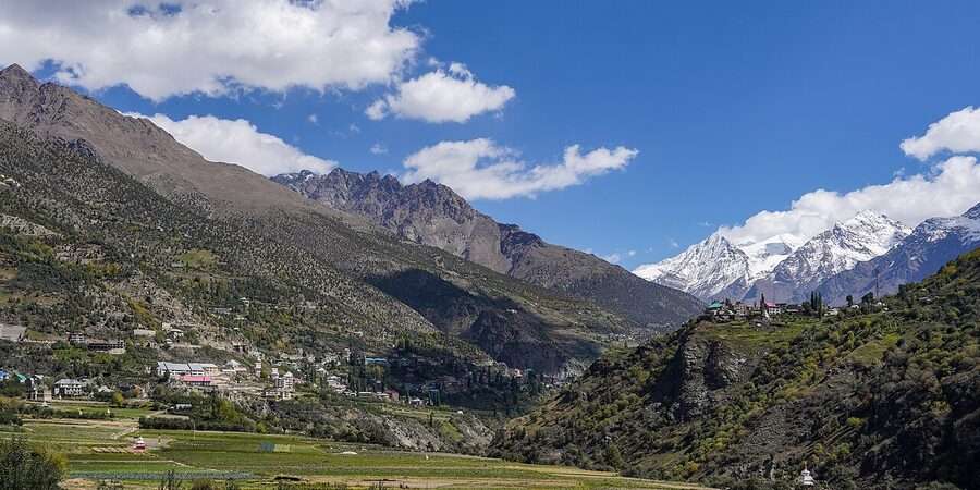
Keylong is the district headquarters and the practical base for exploring the rest of Lahaul. It’s a working town more than a tourist one, which some travellers find disappointing and others find refreshing. There’s a single main bazaar, a couple of ATMs that are not always reliable so carry cash, and a HRTC bus stand from which you can pick up local routes.
The standout site is Shashur Monastery, about 3 km up a steep climb above town. Founded in the 17th century by the Lahauli lama Deva Gyatsho, it’s one of the oldest in the valley and a working Drukpa Kagyu gompa. The walk up takes about 45 minutes from town and is steep enough that you’ll feel the altitude. The reward is the view, the prayer hall (open to visitors during morning and evening pujas), and a chance to talk with the resident monks if you time it right.
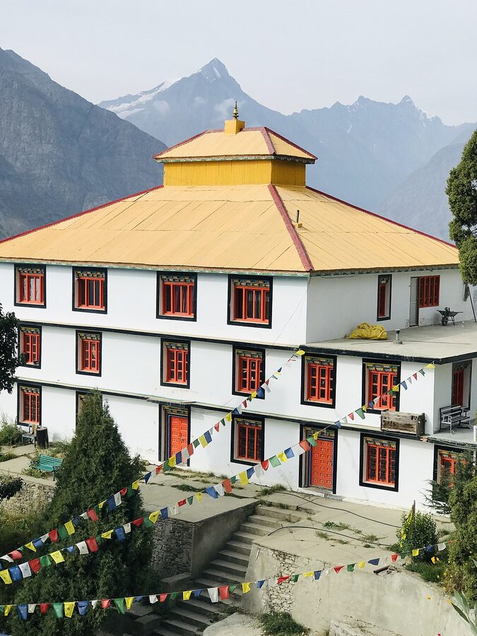
Across the river from Keylong, on the south side, sits Kardang Monastery, at about 3,500 metres. It is reached by crossing the bridge at Tandi and driving up to Kardang village, about 18 km in total.
Kardang dates from the 12th century, with the current building largely from a 1912 reconstruction. It is the largest gompa in Lahaul and the head monastery of the Drukpa Kagyu order in the valley. The library has Buddhist texts, including a hand-written Kangyur in 108 volumes that is brought out on request.
Jispa, Sarchu, and the Road North
Beyond Keylong, the road continues north along the Bhaga towards Sarchu and eventually Ladakh. Jispa, 22 km past Keylong, is a one-street village set in a wide green river bend, used mostly as a stop for travellers on the Manali-Leh route. There’s a small ethnographic museum and a couple of decent guest houses. Beyond Jispa, the road climbs to Baralacha La at 4,890 metres, with Suraj Tal, the source of the Bhaga, just below the pass.
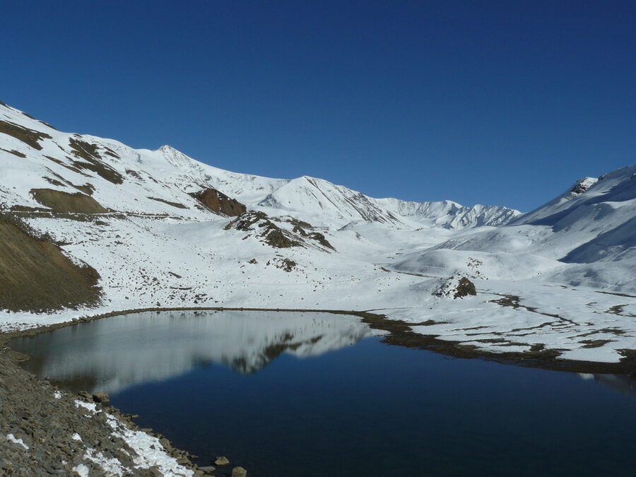
The road from Keylong to Sarchu is open only from late May to October. It is rough, exposed, and serves mostly as a transit route for vehicles heading to Leh. If you are not going on to Ladakh, there’s not much reason to push past Jispa, except a side trip to Suraj Tal on a clear day.
The Two Routes Into Spiti
You can drive into Spiti from two directions. Both end at Kaza. Which one you pick determines a lot of the trip.
The Manali Route via Kunzum Pass
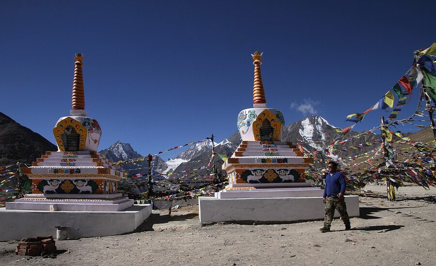
The Manali route is the shorter way to Kaza, about 200 km from Manali. After clearing the Atal Tunnel, the road follows the Chandra east through Lahaul, past Sissu, Tandi, and Gramphoo. At Gramphoo, the road for Spiti turns south, climbing to Chhota Dhara, Batal, and over Kunzum Pass at 4,551 metres. From Kunzum, the road descends into Spiti via Losar to Kaza.
The drive in good conditions takes 8-10 hours, possible in one long day from Manali. The catch is the surface. Between Gramphoo and Losar, the road is in places little more than a track of gravel and water crossings.
After heavy rain or in early season, sections become impassable. A high-clearance vehicle is mandatory; small hatchbacks regularly get stuck at the stream crossings before Chandratal.
The Manali route is also the only way to reach Chandratal Lake, which sits about 14 km off the main road on a side track between Batal and Kunzum. Most travellers do Chandratal as part of this drive, with a night at one of the campsites near Batal.
The route is open mid-June to mid-October in a typical year. Important caveat for AMS: taking this route means climbing from Manali at 2,050 metres to over 4,500 metres in a single day, with no acclimatisation stop. Acute mountain sickness is common. If you are sensitive to altitude or it’s your first time above 3,500 metres, the Shimla side is much safer because the climb is gradual.
The Shimla Route via Kinnaur
The Shimla route is longer, about 450 km from Shimla to Kaza, and it takes 2-3 days because the gain in elevation is gradual and there are stops worth making. From Shimla you drive through Narkanda and Rampur into Kinnaur, halting at Sangla, Kalpa, or Reckong Peo. Reckong Peo to Kaza is the final long day, going via Pooh, Nako, Sumdo, Tabo, Dhankar and into Kaza. The road follows the Sutlej upstream as far as Khab, then crosses into the Spiti valley and follows the Spiti river the rest of the way.
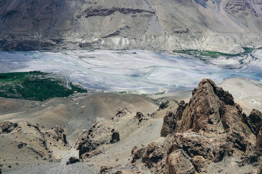
The Shimla route has two huge advantages. The acclimatisation is gradual: you spend two nights climbing through Kinnaur before crossing 3,000 metres, which gives your body time to adjust. And the side trips through Kinnaur (apple orchards at Kalpa under Kinnaur Kailash, the wooden temples of Sangla, the river crossing at Khab) are themselves worth the trip.
The disadvantage is time. Doing the Shimla route both ways means losing a week to driving alone. The Shimla side is theoretically open year-round, but landslides during the July-August monsoon can shut sections for days at a time. October is one of the best months for this drive: roads dry, skies clear, almost no other tourists.
The Loop
If both routes are open, do the loop. Enter from Shimla through Kinnaur (gradual acclimatisation), spend the bulk of your time in Spiti, and exit via Manali through Kunzum and the Atal Tunnel. This way you arrive at altitude slowly and you save the dramatic Manali drive for the descent. Allow ten days minimum, twelve to fourteen ideally.
Kaza: The Hub of Spiti
Kaza is Spiti’s largest settlement and the practical base for almost every visitor. The town sits in a wide bend of the Spiti river, divided into Old Kaza on the south bank and New Kaza on the north. The old part has the bazaar, most of the budget homestays, and the Tibetan-style market that comes alive in the evening.
The new part has the administrative buildings and a few mid-range hotels. There are ATMs in town that work most of the time, but bring cash, ideally a mix of large and small notes. Digital payments are inconsistent past the bazaar.
Kaza also has the world’s highest road-connected fuel station at the HPCL pump on the edge of town. If you are driving the loop, this is the point at which you fill up; the next pump on the Manali side is back across Kunzum, and the Shimla side’s last pump is at Tapri or Reckong Peo. Carry a jerrycan if you are going off the main road.
Most people use Kaza as a base for two or three day trips: one for the Key Monastery cluster (Key, Kibber, Chichum), one for the high villages (Hikkim, Komic, Langza), and one out to Pin Valley with Mud village. Tabo and Dhankar are usually combined with the drive in or out, depending on your direction.
Key Monastery: The Image That Sells the Valley
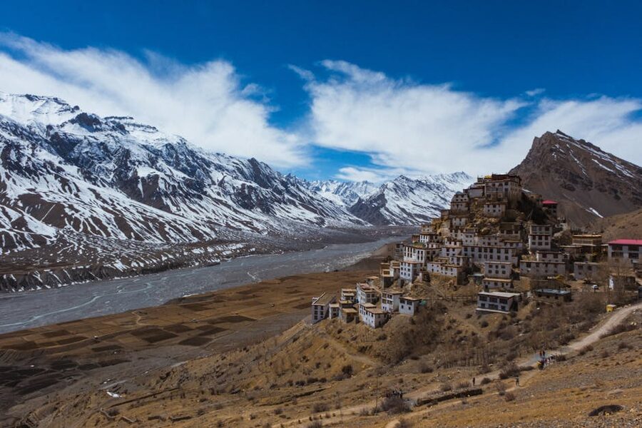
If you have seen one photograph of Spiti, it was probably this one: a layered, white monastery clinging to a conical hill above the brown valley, with snow peaks behind. Key Monastery, also written Kee or Ki, sits at 4,166 metres about 12 km from Kaza, on the road to Kibber. It is the largest active gompa in Spiti, with around 250 resident monks, and the most photographed building in the western Himalayas.
The monastery is thought to date from the 11th century, though it was rebuilt several times after Mongol attacks in the 17th century, an earthquake in 1975, and at least one major fire. The fortified layout, with terraced cells climbing the hill, is a defensive carry-over: Spiti was raided repeatedly by Ladakhi and Mongol forces through the 1600s. The chambers at the base hold the assembly hall and protector chapels; the upper levels are dormitories and the abbot’s residence.
You can wander most of the complex during daylight. There’s no entrance fee but a donation is expected. Try to time your visit for morning or evening puja, when the monks chant in the assembly hall. The acoustics under the painted ceiling are unlike anything you’ll hear elsewhere.
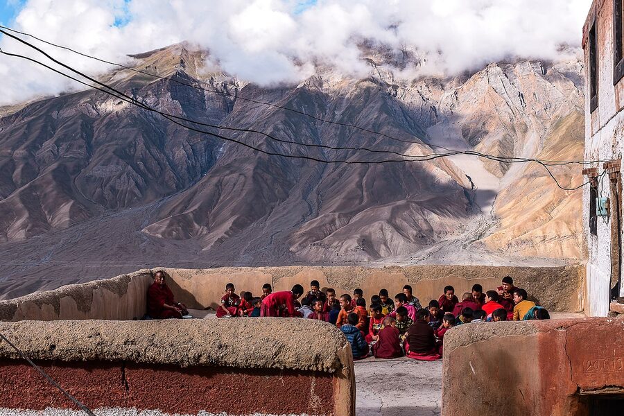
The other thing about Key worth knowing: you can stay there. The monastery runs a small guesthouse for visitors, ₹500-800 (~$6 to $10) a night with breakfast. The rooms are basic, the toilets are shared, and you’ll be woken at 5 am by drums. Many travellers do it once and rate it the most memorable night of the trip.
Behind Key on the same road, the village of Kibber sits at 4,270 metres, one of the highest road-connected villages in India until Komic took the title. Kibber is also the entry point of Kibber Wildlife Sanctuary, the snow leopard reserve that gives Spiti its winter draw. From Kibber, a side road continues another 6 km to Chichum, accessed by what was, until 2017, a hand-pulled cable trolley over a 1,000-foot gorge. The new bridge has replaced the trolley with a normal car crossing, but the gorge below is still vertiginous.
The High Villages: Hikkim, Komic, Langza
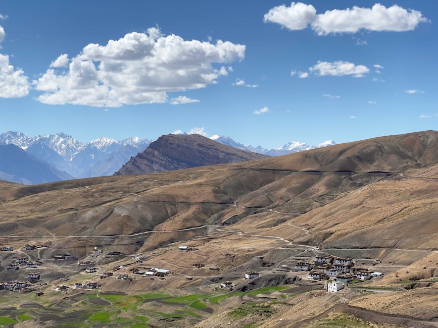
About an hour’s drive from Kaza on the same road that passes Key, three villages sit on a small plateau at over 4,400 metres. They are usually visited as a single loop: Hikkim, Komic, Langza, returning to Kaza in time for dinner. Each one has a hook.
Hikkim and the Highest Post Office
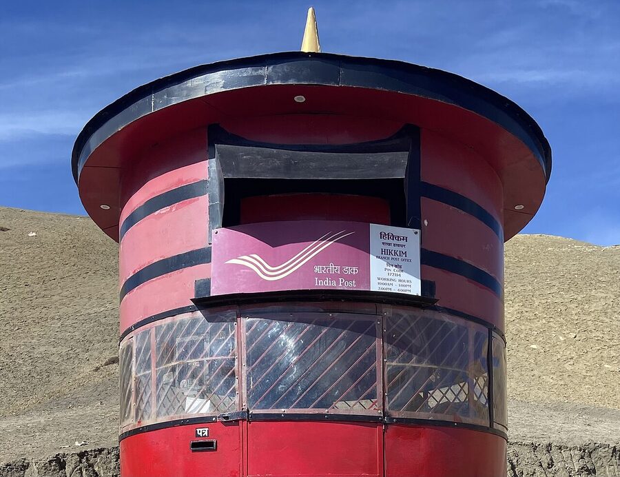
Hikkim’s claim is the world’s highest functioning post office, at 4,440 metres, run by a single postmaster who has held the job for over thirty years. It’s a small concrete shed on the edge of the village. You can buy postcards (₹10 each, ~$0.12), write your message on the spot, and post them home.
They will get there. Mine arrived in Mumbai in three weeks. The novelty is the point. Don’t try to send anything urgent.
Hikkim also has a working polling station, and during the 2022 Himachal assembly elections it recorded one of the highest voter turnouts in the country. The village’s permanent population is small enough that each voter is genuinely known.
Komic and the Highest Monastery
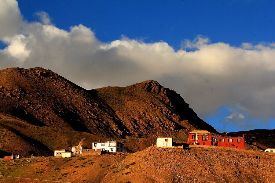
Komic, at 4,587 metres, is the highest road-connected village in the Spiti district and is regularly billed as the highest in the world. (Tashigang at 4,650 m, also in Spiti, is higher but is more often described as the highest with a polling station rather than the highest motorable village.) The handful of stone houses sit beside the small Tangyud Monastery, a 14th-century Sakya gompa that has been carefully restored.
The lama there will take visitors round the prayer hall and show you the small museum of relics in the back room. You will feel the altitude here. Walk slowly. The air at 4,587 metres holds about 56% of the oxygen at sea level, and it’s a noticeable difference even if you’ve already been a few days in Kaza.
Langza and the Buddha Statue
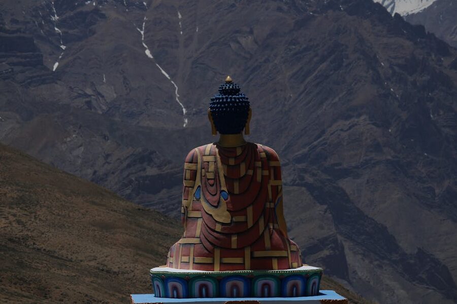
Langza, at 4,400 metres, is the village with the iconic Buddha statue overlooking the valley. The site has been a meditation place for centuries, though the statue itself is much newer in this incarnation. The view from the Buddha’s perch back over the village to the Chau Chau Kang Nilda peak (6,303 m) is one of the defining images of Spiti.
Langza is also a centre for fossil hunting. The surrounding scree fields hold marine fossils from when this entire region was the sea floor of the ancient Tethys Ocean. Local children sell fossils to passing tourists, often very cheap. Be aware that taking fossils out of India is technically restricted under the Antiquities Act.
Tabo and the Ajanta of the Himalayas
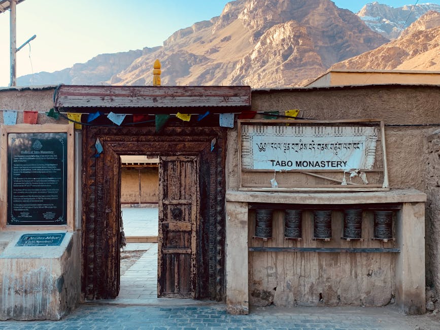
If Spiti has one place you should not skip, this is it. Tabo Monastery was founded in 996 CE by the Tibetan king Yeshe Od, more than a thousand years ago, and it has been continuously occupied as an active gompa ever since. It is older than every other monastery currently functioning in India and the western Himalayas. After Tholing in Tibet was destroyed during the Cultural Revolution, Tabo became one of the few intact remnants of the old Indo-Tibetan Buddhist civilisation.
The monastery sits in the centre of Tabo village, at 3,280 metres, about 47 km from Kaza on the road to Kinnaur. From the outside it looks unremarkable: a low complex of mud-brick walls without a roof to speak of, more like a fortified mound than a temple.
The astonishment is inside. Nine surviving temples, dating from the 10th to 16th centuries, hold an unbroken sequence of Tibetan Buddhist murals, painted clay sculptures, and stucco reliefs. The Tsuglagkhang, the main assembly hall, has a 14-foot life-sized clay assembly of bodhisattvas surrounding a central Vairocana, with painted murals on every wall surface depicting the entire mandala of the Vajradhatu.
Photography inside the temples is prohibited. The lighting is poor (oil lamps and a single skylight) and your eyes take a few minutes to adjust before the murals come up. Take it slow.
A guide from the monastery will explain what you are looking at if you ask; a small donation is appropriate. The murals are why the comparison to Ajanta is made: not the same in style but the same in scale and in their preservation of an artistic tradition that exists almost nowhere else now. The Tabo Monastery’s official site lists puja timings and visiting protocols.
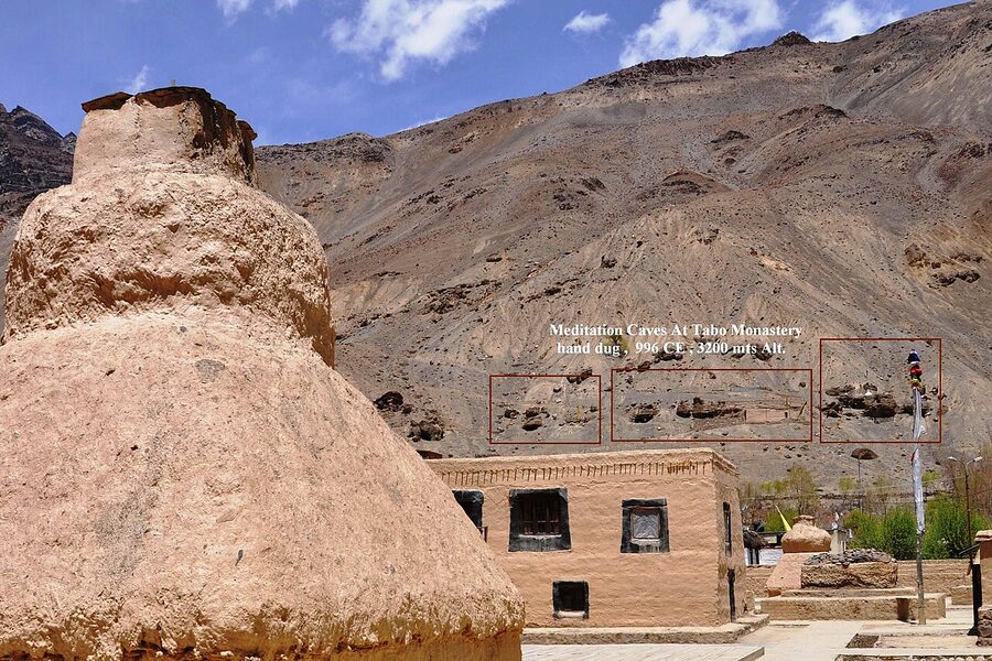
Above Tabo on the cliff, you can see the dark openings of meditation caves, hand-cut into the soft rock and used by monks for solitary retreat. They are a 30-minute walk up from the monastery. You can enter most of them; the floors are smooth from a thousand years of bare feet.
Tabo village has a small monastery guesthouse, several budget homestays, and a couple of cafes. If your route allows, spend a night. Tabo at sunset, with the white-washed stupas catching the last light, is worth more than a stop-and-photograph visit.
Dhankar: The Monastery on the Edge
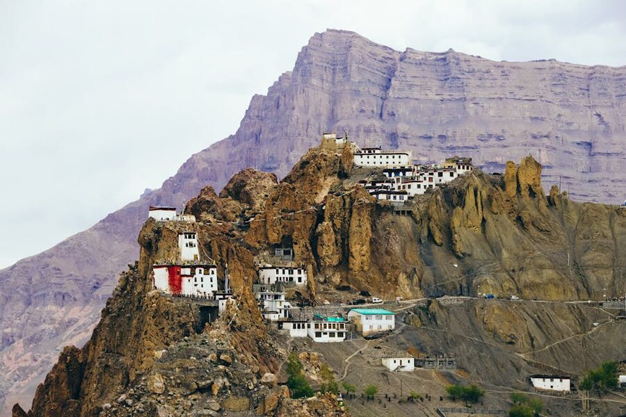
Halfway between Tabo and Kaza, the road passes a turnoff to Dhankar, an old fort-monastery built into the cliff above the confluence of the Spiti and Pin rivers. The site is one of the most photographed in the valley, and at 3,894 metres it is a strong contender for the most dramatically located.
Dhankar served as the seat of the Nono, the hereditary ruler of Spiti, until the 19th century. The fort, monastery, and village all share the same precarious clifftop. Sections of the old monastery have been closed because of structural collapse, and the building is on the World Monuments Fund’s list of endangered sites. A new monastery has been built on a more stable platform a short walk down the hill, where most of the active religious life now happens.
From Dhankar village, a steep 1.5-hour walk takes you up to Dhankar Lake, a small turquoise tarn at 4,270 metres in the lap of the Mane mountain range. The walk is a serious climb, exposed to sun, with no water source on the way; carry a litre and start early. The view from the top, back down to the monastery and out across the Spiti and Pin rivers below, is one of the best in Spiti.
The diversion to Dhankar from the main Tabo-Kaza road adds about 8 km and 30 minutes, plus however long you stay. Almost everyone says it was worth it.
Pin Valley and Mud
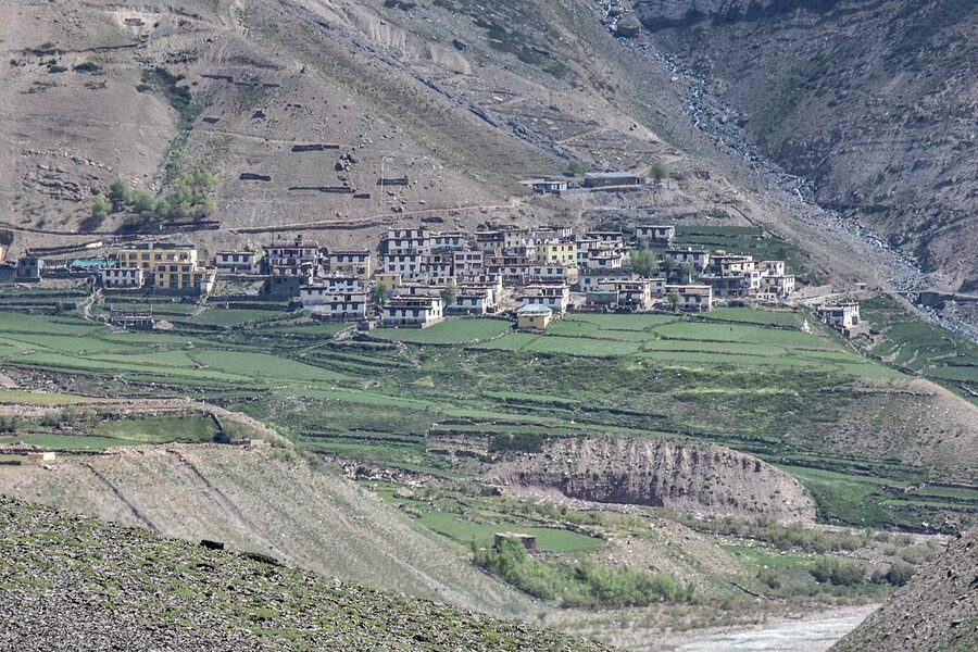
The Pin Valley turns off the Spiti river at Attargo, about 12 km below Dhankar. It is Spiti’s wildest side trip and the part of the district that most travellers, even those who get to Tabo and Key, end up missing. The drive in follows the Pin river for about 35 km, past green meadows and a sequence of small villages (Sangnam, Gulling, Kungri) before ending at Mud, the road’s end at 3,810 metres.
Pin is a different microclimate from the rest of Spiti. It gets more rain (the Pin valley is open to the south), the slopes are greener, and the wildlife is denser. Pin Valley National Park, declared in 1987, covers 675 square km of the upper valley and is one of the protected habitats of the snow leopard, the Tibetan wolf, the Himalayan ibex, and the rare Tibetan gazelle. The lower valley still has cultivated fields and herds of yaks and dzos (yak-cow hybrids).
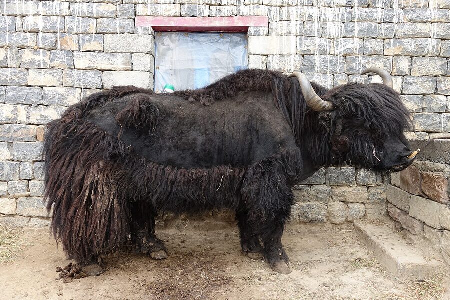
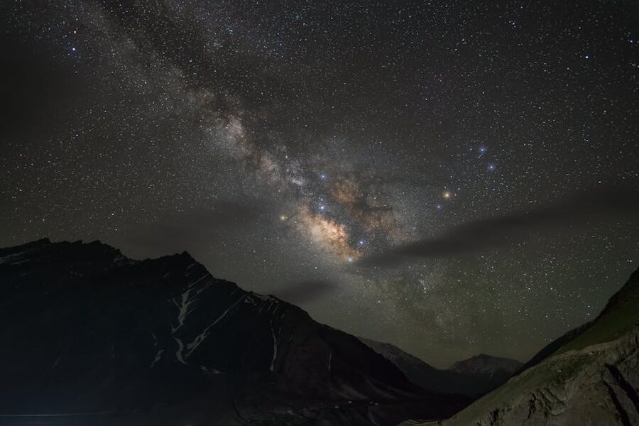
Mud village has homestays from ₹600-1,200 (~$7 to $14) a night with meals included. The food is local: thentuk noodle soup, momos, chapati and dal in the simpler kitchens, sometimes chicken on request. Stay a night if you can. The Pin Valley sky at night is darker than anywhere else in the district, including Kaza, and the stars are extraordinary.
From Mud, serious trekkers attempt the Pin-Parvati Pass, a 5,319-metre crossing into the Kullu Valley that takes 7-9 days and serious gear. It is one of India’s most remote treks and not recommended without a guide. Easier options: a day walk up the valley to the seasonal yak pastures, or a half-day hike to Kungri Monastery, the oldest in Pin Valley, founded around 1330 CE.
Gue and the Mummy
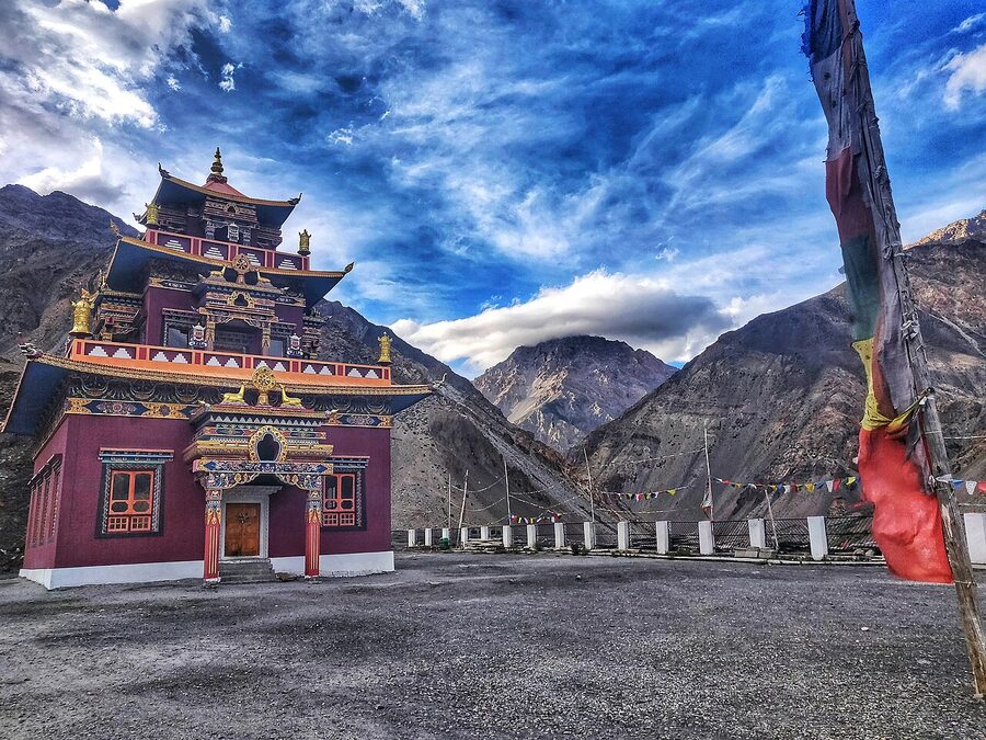
Gue is a small village near the Tibet border, about 35 km below Tabo. Until 1975 it was virtually unknown outside Spiti. Then an earthquake exposed the body of a 15th-century Buddhist monk, Sangha Tenzin, naturally mummified in a sitting meditation posture, his hair and skin still partly intact.
The mummy is now housed in a small glass-fronted shrine in the village’s monastery, open to visitors during daylight. The presumed cause of preservation is a combination of self-mummification (a meditative practice known in some Tibetan Buddhist traditions) and the cold dry climate. The body still shows visible teeth and finger bones; the visit is unforgettable in a way that’s harder to articulate than describe.
Gue requires a small detour off the main Tabo-Kaza road. There is no entrance fee; a donation to the monastery is the appropriate gesture. Foreign nationals need an Inner Line Permit (see permits section below) to visit Gue, as it lies in the protected zone close to the Chinese border.
Chandratal: The Lake That Justifies the Drive
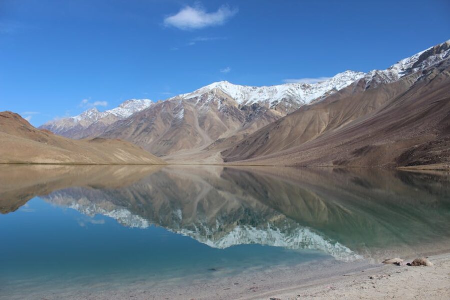
Chandratal, the moon lake, sits at 4,250 metres on a high meadow about 14 km off the Manali-Kaza road, between Batal and Kunzum Pass. It is roughly half a kilometre across and crescent-shaped (which is what gives it the name). The water is exceptionally clear and changes colour through the day, from blue to green to a striking red around dusk.
The setting, surrounded by the high Chandrabhaga peaks with no trees in sight, is the kind of place that looks made up. People who have spent years travelling in the Himalayas tend to put it in their top three.
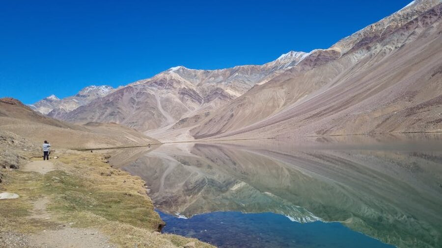
You cannot drive to the lake itself. Vehicles are stopped about 1.5 km from the water and the rest is on foot, a flat 25-minute walk. Camping at the lake itself is no longer permitted, an environmental restriction that came in around 2018 after years of damage from large groups.
Tented campsites operate on the meadow lower down, accessible by car. Tents cost ₹2,500-4,500 (~$30 to $54) per person per night including dinner and breakfast.
Chandratal is open from June through September. Outside that window the road in is closed by snow. The best time to visit is the first half of June, before the peak crowds, or mid-September after most monsoon traffic has cleared. Bring a torch for the camp, warm layers (it drops below freezing at night even in July), and water; the lake water is not for drinking.
The Practical Bits
How to Get to the Region
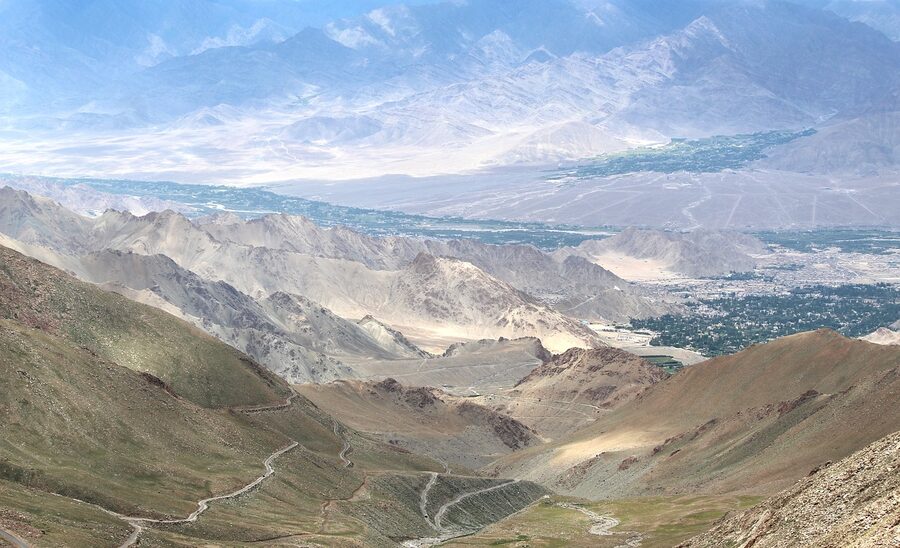
By air: The nearest airports are Bhuntar (Kullu-Manali airport, 51 km from Manali) and Shimla. Both have limited and weather-dependent connections. Most travellers fly to Chandigarh or Delhi and drive from there.
By car or shared taxi: Manali to Kaza is roughly 8-10 hours in one go, but most break the journey at Sissu, Keylong, or Chandratal. Shimla to Kaza takes 2-3 days with stops in Kinnaur.
Self-drive is possible if you have a high-clearance vehicle (SUV or pickup); small hatchbacks regularly come to grief on the Manali side. Hired SUVs from Manali run ₹4,500-6,000 (~$54 to $72) per day plus fuel, with a driver. Shared cabs from Manali to Kaza in season cost around ₹1,500 (~$18) per seat.
By bus: Himachal Roadways (HRTC) runs daily buses from Manali to Kaza in season (roughly mid-June to early October), departing Manali at around 5 am and reaching Kaza by evening. From Shimla, daily buses run via Reckong Peo, with most travellers breaking the journey overnight. The HRTC fare from Manali to Kaza is around ₹500 (~$6). Bus is the cheapest option but slow and uncomfortable; book seats a few days ahead in summer.
Permits
Indian citizens do not need a permit to visit any part of Lahaul-Spiti, including Spiti Valley itself.
Foreign nationals need an Inner Line Permit (ILP) for the protected zone between Reckong Peo and Tabo, which includes Nako, Hurling, Sumdo, Gue, and Tabo. The permit is free and is issued same-day at the Sub-Divisional Magistrate’s office in Reckong Peo, Kaza, or Shimla.
You’ll need a passport copy, a passport photo, and a basic application form. There’s no permit needed for Spiti proper between Tabo and Kaza, or for Lahaul. Note that foreign nationals are not allowed to camp or stay overnight in some sensitive border areas; check current rules with the SDM office before travelling. For full updated guidance, the Himachal Pradesh Tourism Department publishes the current restrictions and permit forms.
Accommodation, Costs, and Connectivity
Spiti is genuinely cheap if you stay in homestays, which is also the best way to experience the place. Village homestays in Hikkim, Komic, Langza, Mud, or Dhankar typically cost ₹500-1,200 (~$6 to $14) per person per night including dinner and breakfast. Rooms are basic: a couple of beds, layered blankets, shared squat toilet, often no running hot water. The food is simple and good.
In Kaza, you have more options. Backpacker hostels start at ₹500 (~$6) a dorm bed. Mid-range hotels run ₹2,500-5,000 (~$30 to $60) per night. A handful of upper-end stays in Sissu or Jispa charge ₹6,000-10,000 (~$72 to $120).
Mobile connectivity is patchy. BSNL works in most populated areas of Spiti including Kaza, Tabo, Hikkim, Komic, and Langza, but signal is weak. Jio works in Kaza, Tabo, and parts of Lahaul. Airtel covers Kaza inconsistently.
WiFi at homestays exists in Kaza and Sissu but is rare elsewhere. If you need reliable connectivity, get a BSNL SIM in advance and don’t expect data speeds beyond basic messaging.
Altitude Sickness Is Real
Spiti is the most likely place a typical traveller will encounter Acute Mountain Sickness (AMS). Kaza is at 3,650 metres; Komic at 4,587 metres. Symptoms (headache, nausea, sleeplessness) are common above 3,000 metres for the unacclimatised.
The single most effective prevention is gradual ascent: take three to four days to climb from below 2,000 metres to Kaza, with at least one night at 3,000-3,500 metres on the way. The Shimla-Kinnaur route is structured exactly for this. The Manali route is not, and that is its biggest practical drawback.
Diamox (acetazolamide) helps as a preventative if you start it 24 hours before ascending. Standard dose is 125-250 mg twice a day. It causes a mild tingling in the fingers and increased urination, both normal.
Drink three to four litres of water a day at altitude. Avoid alcohol the first two days. If symptoms get serious (vomiting, ataxia, confusion), descend immediately. Kaza has a small hospital and oxygen is available at most homestays in town.
Wildlife and Snow Leopards
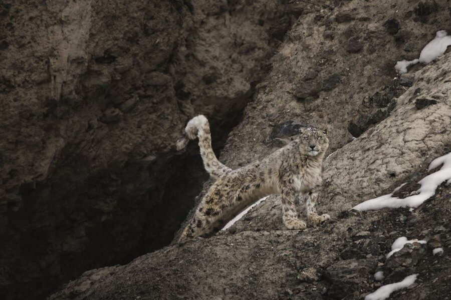
The Spiti Valley and the surrounding Pin Valley National Park are one of the best confirmed habitats for the snow leopard (Panthera uncia) anywhere in the world. Estimates put the population at around 30 individuals across Kibber Wildlife Sanctuary alone, with another 30-40 across Pin Valley National Park. Sightings happen mostly in winter, when the leopards descend with their prey (blue sheep or bharal) into the lower valleys near villages.
Sightings in summer are exceptionally rare. Sightings in winter, on a properly run tour with experienced local trackers, are now reasonably likely; reputable conservation-led operators report sighting rates above 80% for tours run between mid-January and end-February.
Most snow leopard tours operate out of Kibber village and use a network of village spotters with high-quality scopes. Costs run high (see the winter section above) but a portion of every booking goes to community conservation funds. The local community-led tourism around snow leopards has been one of the most successful conservation models in the Himalayas; previously, the leopards were occasionally killed in retaliation for livestock losses.
Other wildlife you might see year-round: blue sheep on the cliffs above Kibber, ibex above Pin Valley, Tibetan wolf (rare), red fox, and the elusive Pallas’s cat at altitude. Bird species include the lammergeier, golden eagle, Himalayan griffon, snowcock, and the yellow-billed chough that travels in flocks even at 4,500 metres. For wider context on the state’s ecology, see our overview of wildlife in Himachal and the other destinations on the site.
Putting It Together: Sample Itineraries
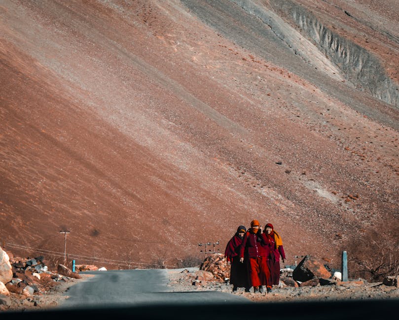
How long you have determines almost everything. The realistic minimum to see Lahaul properly is 3-4 days. The realistic minimum to see Spiti properly is 7 days.
The full loop wants 10-14 days. Anything shorter is essentially a sampler.
3 days: A taste of Lahaul
- Day 1: Manali to Sissu via Atal Tunnel, afternoon at Sissu lake and waterfall. Stay overnight Sissu.
- Day 2: Sissu to Keylong, visit Shashur Monastery, drive on to Kardang, return to Keylong. Stay Keylong.
- Day 3: Keylong to Jispa for the morning, return to Manali via the tunnel.
7 days: Spiti via Shimla, exit via Manali
- Day 1: Shimla to Sangla. Stay Sangla.
- Day 2: Sangla to Kalpa for sunrise on Kinnaur Kailash, on to Nako. Stay Nako.
- Day 3: Nako to Tabo, visit Gue mummy en route. Stay Tabo, half-day at the monastery.
- Day 4: Tabo to Kaza via Dhankar. Visit Dhankar monastery, then on to Kaza. Stay Kaza.
- Day 5: Day trip Key, Kibber, Chichum. Stay Kaza.
- Day 6: Day trip Hikkim, Komic, Langza. Stay Kaza.
- Day 7: Kaza to Manali via Kunzum Pass, with a night at Chandratal if you can stretch to 8 days.
10-12 days: The full loop with Pin Valley
Same as above but with two extra nights at Mud village in Pin Valley after Kaza, plus an overnight at Chandratal on the way out, plus an extra acclimatisation night at Kalpa or Nako.
For travellers wanting an organised itinerary built around their dates, see our Himachal tour packages page, or for honeymoon-friendly versions of the easier sections, the honeymoon in Himachal guide.
What to Eat, What to Carry, What to Skip
Eat: thukpa (Tibetan noodle soup) and thentuk (a wider, hand-pulled noodle version), momos in every village, chana madra and siddu in Lahaul, butter tea (po-cha) at the monasteries (it’s an acquired taste; salt and yak butter, not sweet), tingmo bread, and the ubiquitous dal-chawal at homestays. Sea buckthorn juice is the local speciality. Buy roasted barley, dried apricots, and dry cheese at Kaza market for road snacks.
Carry: warm layers (down jacket, thermal base layer, fleece) even in July, a windproof shell, sunscreen and a hat (the UV at altitude is brutal), a torch with spare batteries, a basic first aid kit including Diamox and pain medication, water purification tablets or a filter, a power bank (electricity supply is intermittent in remote villages), and cash, ideally a mix of ₹500 and ₹100 notes.
Skip: trying to see everything in five days. Skip the rented hatchback if you’re driving the Manali side; pay extra for a 4×4. Skip alcohol the first two days at altitude.
Skip the ATM in remote villages and bring cash from Manali or Shimla. Skip Chandratal during the school summer holidays in July if you can possibly avoid it.
One Last Thing
Lahaul and Spiti is not a hill station. It is not the Himachal of festivals like Kullu Dussehra or the green slopes of central Himachal trekking. It is the back wall of the country, dry and high and thin, and it asks something of every visitor in patience and acclimatisation.
People who go expecting Manali in disguise come back disappointed. People who go expecting Tibet at the edge of India come back changed.
If you have time only for a weekend, drive through the tunnel to Sissu, eat thukpa at a homestay kitchen, and turn around. You’ll have seen enough to know whether you want to come back for the rest.