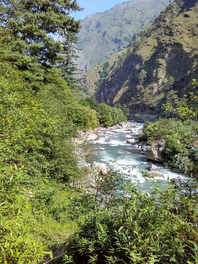
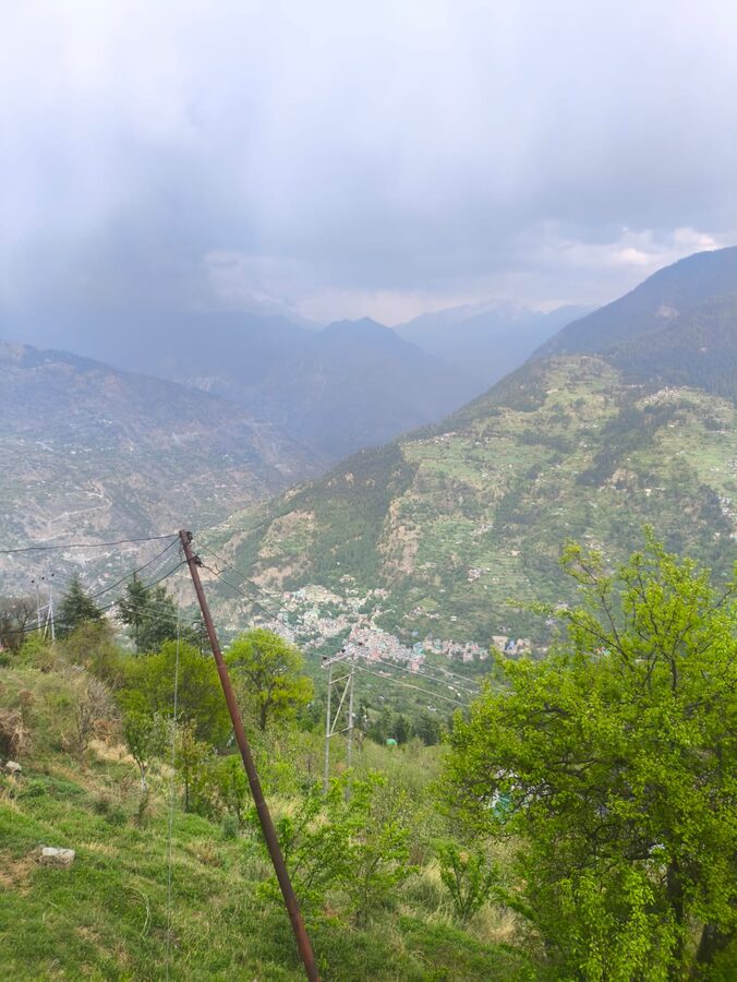
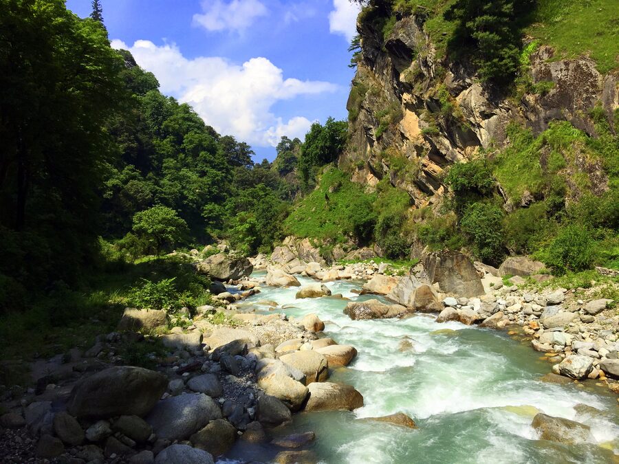
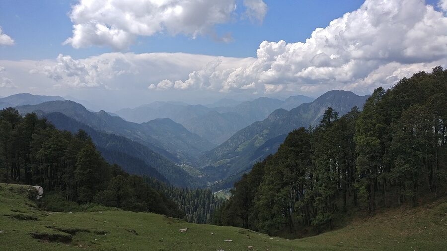
The single most useful thing in this whole article is a road decision. About six hours north of Chandigarh, the Manali highway swings into a tunnel called Aut. Tunnel on the left, narrow road on the right. Take the right. Cross the dam, then the bridge, then keep going as the road peels away from the river you came on and starts following a different one. Inside twenty minutes the noise of the highway is gone and you’re in a valley the rest of Himachal forgot to ruin.
That decision is what Tirthan is. It’s a 30 km dead-end road off a national highway, leading to a cluster of villages along a trout-rich river that drains the western edge of the Great Himalayan National Park. People drive past it every day on the way to Manali, which is a thing they will have time to regret on the third hour of bumper-to-bumper traffic outside Kullu town.
I’ve been coming here on and off since 2018. Tirthan has changed in that time, mostly for the worse, but the version that exists in 2026 is still a quieter, slower, less commercialised valley than anything else within reasonable striking distance of Delhi. This is a guide to making that work for you.
Where Tirthan Actually Sits
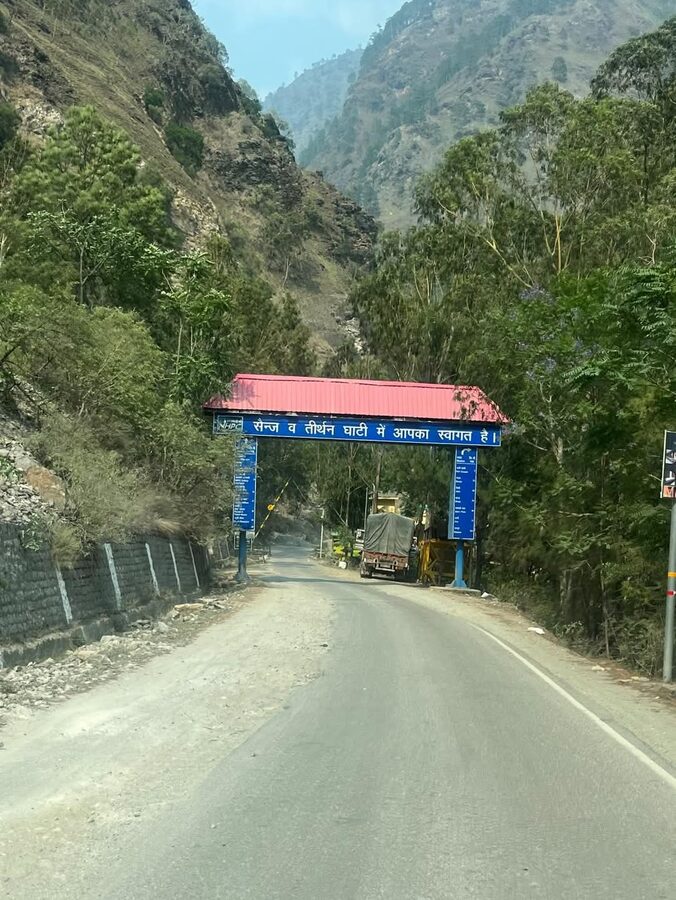
The geography confuses a lot of first-time visitors, so let me get it out of the way. The administrative tehsil is called Banjar, and Banjar town is the largest settlement in it. The Tirthan river drains one half of the tehsil, the Jibhi nala drains the other. Both valleys spread out from a junction near Banjar town. So when somebody says they’re “going to Tirthan,” they almost always mean the Tirthan-river side, and the village of Gushaini specifically, which sits about 10 km up the river from Banjar. When somebody says they’re “going to Jibhi,” they mean the other branch, which leads up towards Jalori Pass.
The two valleys are 20 minutes’ drive apart and most travellers do both. Tirthan is the riverside-and-trekking side. Jibhi is the cafe-and-waterfall side. They have different personalities, and the article covers both because pretending otherwise would be useless.
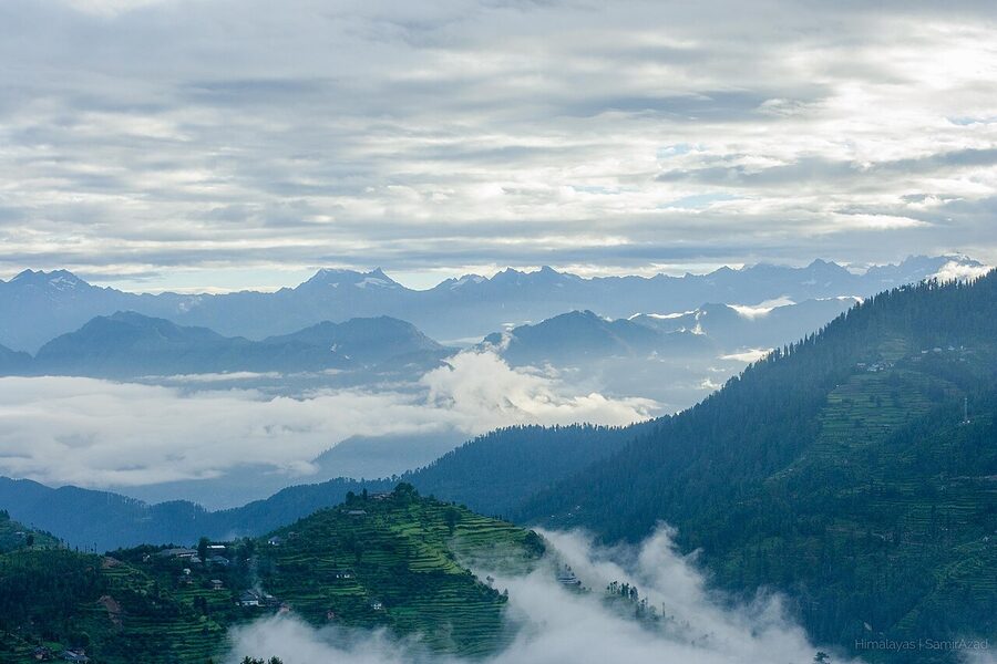
The whole area sits in the Kullu district, around 1,600 m at valley floor, climbing to 3,120 m at Jalori Pass. The bigger picture: you’re on the western flank of the Great Himalayan National Park, with the Sainj valley as the GHNP’s other major tributary on the far side of a forested ridge.
When to Go
There are two good windows and one merely-okay one.
Mid-March to mid-June is the headline season. April is the rhododendron and apricot bloom, late May and early June are warm enough to swim in the river (briefly, the water never really warms up, but you can get in). Day temperatures are 18-26 °C and nights drop to single digits. The trekking trails inside GHNP open up in this window as the snow melts off the higher passes. Book your homestay early. By the May long weekend even Tirthan fills up.
Late September through November is the second window, and arguably the better one. Skies clear after the monsoon, the valley turns gold with deciduous yellow and persimmon orange, fewer Delhi weekenders are about. Trout fishing season closes 31st October so anglers concentrate in the first half of this window. Nights cool fast in November, and by the third week the higher trails (Jalori, Bashleo) start getting unreliable.
July and August are monsoon. Don’t. The road from Aut is built into a fairly active landslide zone and gets cut every few weeks; the GHNP trails are leech country; mobile network gets patchy when towers go down. If you must come in monsoon, give yourself an extra day on each end of the trip and don’t book non-refundable transport on the last leg.
December through early March is winter. The valley itself stays accessible (Banjar gets occasional light snow, the river runs even colder) but Jalori Pass is closed under snow from late December and only opens by mid-March most years. If you’re coming for snowfall, book a homestay in or above Shoja so you’re already on the right side of the pass when it shuts.
The Aut Junction Decision
I covered the road decision in the opening, but the practical mechanics deserve a section because every Volvo company in Delhi will sell you a “Manali” ticket and pretend Tirthan doesn’t exist.
From Delhi: the only sensible way is overnight Volvo on the Delhi-Manali corridor. HRTC, HPTDC and the better private operators (Zingbus, IntrCity) all run buses leaving ISBT Kashmere Gate or Majnu ka Tila between 6 and 9 pm, reaching Aut around 6 am. Tell the conductor when you board that you’re getting off at Aut. Some drivers wave you off; most don’t. If you tell them they will stop. Fare is ₹1,200-1,800 (about $14-22) one way for the AC seater Volvo. The semi-sleeper variants are about ₹400 more and worth it because you actually sleep.
From Aut, you have three choices to cover the last 30 km to your homestay.
- Local bus to Banjar (₹40-50, about $0.50). They run roughly hourly during daylight, leave from a stand 100 m past the tunnel exit. From Banjar, change to a Gushaini bus (another ₹30) or a Jibhi bus (₹20). Cheap, slow, the most authentic option, and not great with luggage.
- Shared taxi from the Aut stand to Banjar (₹150-200 per seat) or all the way to Gushaini (₹250-300 per seat). Fills up when there are enough passengers, which during peak season is most of the time.
- Pre-booked taxi arranged by your homestay. ₹1,500-2,200 (~$18-26) for the whole vehicle to Gushaini. This is what I do. The driver knows where the homestay is, you don’t have to negotiate at 6 am, and on a long-weekend the buses fill up before locals can board.
From Chandigarh: 5-6 hours by road via NH154. Faster than Delhi by about 4 hours but you’ve got to get to Chandigarh first. Self-drive is the cleanest option. Hatchbacks and sedans handle the road fine; you do not need a 4×4.
From Manali: 100 km, 3-3.5 hours back south to Aut and then up. Any Manali-Delhi or Manali-Kullu bus will drop you at Aut. From there the same options apply.
By air: Bhuntar (Kullu-Manali airport, IXB) is the closest at 50 km. Daily flights from Delhi when the weather behaves; the airport has a reputation for cancellations during monsoon and winter and there are only two or three operators. Total taxi fare from Bhuntar to Gushaini runs ₹2,500-3,000 (~$30-36) because the driver returns empty.
By train: the nearest broad-gauge stations are Chandigarh (300 km from Tirthan) and Kalka (340 km). The narrow-gauge Kalka-Shimla toy train is a viable scenic option if you’re routing in via Shimla and Jalori Pass; that’s a different itinerary I’ll cover further down.
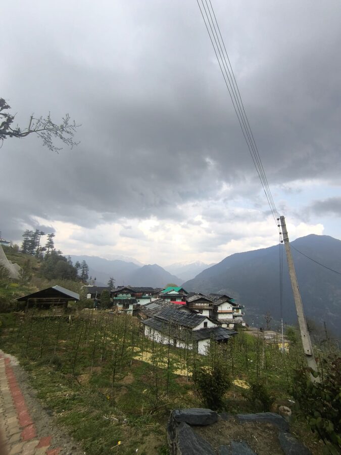
Banjar: The Town You Drive Through
.jpg)
Most guides skip Banjar. Most travellers also skip Banjar. I think this is a small mistake.
Banjar is the only place in the valley with a proper market, multiple ATMs (SBI, Punjab National, HDFC, all reliable), a chemist worth visiting, and basic medical facilities. If you’re staying anywhere in the inner valley, Banjar is your re-supply point. Carry whatever cash you’ll need for the trip out from here, because the ATM in Gushaini is single-machine and breaks regularly. The market is at its busiest on Tuesday, which is the main weekly haat day for the surrounding villages and the day you’ll see the actual valley population rather than the visiting one.
The bus stop sits about a kilometre outside the town centre, on the outskirts. The walk in is pleasant; if you’ve come straight off a Volvo you can drop your bag at the small dhabas opposite the stand and stretch your legs into the bazaar.
One thing nobody mentions: Banjar has a clutch of decent dal-roti dhabas serving local Himachali plates that the homestays don’t. If you’re tired of the standard “veg thali” your homestay produces twice a day, Banjar bazaar is where you go. Look for the one with a Hindi-only signboard and at least three customers eating; that’s the rule everywhere in the hills and it works here.
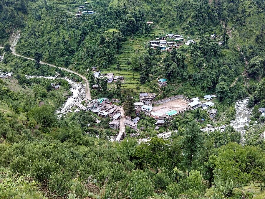
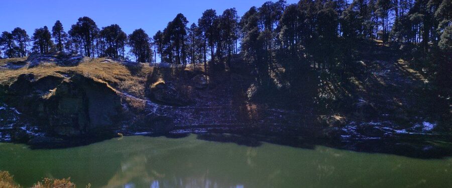
Sai Ropa, Nagini, Gushaini: The Inner Valley
Banjar to Gushaini is 10 km of single-lane road following the river. Three settlements punctuate it.
Sai Ropa comes first, about 5 km in. This is where the GHNP tourist office and the Forest Rest House sit. If you plan to enter the core zone of the park you’ll need to come here for your permit; if you’re staying at the FRH (cheapest option in the valley, ₹200-300/bed in the dorm, about $2.40-3.60) this is your destination. The settlement itself is small, two or three buildings around a road bend, but the office is professional and the staff actually answer questions if you arrive in office hours.
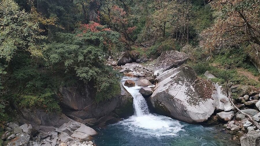
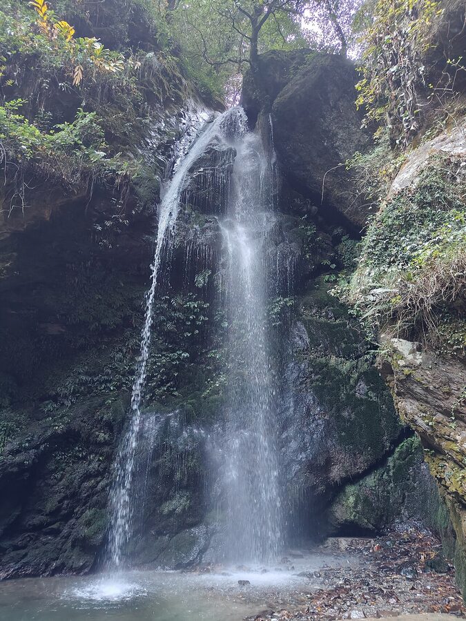
Nagini is a few kilometres further, and is now the densest stretch of homestays in the valley. The Tirthan Anglers’ Retreat sits here; so does the Himalayan Trout House and a dozen others that have built up since around 2019. From Nagini you can walk to Choi waterfall in about 40 minutes, a small two-tier fall most people miss.
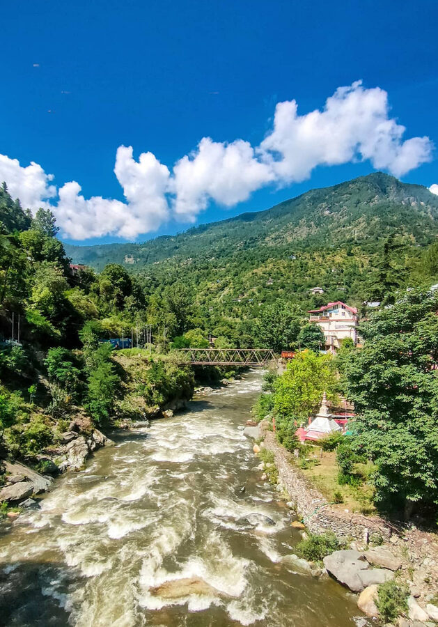
Gushaini is the de-facto hub. About fifteen shops in a single bazaar, an SBI ATM that works most of the time, the trifurcation point where the road splits three ways: down to Sarchi (across the bridge), up the Tirthan towards the GHNP gate, or up the Phalachan tributary towards Bathad. Most travellers base themselves here or just outside. Raju Bharti’s Cottage, the place that put Tirthan on the editorial map in the early 2000s, sits across a pulley-trolley from Gushaini and still runs. ₹3,500-4,000 per couple per night (~$42-48) including all meals; book at least a month ahead.
One small recommendation. The inner-valley walk from Sai Ropa to Gushaini, if you do it on foot rather than by car, is one of the better hours of any visit. About 5 km, mostly flat, with the river at your right shoulder. Drop the bag at your homestay first, then come back out and walk it.
The Side Roads: Sarchi, Pekhri, Phalachan, Bathad
If you only stay near Gushaini you’ve seen 30 percent of the valley. The other 70 lives up the side roads.
Sarchi is 19 km from Gushaini, reached by crossing the bridge before Gushaini and turning right rather than left. The road is narrow and one bus a day services it (afternoon, ask at Gushaini for the timing). Sarchi is the trailhead for the Lambhari trek and the population is mostly farming families who have not yet opened homestays. If you’re looking for the version of Tirthan that Gushaini was twenty years ago, it’s here.
Pekhri is 9 km from Gushaini up a different fork. The road is recent (post-2018) and the village still doesn’t show up on Google Maps reliably. Pekhri is the trailhead for the Rangthar trek and home to a few of the better hill homestays in the valley, ₹1,000-1,500 per night with food (~$12-18). One bus a day runs up here and isn’t always reliable; coordinate with your homestay for a pickup.
Bathad, also written Batahad, sits 10 km up the Phalachan tributary. Phalachan is the side valley off Gushaini and Bathad is its road-head. From here the Bashleo Pass trek begins. Galingcha and Mashiyar are two further villages above Bathad, both walkable in a day, both worth it if you’re willing to put four hours of climbing into your visit.
What ties these side roads together: they all dead-end. There’s no through-traffic and after the last bus of the day they’re as quiet as anywhere in the Indian Himalayas. If your idea of a destination is a single-village base from which you can do absolutely nothing for three days, pick one of these over Gushaini.
The Great Himalayan National Park, From Here
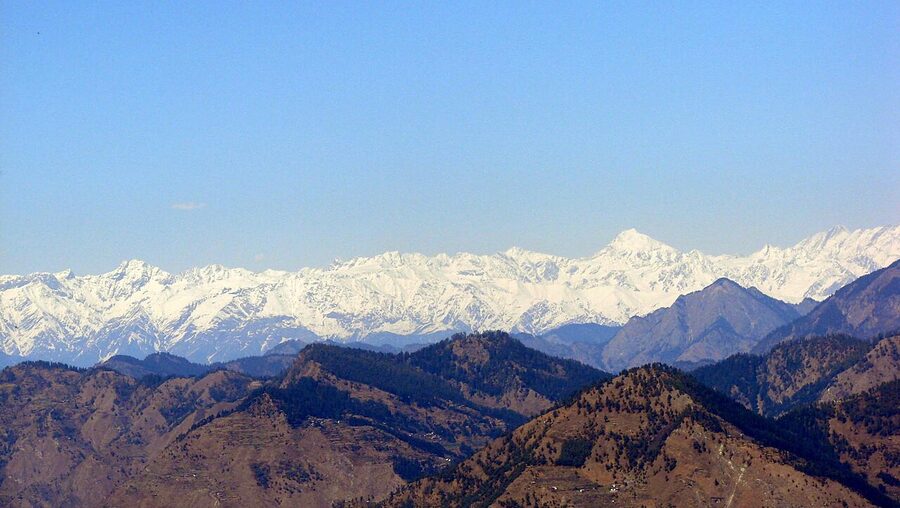
The Great Himalayan National Park is a 1,171 km² UNESCO World Heritage Site, gazetted as a national park in 1999, recognised by UNESCO in 2014. It protects four river basins (Tirthan, Sainj, Jiwa, Parvati) on the western flank of the inner Himalaya, with elevations from about 1,500 m to over 6,000 m. It’s the reason Tirthan is the way it is. The valley is the “ecozone” buffer for the park’s western edge, and the gate at Rolla is the closest most day-visitors get to the protected core.
Practical particulars worth knowing before you arrive.
- Permits and fees. No permit is needed to visit Tirthan villages or to walk in the ecozone (the inhabited buffer outside the core). To enter the core zone, you need a permit from the GHNP office at Sai Ropa (or the secondary office at Shamshi, near Kullu). Entry fee is ₹100 per Indian visitor per day, ₹400 per foreign visitor per day (about $1.20 / $4.80). Camping fees, guide fees and porter fees are extra and stack up quickly on a multi-day trip.
- Guides are mandatory for the core zone. Not optional, not recommended; mandatory. The park insists on it for safety and for local-economy reasons. Most homestays have arrangements with one or two local guides. Daily guide fees run ₹1,000-1,500 per group (~$12-18), porter fees ₹600-800 per porter per day.
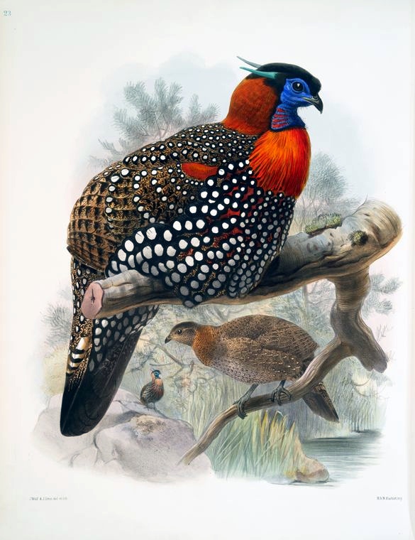
- Wildlife. The park lists 31 mammal species and over 200 bird species. The headline mammals are Himalayan brown bear, snow leopard, musk deer, Himalayan tahr and blue sheep. Realistically, you’ll see almost none of these on a short visit; they live above 3,000 m and require multi-day treks with patience. The bird life is much more accessible. The state bird, the Western Tragopan, lives in the upper ridges and is one of the rarer Himalayan pheasants. The park is one of its principal protected ranges.
If you’ve come for wildlife specifically rather than scenery, Tirthan is the better access point than Manali or Shimla but a worse one than the higher-altitude reserves at Pin Valley or Kibber in Lahaul-Spiti. Snow leopard sightings here are vanishingly rare; for those you go to Kibber in winter.
Day Walks That Don’t Need a Permit
You don’t need to go on a multi-day trek to feel like you’ve seen GHNP. The day-walks accessible from Gushaini and the side villages are some of the best walking in lower Himachal, and none of them require a guide or a permit if you turn around at the right point.
Gushaini to the Rolla gate. 8 km up the river from Gushaini, climbing gently along the Tirthan, ends at the actual GHNP gate. About 4-5 hours return. You can stand at the gate, eat your packed lunch and walk back. To go further you need the permit. This walk is the headline day option and the one I’d recommend for any first-time visitor with a free morning.
Bandal village from Gushaini. Short uphill, maybe 90 minutes round trip, leads to a hilltop village with two old tower temples. Quiet, very few visitors.
Choi waterfall from Nagini. 30-40 minutes through orchard and forest. The waterfall itself is unremarkable; the walk is the point.
Galingcha from Bathad. A short 3-4 km hike (or motorable now if you’re lazy) to a meadow village with views back down the Phalachan. The old trekking trail is steep and direct, the new road takes the long way around. I prefer the old trail.
Mashiyar from Bathad. Cross the Phalachan and climb the opposite ridge for an hour to a beautiful tower temple in a tiny village. Steeper than Galingcha and rarely walked.
What unites these walks: each one is a 3-5 hour commitment, each one is on a marked or obvious trail, each one ends in a village or a recognisable landmark, and each one would be the headline activity on most other Himachal trips. Here they’re side dishes.
The Multi-Day Treks From Tirthan
If you’re here to actually trek, four routes are worth your time. All require permits and a registered guide. Costs run ₹2,500-4,000 per person per day (~$30-48) all-in for a small group, including park fees, food, tents and porters.
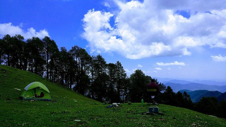
Tirath/Tirthan Valley trek (6-7 days). The classic. Goes up the river from Gushaini, past Rolla, into the upper Tirthan watershed and on to the source of the river, the lake the locals call Tirath. Camp at Rolla (1,800 m), Shilt (~3,100 m), and progressively higher. Reasonably strenuous, no technical difficulty, peak season May-October.
Bashleo Pass trek (1-2 days). From Bathad up over the 3,400 m Bashleo Pass and down into Kullu Sarahan on the other side. Done in one long day if you’re fit and the weather is good, two days otherwise. The pass holds patches of snow into June; I’ve seen fresh snow on it as late as the second week of June.
Pekhri to Rangthar (2-3 days). Out of Pekhri village to the Rangthar meadow at around 3,500 m, with optional further-on camping at higher meadows. This is the easier of the multi-day options and the one I’d recommend for trekkers who don’t want to commit a full week.
Sarchi to Lambhari Top to Serolsar (2-4 days). Sometimes promoted as the “Tragopan Trail” by guide outfits, because the western tragopan is occasionally sighted in the mid-altitude rhododendron near Lambhari. I’ve never seen one. The walking is excellent regardless. The full traverse comes out near Jalori Pass, which is a satisfying way to finish a trek.
One thing to know about the multi-day options: GHNP rangers are now strict about itinerary deviation. If your permit says you’re going to Rolla and on to Shilt, you go to Rolla and Shilt. Don’t try to free-camp off-route or to push to the next valley over. The patrol presence is light but real and the fines are unpleasant.
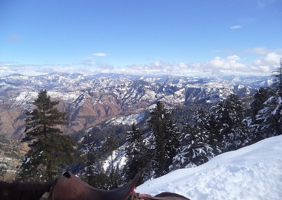
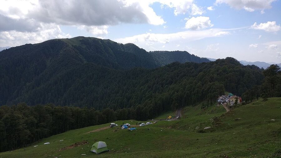
Jalori Pass and the Banjar Side
Jalori Pass at 3,120 m is the high point of the Banjar tehsil and the boundary between the Kullu and Shimla districts. It’s a motorable pass, just barely; the climb from Shoja on the Kullu side gains 1,200 m in 7 km and is genuinely steep enough to deserve respect from drivers in older vehicles. Use low gear on the descent. People do burn out brakes on this road and have to be towed off the mountain.
The pass itself is a small saddle with a basic dhaba, a Jalori Mata temple and a parking patch. People come for two reasons.
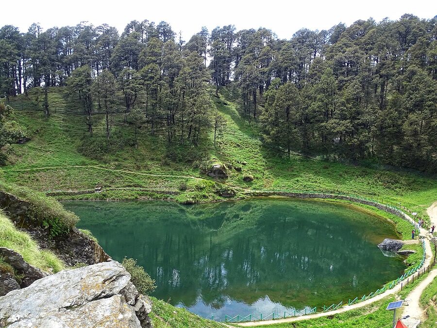
Serolsar Lake. A 5 km hike from the pass east through oak and rhododendron forest to a small high-altitude lake with a temple at one end. It’s not a strenuous walk on the way out; it has a slight downhill bias and the return is the harder leg. Allow 4-5 hours round trip with photo stops. Mid-week the trail can be empty; on a long weekend it has the feel of a busy footpath. Carry water, the dhaba at the lake is unreliable.
Raghupur Fort. A 3 km climb in the opposite direction (west) from the pass. The fort is ruined; the views are not. On a clear day you can see well into the Pir Panjal and as far west as Dhauladhar. I prefer this short hike to the longer Serolsar walk, but it’s not unanimous. Most people do both on a long day from a Shoja base.
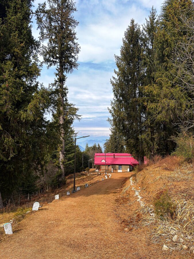
Jalori is reached from the Tirthan side via Shoja, which sits 5 km below the pass on the Banjar-Anni road. Shoja is now its own minor base, with a few cottage-style accommodations (Banjara Retreat being the established one, doubles ₹6,500-8,000 / ~$78-95) and the Banjar Forest Rest House. If you want to do both Jalori and Tirthan but split your trip, two nights in Gushaini and two nights in Shoja is a clean shape.
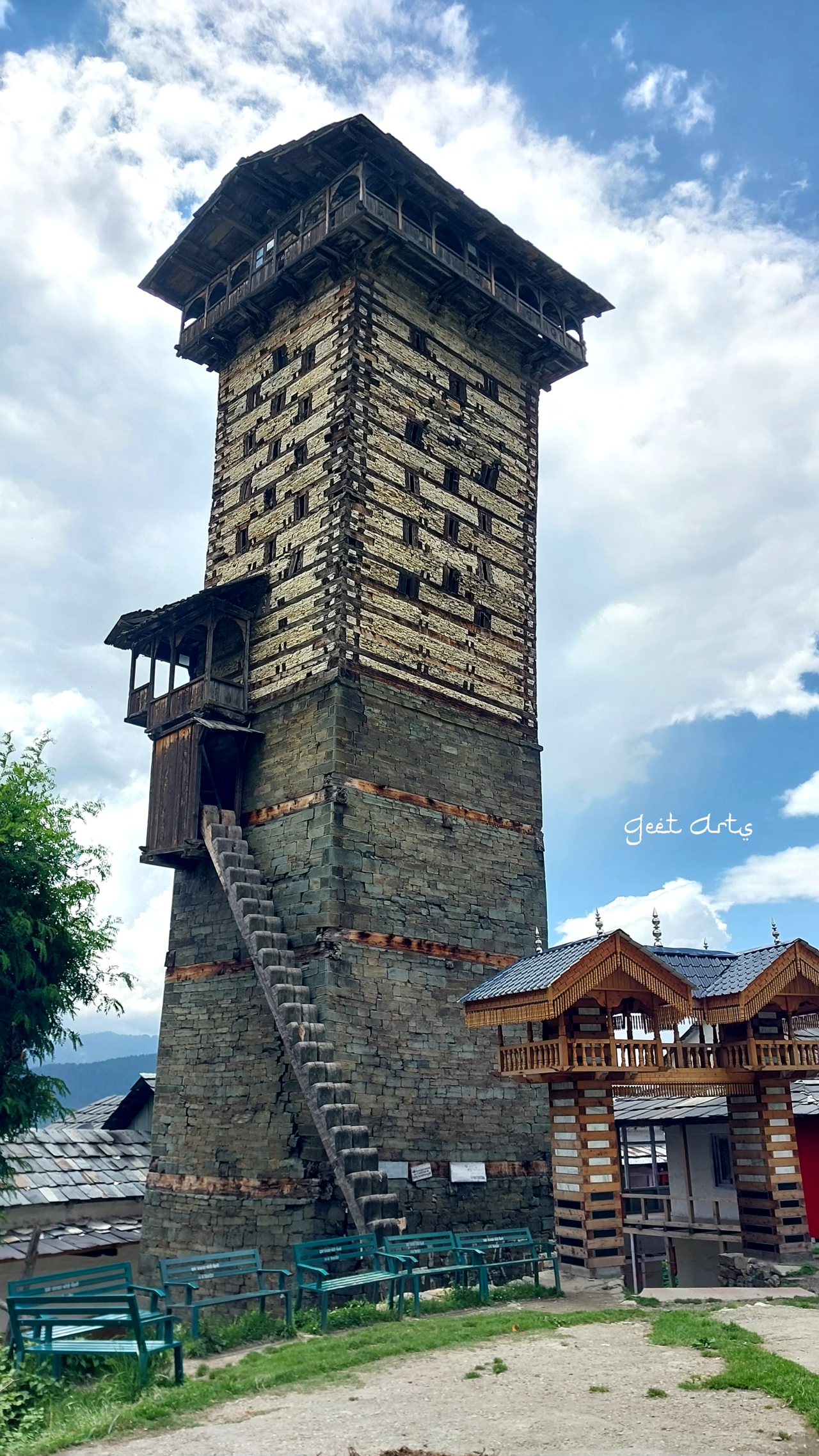
The other reason to come to Shoja and Jibhi is Chehni Kothi, a 17th-century stone-and-wood tower temple that survived the 1905 earthquake. It sits about 30 minutes’ uphill walk from the village of Chehni, which is 5 km from Banjar. The kath-kuni style (alternating courses of stone and timber, no mortar) is the local building tradition, and Chehni Kothi is the surviving high-water-mark example. It’s worth the climb.
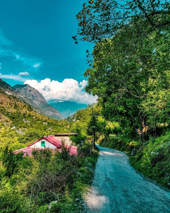
Jibhi: The Cafe Side
Jibhi is the other half of Banjar tehsil and it has a different personality from Tirthan. Where Tirthan’s economy is homestay-and-guide, Jibhi’s is cafe-and-cottage. The village got Instagram-popular around 2019 and a wave of cafes followed. There are now somewhere between 20 and 30 cafes and cottages in Jibhi proper and the adjacent villages of Ghiyagi and Shoja. Some are good; most are average; a couple are tourist traps charging ₹400 for filter coffee that costs ₹120 in any decent Indian city.
What Jibhi does have, more than Tirthan, is the kind of long-stay infrastructure remote workers like. WiFi at the better stays is reliable; you can string together a workable two-week routine of writing, cafe lunch, afternoon walk, dinner. If that’s the kind of trip you want, base in Jibhi rather than Gushaini. Tirthan-side stays are more aimed at three-night holidays.
From Jibhi, the obvious activities are the Jibhi waterfall (15 minutes’ walk from the main road, free, weekend-busy), the climb to Chehni Kothi (described above), and the drive up to Jalori. Beyond that you’re back at the cafe table.
Where to Stay
Tirthan and Jibhi together now have 200-plus accommodations. Most are good. A few are great. None are luxury in the way Manali or Shimla can be; nobody has built a five-star here yet and I hope nobody does.
The categories worth knowing:
- Forest Rest House at Sai Ropa. Run by the GHNP. Dorm beds ₹200-300 (~$2.40-3.60), private rooms ₹600-1,000. Basic, clean, in the right place. Bookings handled by the Sai Ropa office; phone ahead and don’t expect online booking.
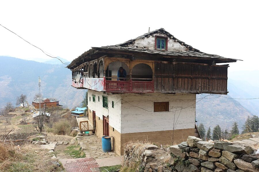
- Mid-range homestays in inner villages (Pekhri, Bandal, side hamlets above Gushaini): ₹800-1,500 per night with food (~$10-18). Family-run, traditional Himachali wooden houses, cooking is wherever the family is cooking that day. Best value in the valley.
- Established homestays around Gushaini and Nagini: ₹2,000-4,000 (~$24-48) per night with food, sometimes per-person sometimes per-room, ask. This includes Raju Bharti’s Cottage, the Himalayan Trout House, the Riverside Resort and a dozen others. Quality is generally good. The river-front rooms are worth paying up for; a homestay 50 m above the road is a different experience to one 50 m above the water.
- Cottage-style stays in Jibhi/Shoja: ₹3,000-8,000 (~$36-95). Banjara Retreat at Shoja, the various properties around Ghiyagi, Doli Guesthouse and Leena’s Place at Jibhi. Better-styled and better-photographed than the Tirthan-side homestays, slightly less rooted.
- Camping: organised camps run from Gushaini and Bathad in season. ₹1,500-2,500 per person per night (~$18-30) for a tent with shared bathroom and meals. Useful in May-June when homestays book out.
If I had to pick one shape for a first visit: two nights in a Gushaini-area homestay for the river and the GHNP day-walk, then two nights in Shoja for Jalori and Serolsar. Avoid trying to do everything from one base; the half-hour drive between the two halves of the tehsil tires out a long day.
What You’ll Eat
The food situation is straightforward. There are very few standalone restaurants in Tirthan; you’ll eat at your homestay for two of three meals and walk to a Banjar dhaba for the third if you fancy variety.
The Himachali plates you should look out for:
- Siddu. A steamed wheat dumpling stuffed with poppy-seed paste, walnut, or sometimes paneer, eaten with ghee. Heavy, slow-burn carbs, perfect after a day of walking. Most homestays make it on request, often as evening tea food rather than a main meal.
- Madra. A chickpea or kidney-bean curry in yoghurt and cashew, served at celebrations. If your homestay offers it, say yes.
- Babru. Fried wheat flatbread stuffed with urad-dal paste. Festival food, occasionally on offer.
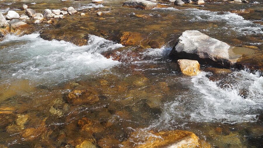
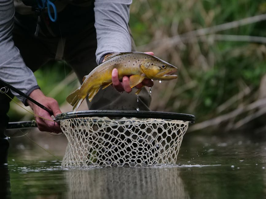
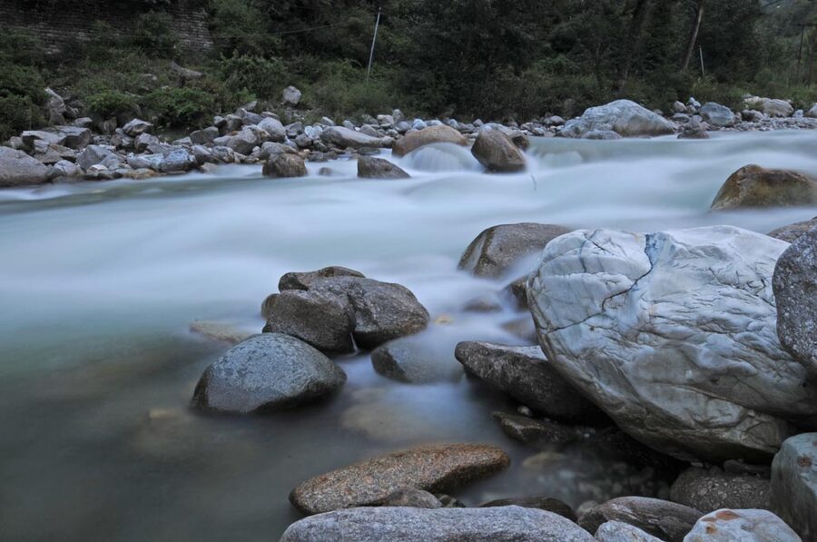
- River trout. If your homestay is near the river they often serve the local trout (brown or rainbow), pan-fried with mustard or tamarind. A whole trout dinner runs ₹450-700 (~$5-8). Worth eating once. The fishing is regulated and the trout in your dinner came out of the same river you’ve been sitting next to.
- Persimmon and apricot, in season. The October-November persimmon crop is locally famous. A basket from Banjar bazaar is ₹100-150 (~$1.20-1.80) for what’d cost three times as much in any city.
The standard “veg thali” at most homestays is competent but unmemorable. Ask in advance, the night before, if you’d like specific Himachali dishes; the household needs to plan around them and most are happy to cook them if asked.
Trout, Permits, and the Fishing Question

Trout fishing was the original draw of Tirthan. The Tirthan, Sainj and Beas all hold introduced brown trout (stocked by the British in the 1900s) and rainbow trout (a later introduction). The Tirthan is generally considered the best of the three for serious anglers because the water stays cleaner and the population is more densely concentrated.
The basics:
- Season. 1st March to 31st October. Closed in winter and during the autumn spawning run.
- License. ₹100 per rod per day (~$1.20). Issued by the Himachal Fisheries Department; in practice your homestay or guide will arrange it for you. Non-transferable. Carry the paper.
- Stretch. The licensed stretch covers about 45 km of the Tirthan. Inside the GHNP core zone fishing is prohibited regardless of license.
- Method. Fly fishing for catch-and-release is what the responsible homestays are pushing. Bait fishing is technically permitted but the fish populations are getting visibly thinner in heavily-fished stretches and the move to catch-and-release is the right one. Take the picture, take the hook out, put the fish back.
- Equipment. Most homestays geared towards anglers (Tirthan Anglers’ Retreat, Himalayan Trout House, Raju’s) can lend rods, reels and basic flies. If you’re a serious angler, bring your own. The local supply runs to roughly half a dozen useful fly patterns and not much else.
If you’re not an angler and have no interest in becoming one, the river is still the centre of the experience. Pull up a flat stone, watch the water for an hour, get cold, go inside.
The Long-Route Option: Via Shimla and Jalori
If you’ve got an extra day, the Shimla-Narkanda-Jalori route into Tirthan is the better drive than the Aut highway. You leave the national highway at Shimla and take the smaller NH5 / NH305 up to Narkanda, then keep going on a single-lane road through Khanag and Ani and up to Jalori. The pass approach from this side (gradual gain through cedar forest) is gentler than from Shoja but the final 2 km are still steep.
The full circuit looks like this: Delhi to Shimla (overnight), Shimla to Narkanda to Jalori to Tirthan (long day, but scenic), four nights in the valley, then back via Aut to Manali and the standard return route. That’s a 7-8 day trip, and it’s how I’d recommend a first visit if you’re flying in from outside India.
Caveat: Jalori is closed under snow late December through mid-March. In those months the only way in is the Aut highway and the only way out is the same.
Practical Things Worth Knowing
- Mobile network. Banjar and Gushaini are well covered (Airtel, Jio, BSNL). Anything above Bandal or off the main valley road is patchy. BSNL has the best deep-village reach. Don’t plan on streaming video from a homestay above 1,800 m.
- ATMs. Banjar (multiple, all reliable). Aut and Larji on the way in. The ATM in Gushaini bazaar exists but breaks weekly; don’t depend on it. Carry enough cash for the trip out, plus a buffer.
- Petrol. Larji has the closest pump (just past the Aut tunnel turn-off). Banjar has one. Plan around them; nothing inside the valley.
- Power. Voltage drops and short outages happen, especially during summer storms. Carry a power bank. The better homestays have inverters; cheaper ones don’t.
- Health. Banjar has a small civil hospital, adequate for cuts, AMS, gastric trouble, fractures. For anything more serious it’s Mandi (3 hours) or Kullu (2.5 hours). The Aut tunnel route is faster than the Jalori route in any medical situation.
- Solo travel. Tirthan is one of the easier valleys in Himachal for solo travel, women included. Homestay families are uniformly welcoming and the local population is small enough that you become a known quantity inside two days. The usual hill-station precautions apply for trekking solo into GHNP. Don’t.
- Maps. Google Maps is reasonable on the main valley road and unreliable above it. If you’re walking the side roads, ask locals at every fork. People are happy to point.
- Garbage. Carry your trash out. The valley has a real waste problem on the popular trails (the Rolla day-walk especially). The Forest Department and homestay owners have been pushing back and the visible litter is slowly thinning, but new arrivals add to it faster than locals can clean it. Be one of the people not adding.
A Suggested Three-to-Five Day Shape
.jpg)
Three days is the minimum that earns the trip. Five is better. Beyond five it depends on what kind of traveller you are.
Three days (long-weekender). Day 1: Volvo arrives Aut, taxi to Gushaini, settle in, walk to the river, eat, sleep. Day 2: Rolla day-walk in the morning, lunch back at homestay, afternoon at the river or a short hike. Day 3: drive up to Jalori and back via Chehni Kothi, evening Volvo back to Delhi.
Four days. Add a half-day for the Serolsar walk from Jalori. Pack lunch, do it before you head back.
Five days. Add a night in Shoja so you don’t have to drive the Jalori day in one piece. Replace the half-day at the river on Day 2 with a half-day hike to Bandal village or Choi waterfall.
Seven to ten days. Add a multi-day trek (Bashleo or Pekhri-Rangthar). Two nights at one homestay before, one night after, three to five days on the trail.
Two weeks plus. You’re in remote-work territory now. Base in a Jibhi cottage with reliable WiFi and treat Tirthan as the weekend trip from there.
Verdict
Tirthan is not the most spectacular valley in Himachal. Spiti is more dramatic; Lahaul is bigger; the high reaches of the Kullu valley have peaks that Tirthan doesn’t. What Tirthan offers is a rare combination on this side of the Himalaya: easy access (one Volvo from Delhi, one taxi off the highway), a real river, a UNESCO national park as the back garden, and a tourism economy that hasn’t yet been wrecked by overdevelopment.
If you’ve been to Kasol recently and want the version of that trip that still exists in 2008, this is it. If you’ve never been to Himachal at all and are choosing between Manali, Shimla and somewhere quieter, pick Tirthan and don’t look back. If you’re an experienced Himachal traveller and have somehow missed it, fit it in before the next big road project does to it what the four-laning around Aut did to Kullu.
And take the right at the tunnel.