
Most first-time itineraries in Himachal Pradesh use the same four pins: Shimla, Manali, Dharamshala, and one of either Spiti or Dalhousie depending on the season. Get those right and the rest of the state opens up.
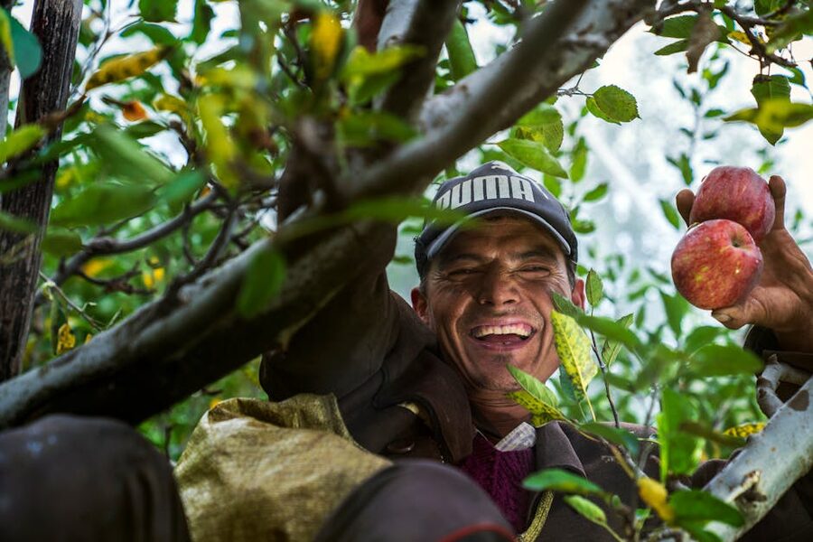
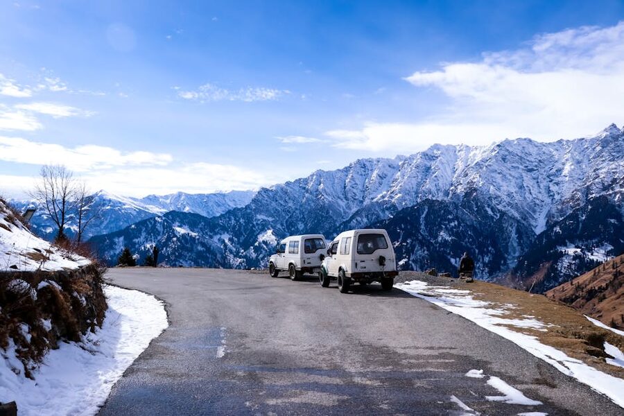
Himachal Pradesh is a state the size of Switzerland with the climatic variety of three different countries. The southern slopes drop into the plains of Punjab and Haryana around 350 metres above sea level. The northern districts sit in the trans-Himalayan rain shadow at altitudes over 4,000 metres, with terrain that looks more like Tibet than India. Between those two extremes are the hill stations Indian travellers have been visiting for over a hundred and fifty years, the Tibetan-Buddhist towns the Dalai Lama settled in 1959, the festival valleys where two-hundred-odd village deities still meet once a year on the same maidan, and a string of trekking valleys whose names were unknown to most Indian visitors until Instagram changed that around 2014.
The point of this guide is to keep first-timers out of the trap of trying to see everything in one trip. You can’t. The Manali to Spiti road is closed half the year. Dharamshala and Spiti are eight hours apart on Himalayan roads and most rentals won’t let you drop a car in a different city. The right move is to pick a region, do it properly, and come back for the next region in a different season. What follows covers the state’s main destinations in the order most planners actually need to decide between them, with practical takes on which ones reward the trip and which ones to skip if you’ve only got a week.
In This Article
- The Four Trips Most People Actually Take
- Manali
- Shimla
- Dharamshala and McLeod Ganj
- Spiti Valley
- Kullu Valley
- Dalhousie and Khajjiar
- Kasol and Parvati Valley
- The Smaller Hill Stations: Kufri, Chail, Kasauli
- Kinnaur: Chitkul, Kalpa, and the Last Frontier
- Tirthan Valley and the Great Himalayan National Park
- Bir Billing
- Lahaul, Pangi, and the Far North
- Wildlife: The Sanctuaries Worth a Trip
- When To Visit: The Season Problem
- Getting Around: How to Put a Trip Together
- Where to Stay and How to Plan an Itinerary
- Festivals and Culture: Why You Might Want to Time Your Trip
- What to Skip and What to Get Right
- One Last Thing
The Four Trips Most People Actually Take
If this is your first Himachal trip, your itinerary is almost certainly going to fall into one of four shapes. Knowing which one you’re planning makes every other decision easier.
The Shimla-Manali loop. Two hill stations, often paired, usually with a stop at Kullu and a day trip to Rohtang or Solang. The classic 5-to-7-day Himachal trip from Delhi or Chandigarh, suitable any month of the year, friendly to families and first-timers, well-served by buses and packaged tours. This is what most people mean when they say they’re “doing Himachal.”
The Dharamshala-Dalhousie circuit. The Kangra and Chamba side of the state, lower-altitude, greener, less Himalayan-spectacular but easier on the lungs. McLeod Ganj for Tibetan Buddhism, Dharamshala for the cricket stadium and the Dalai Lama temple complex, Dalhousie for old British hill-station charm, and Khajjiar as a half-day side trip. Best in spring and autumn. Slightly fewer tourists than Shimla-Manali.
The Spiti loop. A different kind of trip entirely. Either Manali to Kaza to Shimla (the full 8-to-10-day circuit), or Shimla to Kaza and back (the slower, more weather-reliable version). High altitude, cold-desert landscape, Buddhist monasteries, almost no greenery, only viable from June to early October if you want both passes open. Not for first-timers who want hill-station holidays. Phenomenal for travellers who’ve done the standard trips and want something the Indian Himalaya does better than anywhere else in the country.
The Parvati and Tirthan slow trip. Skip the famous hill stations entirely. Base in Kasol, Tosh, or one of the Tirthan villages. Walk, hike, eat, and ignore the tour-bus circuit. The unhurried version of what social media calls a “Himachal trip” now. Works for solo travellers, couples, and groups of friends in their twenties and thirties; less ideal for older parents or small children.
If you’re trying to figure out which of these to pick, the quick test is the season. Spiti is summer-only. Shimla and Manali work all year. Dharamshala is best in spring and autumn. The Parvati slow trip is most pleasant October to November and March to May. Match the trip to the month you’re actually going.
Manali
Manali sits at 2,050 metres in the upper Kullu Valley, on the Beas River, and despite the worst of what Indian mass tourism has done to it, it remains one of the genuinely useful base towns in the western Himalaya. From Manali you can drive to Rohtang and Lahaul in summer, paraglide at Solang in winter, ride to Spiti when the road opens, raft on the Beas in season, and visit the Hidimba Devi Temple at Dhungri at any time of year.
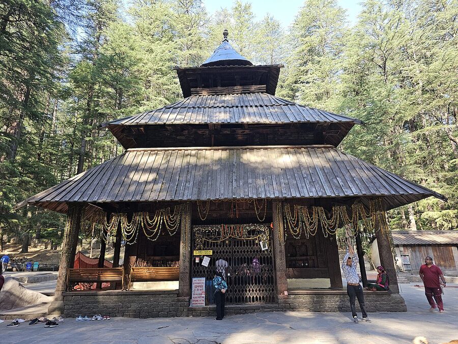
What’s worth your time inside Manali itself is short. The Hidimba Devi Temple, built in 1553 by Raja Bahadur Singh and famous for its four-tiered pagoda roof, is one of the finest surviving examples of Kullu temple architecture. Old Manali, across the Manalsu nala from the main town, has the cafés and the easier walking. The Manu Temple at the top of Old Manali is worth the climb if you’re up there. Vashisht, three kilometres uphill from the main town, has hot sulphur springs and one of the better-preserved old village quarters in the valley.
What’s overrated, in the opinion of pretty much everyone who has visited recently and doesn’t work for a tour operator, is the Mall Road area. It’s dense, traffic-clogged, and most of the shops sell mass-produced goods at prices marked up for tourists. If you’re after Kullu shawls or Pahari handicrafts, the Bhuttico cooperative outlets in town are a more reliable bet than the Mall Road shops. If you’re after food, the cafés in Old Manali are better.
The day trip everyone takes is to Solang Valley (around 14 km north) for paragliding, zorbing, and snow in winter. The day trip nobody mentions enough is to Naggar Castle (about 22 km south on the left bank of the Beas), a 16th-century fort-palace converted into an HPTDC hotel, with the Roerich Art Gallery a short walk away. The Roerich gallery alone justifies the half-day if you have any interest in early-20th-century Himalayan painting.
The Manali to Rohtang Pass road (51 km, open June to October most years) was the standard day trip until Rohtang was made a permit-controlled zone to protect the alpine ecosystem. You now need an online permit, the daily quota fills early, and the Atal Tunnel (opened 2020) has anyway taken most of the through-traffic to Lahaul. If you want the Rohtang scenery, the easier move is to drive through the tunnel to Sissu in Lahaul and back the same day. For a full Manali planning brief, see the dedicated Manali tourist attractions guide.
Shimla
Shimla is the state capital and was the summer capital of British India from 1864 until partition. It sits at 2,200 metres on a long ridge with the Mall Road running along the spine and the residential and commercial neighbourhoods spilling down the slopes on both sides. The colonial-era Christ Church on the Ridge, the Viceregal Lodge at Observatory Hill, the Gaiety Theatre, and the long pedestrianised Mall make up the core of what visitors come for. The town is more pleasant than people who only know Indian hill stations from second-hand reputation expect it to be.
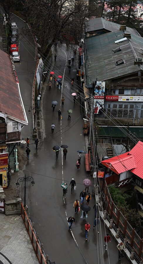

The thing to know about Shimla is that it works as a town to walk in. Cars are restricted on the Mall and on much of the Ridge. The standard tourist circuit (Mall Road, the Ridge, Christ Church, Scandal Point, Lakkar Bazaar, Jakhu Temple) can be done on foot in a long morning. The Viceregal Lodge, now the Indian Institute of Advanced Study, is half an hour by taxi or a 90-minute walk along the Observatory Hill road. The State Museum has a useful collection of Pahari miniature paintings and Himachali bronzes. None of this requires a guide or a tour package; the town is small enough to handle on your own.
The reason most Indian visitors come to Shimla, however, is the toy train. The Kalka-Shimla Railway, opened 1903, is a UNESCO World Heritage Site, runs on a 762-mm narrow-gauge track, climbs 1,500 metres over 96 kilometres, passes through 102 tunnels and over 869 bridges, and takes around five hours each way. The Shivalik Express in the morning and the Himalayan Queen later in the day are the two services most travellers book. The first-class Shivalik is the better-equipped option; the second-class general carriages are cheaper and busier and have no fewer windows. If you do nothing else in Shimla, do the toy train one way and the road the other.
What to skip in the Shimla area: Kufri. The day trip everyone takes from Shimla, fifteen kilometres up the Hindustan-Tibet Road, is a roadside zoo with tired ponies, snow that looks better in photographs than in person, and a small fairground crammed with people being charged premium to pose in rented faux-Himachali jackets. The Mahasu Peak walk above Kufri is fine, but the village itself is not. If you have a half-day spare from Shimla, go to Naldehra (golf course laid out by Lord Curzon, less crowded, beautiful deodar) or to Tattapani (hot springs on the Sutlej, an hour and forty minutes by road) instead.
Dharamshala and McLeod Ganj
Dharamshala (1,475 m) and McLeod Ganj (2,080 m) sit on the same hillside in Kangra district, six kilometres apart, and most foreign visitors mean McLeod when they say Dharamshala. McLeod is the older British cantonment that became the Tibetan government-in-exile after His Holiness the Dalai Lama settled there in 1960. The lower town, Dharamshala proper, is the district headquarters and home to the cricket stadium that put the place on most Indian visitors’ maps in the early 2000s.
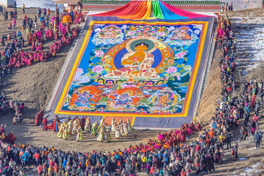
The Tsuglagkhang complex (the Dalai Lama temple and the seat of the Tibetan government-in-exile) is the focus of any visit to McLeod. It includes the Namgyal Monastery, the Tibet Museum, and the Dalai Lama’s residence (closed to the public). His Holiness gives public teachings periodically; if your visit overlaps, the schedule is published on the official Dalai Lama site and you can attend free with online registration. The Norbulingka Institute, eight kilometres downhill towards Dharamshala, preserves Tibetan crafts and is one of the best places in India to see thangka painting and applique work being done by hand.
The trek that defines McLeod for most visitors is Triund. It’s nine kilometres from Galu Devi, climbs about 1,100 metres, takes between four and six hours up depending on your pace, and ends on a meadow at 2,875 metres with the Dhauladhar wall directly above you. The view of the Dhauladhar range from Triund on a clear morning is one of the better mountain views in northern India. You can do it as a day hike with an early start, or stay overnight at the small camp at the top to catch the sunset and sunrise. The camping ground was officially regulated in 2018 after years of complaints about plastic litter; bookings are now mostly through registered operators.
The Bhagsu waterfall and Bhagsunag temple are a short walk from McLeod’s main square and are a sensible easier alternative if Triund is too much. Dharamkot, twenty minutes uphill from McLeod, is where most of the longer-stay travellers settle for yoga, meditation retreats, and cheaper accommodation. The 10-day Vipassana courses at the Dhamma Sikhara centre at Dharamkot have a long waiting list and run year-round.
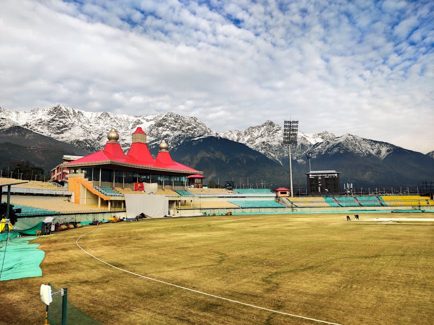
The cricket stadium at Dharamshala (1,457 m, the highest international cricket ground in the world) is worth a visit on a non-match day if cricket means anything to you. Even on a quiet morning the view of the Dhauladhar from the players’ end is striking. The Dalai Lama Cricket Trophy, an inter-monastic competition, is held there annually.
For nature beyond the McLeod circuit, the Kareri Lake trek (a moderate two-day trek from Kareri village) and the Indrahar Pass crossing (a serious 4,300-metre pass, multi-day, mid-summer only) are the standard next steps for trekkers. For temples, Chamunda Devi (15 km from Dharamshala) and Jwalamukhi (60 km, the most-visited Shakti pith in the state) are both day-trippable; the Jwalamukhi Temple at Kangra in particular has a continuous-burning natural gas flame that’s been the focus of pilgrimage for centuries.
Spiti Valley
Spiti is in the cold trans-Himalayan rain shadow, between 3,800 and 4,500 metres for most of the inhabited valley, and looks nothing like the rest of Himachal. The terrain is rock and scree and ochre. The villages are flat-roofed and Buddhist. The barley fields are tiny and walled. There’s almost no tree cover. The drive into Kaza, the main town, is one of the great Indian road experiences regardless of which direction you do it from.
You enter Spiti from one of two ends. The Manali side, over Kunzum Pass (4,590 m), is open June to early October and is the more dramatic introduction. The Shimla side, up the Sutlej through Kinnaur, is open most of the year (closures in heavy winter) and is the steadier of the two. The classic loop, Manali to Kaza to Shimla over 8-to-10 days, requires both passes to be open and a vehicle that can handle them. The other classic, Shimla to Kaza and back via the same route, works for a longer window of the year and is the safer first-timer’s introduction.
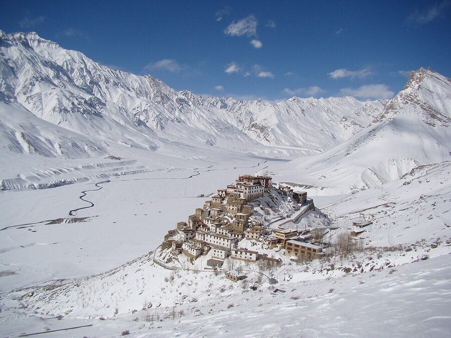
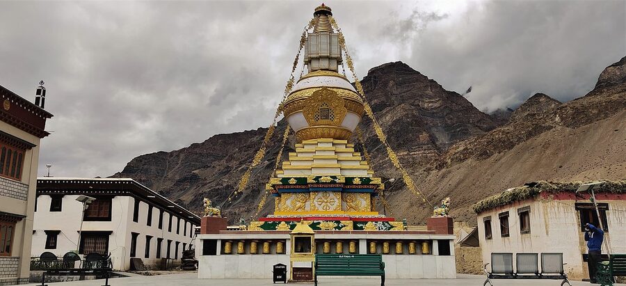
The monasteries are the reason most people go. Key Monastery (Kee Gompa), perched on a hill above the Spiti River at 4,166 metres, founded around 1000 CE and rebuilt several times after Mongol raids and earthquakes, is the most photographed building in Himachal and probably the most photographed monastery in India. Tabo Monastery, downstream, is older still (founded 996 CE), holds wall paintings the Indian state has compared in importance to the Ajanta caves, and is unmarked from the road in a way that surprises first-timers. Dhankar, on a cliff between the Spiti and Pin rivers, is the structurally vulnerable one (parts have been closed to visitors for stabilisation work in recent years; the new Dhankar gompa nearby is open) and the views from the ridge above the monastery are some of the best in the valley.
The other places people put on a Spiti itinerary: Komic (one of the highest motorable villages in the world, 4,587 m), Hikkim (the highest post office in the world, where you can buy a postcard and have it postmarked from there), Langza (the village with the giant Buddha statue and the Jurassic-fossil hillsides), and Chandratal Lake, the moon-shaped high-altitude lake at 4,300 metres reached via a rough side track off the Manali-Kaza road. Chandratal is gorgeous and crowded; the camp owners on its meadow are the reason it’s been pulled back into a regulated visitor zone. You can no longer camp on the lake edge itself.
The Pin Valley, branching off the Spiti at Attargo, is the protected wildlife corridor where the Snow Leopard Project does most of its work; the leopards themselves are a January-February sighting at best, and tour operators marketing snow-leopard summer expeditions are selling something they cannot deliver. The Pin-Parvati Pass trek, which crosses from Spiti into the Parvati Valley, is one of the more demanding multi-day Indian Himalayan crossings and not a first-time trekker’s route.
The single biggest mistake first-timers make in Spiti is altitude. You will go from Manali (2,050 m) to Kunzum Pass (4,590 m) in one driving day, and from Kaza you will day-trip to Komic at 4,587 m. AMS hits people who haven’t acclimatised, and the closest hospital that can handle a serious case is in Reckong Peo or Manali, both at least eight hours away. The standard advice is to enter Spiti from Shimla side, gain altitude over three to four days through Kalpa and Nako, and only do the Komic and Hikkim drives once you’ve slept two nights in Kaza. The full Lahaul and Spiti guide covers the route options in detail.
Kullu Valley
The Kullu Valley is the broad U-shaped basin formed by the Beas River between Manali and Mandi, surrounded on both sides by pine and deodar forest, lined with apple orchards, and dotted with the village temples that give the valley its other name, Dev Bhumi (the Valley of the Gods). Kullu town itself, 40 kilometres south of Manali, is the district headquarters and the site of the seven-day Kullu Dussehra festival every October. Outside the festival the town is unspectacular, but the surrounding orchards, side valleys, and temples are why people stay in the area.
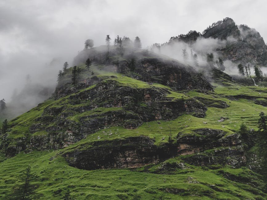
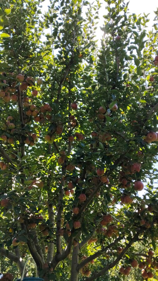
What to actually see in the broader valley: the Bijli Mahadev temple, perched on a 2,460-metre ridge above Kullu town and reached by a steep three-kilometre walk from the road head at Chansari. The temple’s lingam is famously struck by lightning periodically and reassembled by the priests, which is the legend the place is known for. The Raghunath Temple at Sultanpur, the seat of Raghunathji, the head deity of the valley since 1651. The Naggar Castle on the left bank of the Beas, an HPTDC heritage hotel that you can stay in or visit. And the apple orchards themselves, particularly during the September to October harvest, when the lower valleys are red with fruit and the local economy is at its busiest.
The food side of a Kullu Valley visit is undersold by most guides. Pahari cuisine is genuinely distinct from the food of the plains: yoghurt-based curries (madra), steamed wheat-flour breads filled with walnut and poppy-seed paste (sidu), buckwheat pancakes (aktori), and slow-cooked mutton in gram-flour gravy (chha gosht). The sit-down restaurants in Kullu town, the Kala Kendra food stalls during festival weeks, and the occasional homestay kitchen in the side valleys are the places to find them. Most plains-Indian restaurants in Manali don’t carry these dishes.
For shopping, the valley’s signature is the Kullu shawl: handwoven wool, with geometric border patterns in red, black, yellow, green, and white that have become a regional symbol. Genuine handloom Kullu shawls come from village weavers and are sold through cooperatives, the largest of which is Bhuttico. The Bhuttico outlet at Bhuntar (near the airport) and the Kullu town outlet are the most reliable sources. Shawls sold at Manali’s Mall Road are almost all factory-produced and are not the same product.
The Great Himalayan National Park, a UNESCO World Heritage Site since 2014, occupies the higher ground south-east of Kullu town. Tirthan Valley (covered separately below) is the standard entry. The park is one of the better-protected Western Himalayan biodiversity zones in India, with brown bears, blue sheep, Himalayan tahr, and a healthy population of birds. Day-tripping in is straightforward; serious trekking requires a permit and a registered guide.
Dalhousie and Khajjiar
Dalhousie sits at 1,970 metres in Chamba district, on the western edge of the Dhauladhar range, named after the Lord Dalhousie who set it up as a summer retreat in 1854. The town is spread across five hills (Katalagh, Potreyn, Bakrota, Terah, Bhangora) with linking roads that loop through deodar and oak forest. It’s older, smaller, and significantly less developed than Shimla or Manali. For visitors who like colonial-era hill stations done quietly, Dalhousie is the better choice in Himachal.
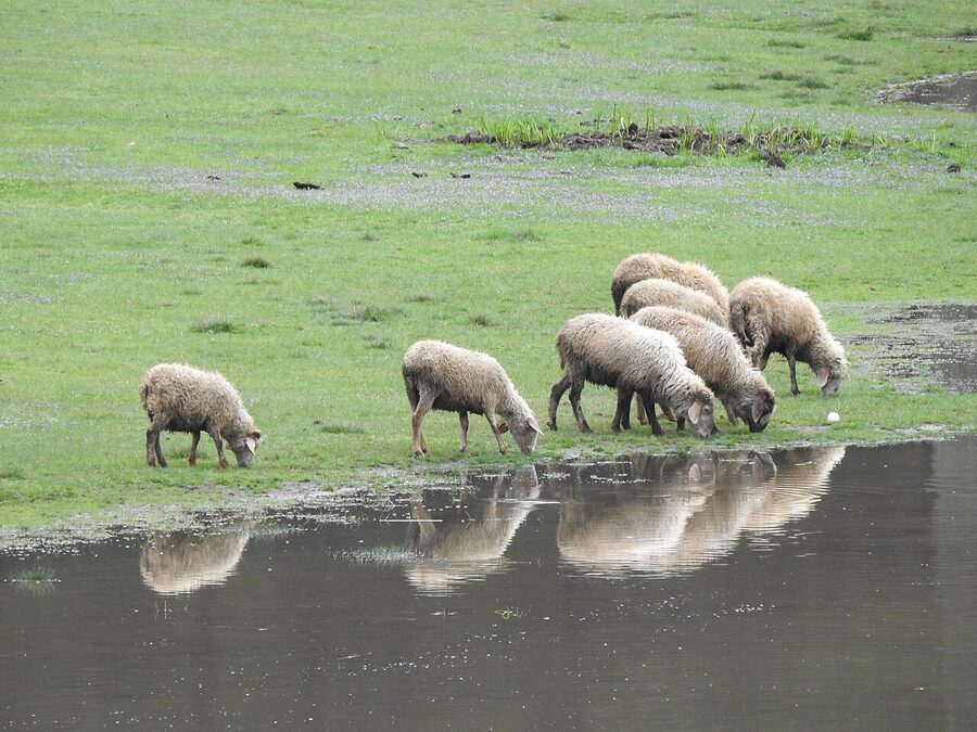
The town’s main pleasures are walking. The Bakrota Hills loop (around five kilometres, mostly on car-free road) takes you through pine forest with views over to the Dhauladhar. The walk from Subhash Baoli to Panjpula, where Sardar Ajit Singh is memorialised, is a flat half-hour stroll. Saint Patrick’s Church (1909) and Saint Francis Church (1894) are the two surviving British-era churches worth a look. The town’s two original commercial squares, Gandhi Chowk and Subhash Chowk, are still the centres of Dalhousie life and have the most reliable restaurants.
Khajjiar (2,000 m, 24 km from Dalhousie) is the day trip everyone takes from Dalhousie. The marketing line is “the mini-Switzerland of India” and that nickname comes from a 1992 visit by the Swiss embassy’s vice-counsellor, who left a sign on the meadow saying so. The actual place is a flat oval meadow about a kilometre across, surrounded by deodar forest, with a small lake in the middle, used by locals for grazing and by visitors for short walks, picnics, and short pony rides. It’s pretty and it’s worth a half-day. The crowds in May and June are the trade-off, and the parking, food, and pony-ride economy at the meadow’s edge has the same rough-and-ready commercialism that you’ll find at Solang or Kufri.
Beyond Khajjiar, the Kalatop Wildlife Sanctuary (a small protected area between Dalhousie and Khajjiar, with a forest rest house and easy walking) is a good half-day for birders and walkers. Dainkund Peak (the highest point in Dalhousie) is a short walk from the road head with views in clear weather. Chamba town, an hour and a half east of Dalhousie, has the Laxmi Narayan temple complex (a group of six stone shikhara temples from the 10th and 11th centuries), the Bhuri Singh Museum (Pahari miniature paintings, including the famous Basohli school), and the annual Minjar Fair in late July. Chamba is a more rewarding town than Dalhousie for travellers interested in temple architecture and miniature painting.
Kasol and Parvati Valley
Kasol is a small village 31 kilometres up the Parvati Valley from Bhuntar, on the Parvati River, at 1,580 metres. It’s developed in the last twenty years from a quiet trekking base into the most concentrated young-Indian and Israeli backpacker scene in the country. The cafés serve hummus, falafel, and shakshuka. The signs are in Hebrew. The bookshops stock Yotam Ottolenghi alongside Vipassana literature. Whether this is appealing or appalling depends on what you came for; Kasol does not pretend to be anything other than what it is.
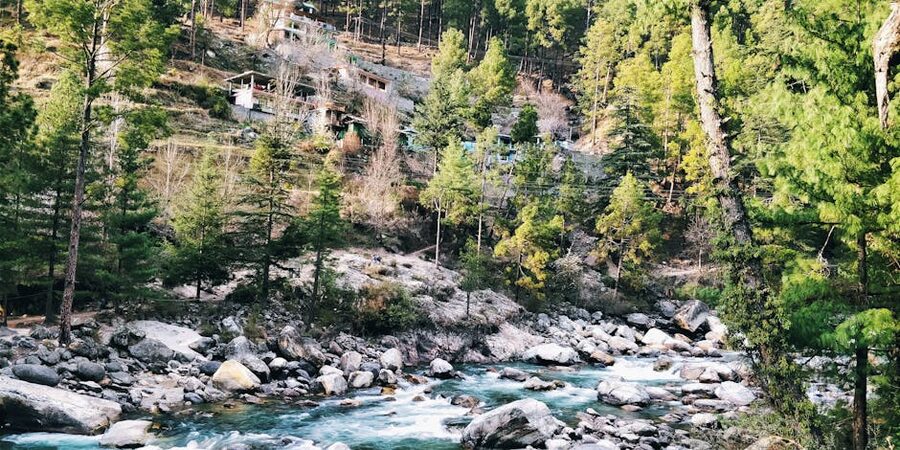
What makes the Parvati Valley worth visiting is what’s beyond Kasol. Tosh, six kilometres further up by jeep and a short walk, is a higher village with cleaner air, fewer crowds, and views down the valley that are genuinely beautiful. Kalga and Pulga, on the opposite side of the river from Tosh, are the two villages from which the four-hour Kheerganga trek begins. Kheerganga itself, at 2,950 metres, is a hot-spring meadow at the head of a side valley, with simple guesthouses and a temple to Lord Shiva. Doing it as an overnight is far more pleasant than doing it as a day trip; the descent in the dark is unpleasant and people have got hurt on the slippery sections.
Manikaran, on the way up to Kasol from Bhuntar, has the second-most-important Sikh gurudwara in Himachal (the most important being Rewalsar) and the hot springs the gurudwara is built around. The langar (free community kitchen) at Manikaran serves food cooked over the geothermal springs and is a worthwhile half-hour stop on the way through. The town has the same density of guesthouses as Kasol and a very different demographic; Manikaran is a Sikh and Hindu pilgrimage town first.
Malana, the village with its own famously independent traditions and democracy, is reached by a steep two-hour walk from the Jari road head. The village’s cultural rules (visitors are not permitted to touch the temple, the houses, or the local population without specific protocol) are real and visitors who break them can be fined. Malana has a long-standing reputation in the cannabis-tourism economy that has done it no favours; visit with respect for the village’s rules or do not visit.
One specific warning about the Parvati Valley: a small but consistent number of foreign trekkers have gone missing in the area over the past two decades, with active investigations and unresolved cases. The standard precaution is to use a registered local guide for any off-trail walking, to leave your itinerary with your guesthouse, and to stay on the marked routes. None of this should put you off the valley, but the risk is real and not worth pretending away.
The Smaller Hill Stations: Kufri, Chail, Kasauli
Three smaller stations cluster near Shimla and most visitors squeeze them into a Shimla itinerary. The straight assessment of each:
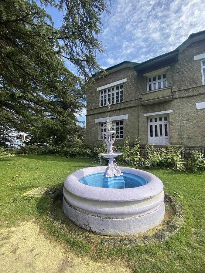
Kufri (16 km from Shimla, 2,720 m): Skip. Already covered above. The “Switzerland of the East” branding is decades-old and the place itself is now a roadside fairground. The Mahasu Peak walk above Kufri is fine if you’re already there. The Himalayan Nature Park (the small zoo at Kufri) houses Himalayan wildlife in conditions older Indian visitors find tolerable and most foreign visitors do not.
Chail (45 km from Shimla, 2,250 m): Worth a half-day. The Chail Palace, built in 1891 by the Maharaja of Patiala after he was banned from Shimla, is now an HPTDC heritage hotel that you can stay at or visit for tea. The world’s highest cricket ground (2,144 m) is on the property. The Chail Wildlife Sanctuary surrounds the palace estate and has good deodar walking. The drive from Shimla via Kufri-Chail is itself the prettier part of the visit.
Kasauli (77 km from Shimla, 1,927 m): Worth a day if you’re driving up to Shimla from Chandigarh. A small army-cantonment town with a different feel from the larger hill stations, no through-traffic, two main roads (Upper Mall and Lower Mall) that you can walk in an hour, and the Christ Church and the Kasauli Brewery (one of Asia’s oldest distilleries, established 1820) as the named-attractions. Kasauli’s pleasure is its smallness; if you’re after sights, it doesn’t deliver many, but if you want a hill station that hasn’t lost itself to mass tourism, this is the closest one to Delhi.
Kinnaur: Chitkul, Kalpa, and the Last Frontier
Kinnaur is the district that runs along the Sutlej River from Rampur up to the Tibet border. Reckong Peo is the district headquarters at 2,290 metres. The valley narrows progressively as you climb upstream, the apple orchards give way to pine forest, the pine forest gives way to high alpine, and you eventually hit Chitkul, the last inhabited village on the Indian side of the border at 3,450 metres. The road in is the Hindustan-Tibet Highway, one of the most spectacular drives in the country and one of the most landslide-prone.
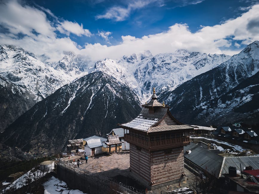
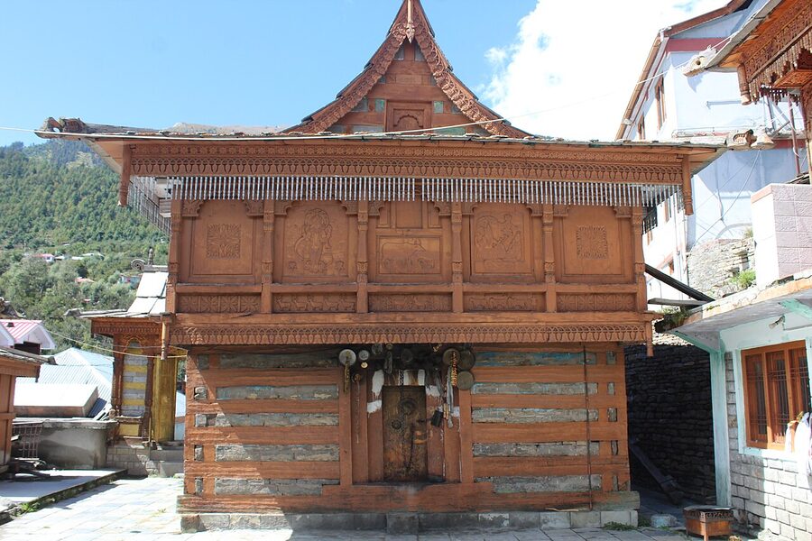
The standard Kinnaur stops are Sangla (the valley’s main resort town, with a cluster of guesthouses, the Kamru Fort and its 15th-century Buddhist-influenced wood-and-stone architecture above), Kalpa (the village across the Sutlej from Reckong Peo with the front-row view of Kinnaur Kailash, 6,050 m), and Chitkul (the last village, with a half-dozen homestays and a single road in and out). All three are spectacular. None of them are crowded the way Manali or Kasol are. The Kinnaur trip is a good fit for travellers who liked Spiti but want green rather than ochre, and for slow-trip travellers who want the mountain experience without the crowds.
The single thing to know about Kinnaur is that you need an Inner Line Permit to go beyond Jangi (about 30 km past Kalpa) towards Spiti. The permit is free, takes 30 minutes at the Reckong Peo SDM office or various online portals, and you need a passport-sized photograph and ID copy. Foreign visitors require a slightly different permit; ask at the same office. Plan for a half-day in Reckong Peo to handle the paperwork if you’re heading on into Spiti.
The other thing to know is that the Hindustan-Tibet road is regularly closed by landslides, especially in monsoon (July to September). If your trip is in those months, build in flexibility; closures of 24 to 72 hours are common, and the alternative routes are limited.
Tirthan Valley and the Great Himalayan National Park
Tirthan is the side valley that branches off the main Kullu Valley at Aut, about 60 kilometres south of Manali. It’s the buffer-zone entry to the Great Himalayan National Park (UNESCO World Heritage Site, 2014), and it’s the slow-travel alternative to Manali for visitors who want pine forest, river-bank walking, and trout fishing without the crowds.
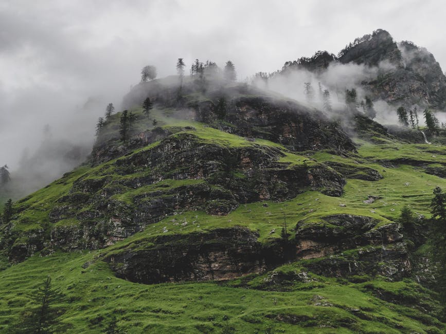
The valley’s main villages are Banjar (the road-head town with the bus connections), Sai Ropa (the GHNP’s eco-zone information centre), Gushaini (the cluster of riverside homestays where most visitors actually stay), and Jibhi, in the parallel Banjar Valley, which has become the more Instagram-known of the two valleys in recent years. Jibhi has the wooden-architecture villages, the Jalori Pass crossing into the Sutlej drainage, and the Serolsar Lake walk from Jalori top. Gushaini and Sai Ropa have the river, the GHNP trekking, and the trout.
For the Great Himalayan National Park itself, the standard short trek is to Rolla (one day from Gushaini, easy enough for a moderately fit walker), and the standard medium trek is to Shilt (two to three days, harder, with a forest rest house at the destination). Permits are arranged through the GHNP office at Sai Ropa. Trout fishing in the Tirthan is licensed by the state fisheries department; permits are issued at Banjar. The fish are real, the river is clean, and the local guides know which pools fish best at which time of year.
Tirthan and Jibhi are the part of Himachal that has changed most quickly in the last five years. Homestays have multiplied. Café-style breakfasts have arrived. The slow-travel marketing has done its work. The valleys remain pretty, but the price-and-crowd trajectory is steep, and what was a quiet fishing village in 2018 is a booked-out homestay zone in 2026. Visit now if you want to; the next five years will change them further.
Bir Billing
Bir is a small town in Kangra district that has become the paragliding capital of India. The take-off site is at Billing (2,400 m, 14 km up the road from Bir), the landing site is at Bir’s Tibetan colony (1,400 m), and the standard tandem flight is a 15 to 30-minute glide between the two. The Paragliding World Cup was held here in 2015 and the international flying season runs from October to early December and again in March to May. The summer season has thermal conditions that favour the cross-country pilots; the autumn season is the better window for tandem visitors.
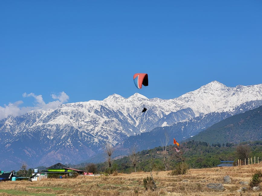
What’s around Bir besides the paragliding: the Tibetan colony itself (one of the older Tibetan settlements in India, established in 1960s, with several small monasteries open to visitors), the Sherabling Monastery (the seat of the 12th Tai Situ Rinpoche, around 13 km from Bir), the Chokling Monastery, and the surrounding forest walks. The Deer Park Institute at Bir runs short courses on Buddhist philosophy and meditation that are open to visitors. The town has filled with cafés in the last five years to support the paragliding scene; the food is decent and the prices are higher than the Kangra average.
For non-fliers, Bir is a pleasant enough overnight on the way between McLeod Ganj and Manali, but it’s not a destination on its own. For fliers, the combination of Bir for the take-off scene and Dharamkot (above McLeod) for the more meditative side of the same general area is the standard week-long itinerary.
Lahaul, Pangi, and the Far North
Lahaul is the district immediately north of Rohtang Pass, on the Chandra and Bhaga rivers, and since the opening of the Atal Tunnel in 2020 it’s been four-season accessible from Manali for the first time. Sissu (the village 18 km from the tunnel’s north portal, with a glacier visible from the road) is now a popular winter day trip. Keylong (the district headquarters at 3,080 m) is the main overnight base. Jispa, further up the road towards Leh, has the riverside campsites and the start of the Suraj Tal-Baralacha-Sarchu corridor.
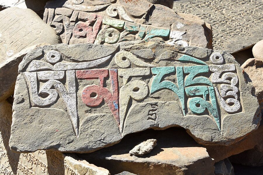
Pangi is the harder-to-reach side. Reaching it requires either the Sach Pass road from Chamba (open mid-June to mid-October, and one of the most dangerous-by-reputation drives in the country) or the long road via Keylong over Rohtang. Killar is the principal village; Hudan and Sural are the inner-valley settlements. Almost no commercial accommodation; the village rest houses need pre-booking through the Chamba district administration. This is the part of Himachal that genuinely has the lowest visitor numbers.
For the Lahaul side, the practical move is to base in Sissu, Keylong, or Jispa, and to do the Chandratal-Suraj Tal day trip and the Patseo and Deepak Tal walks. For the Pangi side, you’re looking at a serious overland trip that’s better as a separate week than tacked onto a standard Himachal itinerary. The full Lahaul and Spiti overview covers both districts.
Wildlife: The Sanctuaries Worth a Trip
Himachal’s protected areas are surprisingly under-visited even by Indian wildlife travellers, who tend to default to Uttarakhand’s Corbett or Madhya Pradesh’s tiger parks. The state has no tigers, but it has Western Himalayan species that you cannot easily see elsewhere in India.
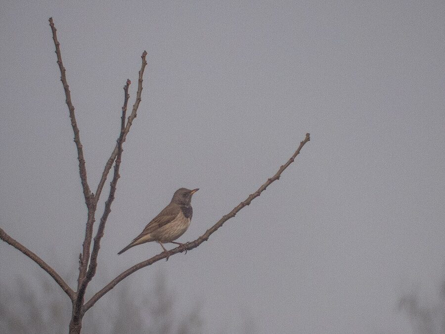
The Great Himalayan National Park (GHNP) in Kullu district is the headline destination, covered above in the Tirthan section. Brown bear, blue sheep, Himalayan tahr, musk deer, and around 200 bird species. UNESCO listing since 2014.
The Pin Valley National Park in Spiti is the snow-leopard project area. Realistic sightings are January-February only and require a multi-day expedition with a specialised guide; summer visits are scenic but not for wildlife. The valley’s other species (ibex, red fox, Himalayan wolf, golden eagle) are sighted year-round.
The Kalatop and Khajjiar Wildlife Sanctuary near Dalhousie is the easy day-trip option, with a forest rest house, easy walking, and good birding. The Pong Dam Lake bird sanctuary in Kangra is the winter migratory bird destination (bar-headed geese, ducks, waders) and is at its best from November to March. The Chail Wildlife Sanctuary, surrounding the Chail Palace, is small but accessible; the Chail Wildlife Sanctuary guide covers it in more detail.
The smaller sanctuaries (Manali, Daranghati, Simbalbara, Kanawar) are more limited in what they reliably show visitors but are pleasant walking. For a state-wide overview see the wildlife in Himachal guide; for the Manali area in particular see Manali Wildlife Sanctuary.
When To Visit: The Season Problem
Himachal’s seasons are not the four polite seasons of the plains. They’re more like five overlapping windows that affect different parts of the state differently, and the trip you can take in March is not the trip you can take in September.
March to mid-June is the standard summer season. Hill stations are busy, Indian school holidays are concentrated in May and early June, and Manali, Shimla, and Dharamshala can be unpleasantly crowded in the May peak. Spiti starts opening in mid-June. Rohtang opens (most years) in late May or early June. Apple blossom in the Kullu Valley runs late March to April. Best window for Dharamshala, Dalhousie, and the lower hill stations is mid-March to late April, before the May rush.
July to mid-September is monsoon. Landslides on the major roads (Hindustan-Tibet, Manali-Leh, Sach Pass) are routine. Shimla and Dharamshala become very green and very damp. Spiti, in the rain shadow, is unaffected by monsoon and is one of the best places in India to be during this season; the Manali-to-Spiti road is generally open. Avoid the Kinnaur-Spiti road from Shimla side in heavy rain.
Mid-September to mid-November is the autumn shoulder season, the best window of the year for most Himachal travel. Crowds thin after the monsoon. Roads are open. Apple harvest peaks in October. The Kullu Dussehra falls in October. Light is at its sharpest. If you can only travel one window of the year, this is it.
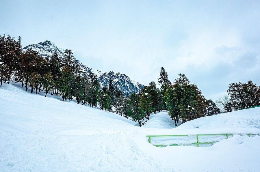
Late November to February is winter. Manali, Shimla, Dharamshala, and Dalhousie are all open and at their cold-but-quiet best. Rohtang and the Spiti road over Kunzum close. Atal Tunnel keeps Lahaul accessible to Sissu and Keylong. Snow falls in late December and through January in most of the higher hill stations. December and January are the standard honeymoon-snow window, and prices in Manali and Shimla peak during that period. Kasauli, Dalhousie, and McLeod Ganj are quieter and cheaper alternatives in the same window.
Getting Around: How to Put a Trip Together
The state’s transport is built around three road corridors and one rail line:
Delhi-Chandigarh-Shimla-Kinnaur-Spiti. The eastern corridor. Shimla is reached by overnight Volvo from Delhi (around 10 hours), by train to Chandigarh and onward bus or taxi (8 to 10 hours), or by the toy train from Kalka (5 hours, the famous option). Kinnaur and Spiti continue on from Shimla via the Hindustan-Tibet Highway.
Delhi-Chandigarh-Kullu-Manali-Lahaul. The central corridor. Manali is reached overnight from Delhi by Volvo (12 to 14 hours), or by air to Bhuntar (the Kullu-Manali airport, 50 km from Manali), with onward taxi. Lahaul continues on from Manali through the Atal Tunnel.
Delhi-Chandigarh-Pathankot-Dharamshala-Dalhousie-Chamba. The western corridor. Dharamshala is reached by overnight bus from Delhi (around 10-11 hours), by air to Gaggal (the Dharamshala airport, 13 km away), or by train to Pathankot and onward road (3 to 4 hours).
Kalka-Shimla narrow-gauge railway. The toy train, Shimla-bound only. UNESCO World Heritage Site. Worth doing one way as the journey itself, not as transport.
For getting between regions within the state, the practical fact is that the road network is not built for cross-state movement. Manali to Dharamshala is about 250 kilometres but takes six to seven hours in good conditions. Shimla to Manali is 250 kilometres and seven to eight hours. Manali to Spiti is a full day with weather flexibility. Plan a single regional base per trip; trying to cover Shimla, Manali, and Dharamshala in one ten-day Indian itinerary will leave you spending more time in the car than in the places.
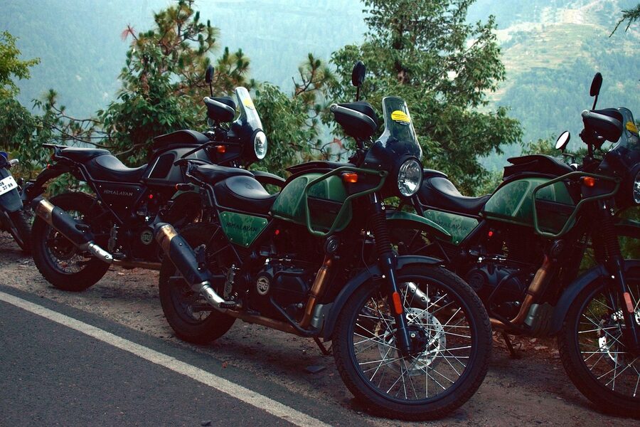
For families and first-timers, the standard advice is to use HPTDC’s coach tours or a private taxi-with-driver hired by the day. Self-driving in Himachal requires comfort with narrow roads, frequent overtaking, and altitude; it’s not a first-trip activity. Motorbike rentals out of Manali are common for the Spiti loop; both Royal Enfield 350 and 500 cc are the standard rentals, and several rental agencies have insurance policies that cover Spiti routes.
Where to Stay and How to Plan an Itinerary
For accommodation across the state, the price ladder runs from village homestays (around ₹800-1,500 per night with meals included), through small private guesthouses (₹1,500-3,000 per night), HPTDC government hotels (₹2,500-5,000 per night, varying widely by property), private mid-range hotels (₹3,000-6,000), and the occasional luxury property (₹8,000 and up). HPTDC’s heritage properties (Chail Palace, Naggar Castle, Chamba’s Iravati, Manali’s Holiday Home) are the most distinctive end of the state-run options and worth booking ahead.
The full hotels in Himachal guide covers the major destinations in detail; for honeymooners specifically, the honeymoon in Himachal guide focuses on the quieter properties around Tirthan, Naggar, and Pragpur. For Manali specifically, see Manali hotels; for Chail, the Chail Palace page covers the heritage hotel in detail, and the Chail hotels page covers the rest of the area.
For itinerary planning, the rule that holds across budgets and trip lengths is to commit to one region per trip. The standard shapes:
- 5 to 6 days, Shimla-Manali: Two nights Shimla, two or three nights Manali, one day in transit or at Solang. The classic introduction.
- 5 to 6 days, Dharamshala-Dalhousie: Two nights McLeod Ganj, one day at Bir or Norbulingka, two nights Dalhousie with a half-day at Khajjiar. Flatter trip, easier with kids or older parents.
- 7 to 9 days, Spiti loop: Either Manali-Kaza-Shimla or Shimla-Kaza-Shimla, with two nights at Kaza for the monastery day-trips. Summer only.
- 5 to 7 days, slow Parvati or Tirthan trip: Single base, walks and meals as the structure. Off-season recommended.
- 10 days plus, two regions combined: Possible but requires comfort with long road days. Standard combination is Shimla-Manali plus a Dharamshala add-on, with the long Manali-Dharamshala drive in the middle.
For packaged options, the Himachal tour packages overview covers what’s typically included; the Delhi to Manali route is the most-booked single-corridor package. For a categorised browse of where-to-stay reviews, the Where to Stay archive collects the property-level pieces; for the activity-focused planning, Things To Do indexes treks, festivals, and seasonal activities.
Festivals and Culture: Why You Might Want to Time Your Trip
Himachal’s village festivals are the part of the state most foreign visitors don’t realise exists. Hundreds of village deities are still treated as the lords of their land, and the festival calendar is when those deities meet, travel, and the villages they belong to gather around them. The state’s official tourism calendar lists the major fairs, but the local melas in the side valleys are where the older traditions still run. The fairs and festivals of Himachal calendar is the place to start if you want to plan a trip around one.
The headline events are the Kullu Dussehra in October (a seven-day festival that brings over two hundred village deities to Kullu town and is one of the largest functioning village-deity festivals in India), the Minjar Fair at Chamba in late July (a week-long fair with a procession down to the Ravi River and the floating of corn-tassel garlands), the Lavi Fair at Rampur in November (the Indo-Tibetan trade fair, a thousand-year-old market where Kinnauri and Tibetan traders historically met to exchange wool and salt), and the Holi celebrations at Sujanpur Tira (a week-long traditional Holi at a former Pahari kingdom’s capital).
For Tibetan-Buddhist visitors, Losar (the Tibetan New Year, late February or early March) at McLeod Ganj and the major monasteries, and the Dalai Lama’s birthday celebrations on July 6th, are the events to plan around. For temple visitors, the Shivratri at the Bhutnath temple in Mandi (March) and the Chaitra Navratri at Naina Devi (March-April) are the largest gatherings. The Festivals and Culture archive collects more pieces on the specific traditions.
What to Skip and What to Get Right
A short, opinionated rundown for first-timers, drawn from where the consensus across recent travellers is clearest:
Get right: the toy train into Shimla; an early morning at the Hidimba Devi Temple before the crowds; an overnight at Triund or at least the day hike on a clear morning; one Pahari food meal that isn’t at a tourist restaurant; the drive into Spiti from Shimla side rather than Manali side if it’s your first time; the Bir Billing tandem paraglide if your trip lines up with the season; one hour at the Tibet Museum at McLeod Ganj before you decide what you think about the politics; one apple from a Kullu orchard tree, not from a roadside stall.
Skip: Kufri (full stop); the Mall Road shawl shops in Manali (use Bhuttico instead); the standard Solang day trip if you’re not actually doing an activity (the road is congested and the place itself is a fairground); the half-day “city tour” packages of Shimla (the town is small enough to walk); any tour operator who tells you they can show you snow leopards in Pin Valley between June and September; any “private tour” of the Dalai Lama’s residence (it doesn’t exist; he lives there).
Reconsider before booking: the May and June peak in Shimla and Manali (you will spend more time in traffic than in the hills); the Spiti loop in early June (Kunzum may not be open, plan for late June onwards); a Manali-Dharamshala-Dalhousie three-region itinerary in seven days (you cannot do it well; pick two); a Parvati Valley first-trip itinerary if you’re travelling with parents over 65 (the walking and the altitude are not gentle); any trek in monsoon without a registered local guide.
One Last Thing
The mistake first-timers make in Himachal is treating the state as a single destination. It isn’t. Spiti and Shimla are as different as Ladakh is from Goa. McLeod Ganj and Manali are an easy hour apart on a map and a different country apart in feel. The right approach is to pick one corner of the state, give it a proper week, and accept that you’ll need to come back for the next corner. Ten days is enough for one region done well; it is nowhere near enough for the state.
If you take only one piece of practical advice from this guide, take this one: book the toy train into Shimla in advance, do not try to do Spiti as a four-day rush from Delhi, and base in one valley rather than chasing four. Himachal rewards the slow trip. The Indian Himalaya is bigger than your itinerary thinks it is, and the people who come back from their first trip wishing they’d done less are right.